Flood disaster situation assessment method based on vector guidance

A flood and vector technology, which is applied in the field of flood disaster assessment based on vector guidance, can solve the problems of insufficient assessment accuracy, low timeliness, and high difficulty of analysis, and achieve the effects of low cost, simple and fast implementation, and simple analysis

Pending Publication Date: 2022-01-11
CHENGDU UNIV OF INFORMATION TECH +1
View PDF0 Cites 1 Cited by
  • Summary
  • Abstract
  • Description
  • Claims
  • Application Information

AI Technical Summary

Problems solved by technology

[0003] So far, there is no complete set of sensors or systems that can stably and fully automatically extract target features from remote sensing images and make assessments. Most of the existing flood disaster assessment methods are time-consuming and not time-effective. In addition, the evaluation process requires a large amount of data, and the analysis is relatively complex and difficult. In addition, the existing methods are also insufficient in the evaluation accuracy, so as to provide faster and more accurate decision support for disaster reduction and relief services. Therefore, this paper The invention proposes a flood disaster assessment method based on vector guidance to solve the problems existing in the prior art

Method used


Image

  • Flood disaster situation assessment method based on vector guidance
  • Flood disaster situation assessment method based on vector guidance
  • Flood disaster situation assessment method based on vector guidance

Examples


Embodiment 1

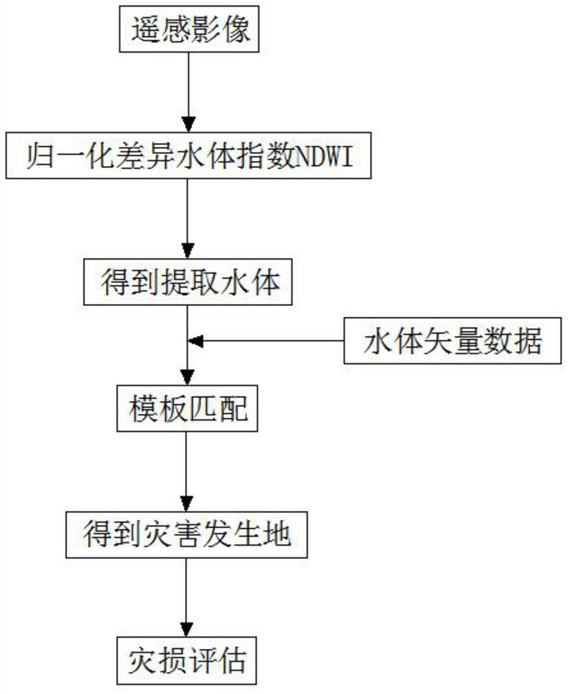
[0047] see figure 1 , the present embodiment provides a vector-guided flood disaster assessment method, comprising the following steps:

[0048] Step 1: Water Extraction

[0049] Based on the remote sensing satellite remote sensing images of the area to be assessed, the normalized difference water index NDWI is used to extract the water body in the area to be assessed, where NDWI is defined as follows:

[0050]

[0051] The water body extraction method also includes the threshold-based multi-band spectral relationship method and the shadow water index method. The threshold-based multi-band spectral relationship method mainly uses the comprehensive advantages of image multi-band to extract water body information, including the spectral relationship method. Compared with the ratio method, the shadow water index method is based on the existing multi-band spectral relationship method and constructed according to the spectral characteristics of the water body. It can better disti...

Embodiment 2

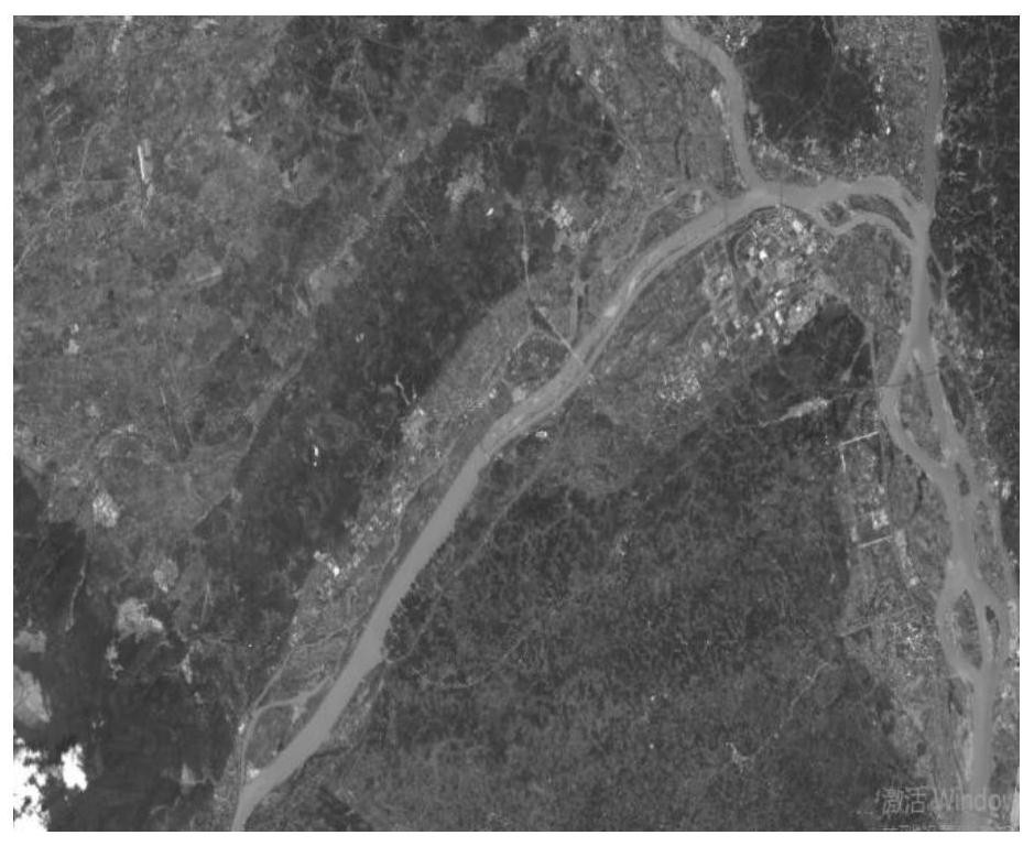
[0077] Taking Shizhong District, Leshan City, Sichuan Province, where flood disasters occur frequently, as the research object, based on the remote sensing images of GF1 in Leshan City, such as figure 2 As shown, the normalized difference water index NDWI is used for water extraction, such as image 3 shown;

[0078]

[0079] Convert the water body extracted based on NDVI into a vector and then export it into a picture, such as Figure 4 As shown, and then export the water body vector data of Leshan City into a picture, such as Figure 5 shown, and then do template matching on it;

[0080] After template matching based on vector data guidance, it can be determined that the disaster occurred in Shizhong District of Leshan City, and the extracted water body is superimposed with the image before the disaster, as shown in Figure 6 shown;

[0081] Overlay the extracted water bodies with the land use data of Leshan City downloaded from the National Geographic Information Re...


PUM


Abstract

The invention discloses a flood disaster situation assessment method based on vector guidance. The method comprises the steps of water body extraction, vector guidance, flood inundation range determination and flood disaster loss estimation. According to the method, the water body range is obtained through the flood period remote sensing image, then the water body range is matched with the geographic vector data to quickly position the flood site, disaster damage assessment can be performed to obtain disaster damage information, disaster information can be quickly extracted under the condition of overcoming the limitation of processing resources, implementation is simple and quick, the required cost is low, the auxiliary function of geographic vector information is utilized, coordination ability inside and among different data is fully and deeply excavated, flood disaster assessment is achieved, data needed in the assessment process is less, analysis is simple and convenient, compared with an existing assessment method, the efficiency is higher and more accurate, processing is conducted based on 0-level or 1-level data, and rapid decision support can be provided for disaster reduction and relief services.

Description

technical field [0001] The invention relates to the technical field of disaster assessment, in particular to a vector-guided flood disaster assessment method. Background technique [0002] Flood disasters are one of the major sudden natural disasters that our country is facing. It is of great significance to apply modern information technology, especially spatial information technology with "3S" as the core, to the dynamic monitoring of flood disasters, disaster assessment, and disaster relief decision support. Significance, how to use modern spatial information technology to provide more scientific and rapid auxiliary decision-making support for flood disaster monitoring, rescue, assessment, etc. has always been a major problem that needs to be solved urgently. The probability of occurrence, but also predict the losses caused by flood disasters, and provide data support for the formulation of disaster relief and disaster relief plans for flood control and disaster reduction...

Claims


Application Information

Patent Timeline
Patent Type & Authority Applications(China)
IPC IPC(8): G06V10/74G06K9/62G06Q10/06G06Q50/26
CPCG06Q10/0639G06Q50/26Y02A10/40
Inventor 孙艺琳柳锦宝梁芳陶星宇王志强阿多
Owner CHENGDU UNIV OF INFORMATION TECH
Why Eureka
Try Eureka