Ground vehicle path planning method based on maneuverability evaluation

A technology for vehicle routing and mobility, applied to road network navigators, measuring devices, instruments, etc., can solve the problem of identifying, not taking into account the number of times the vehicle goes uphill, the cumulative uphill length of the road curvature, and maneuvering without considering the effect of soil mechanics Performance and other issues to achieve the effect of ensuring mobility

Pending Publication Date: 2022-01-28
HEFEI INSTITUTES OF PHYSICAL SCIENCE - CHINESE ACAD OF SCI
View PDF10 Cites 2 Cited by
  • Summary
  • Abstract
  • Description
  • Claims
  • Application Information

AI Technical Summary

Problems solved by technology

[0003] The current mobility evaluation methods often evaluate the passing performance of vehicles and divide the terrain into passable areas and impassable areas. However, for task decision makers, it is difficult to identify better vehicles from the passable area. Therefore, it is necessary to quantify the mobility of vehicles in the passable area. At the same time, when determining the passable and impassable areas, the influence of soil mechanical effects on vehicle maneuverability is not considered. Different soil types not only restrict vehicle performance. If it is passed or not, its soil mechanical effect also restricts the speed of the vehicle. Therefore, when quantifying the mobility of a vehicle on a certain terrain, it is necessary to consider the impact of the mechanical effect of the soil on the mobility of the vehicle.
In the path planning process, only factors such as the distance between the starting point and the target point and terrain cost are considered, and the number of times the vehicle goes uphill, the cumulative uphill length, and the curvature of the road are not taken into account, and the path planning results based on the two-dimensional grid , it is difficult to carry out intuitive three-dimensional visualization display, and it has caused certain difficulties for task decision makers to observe the terrain fluctuations, analyze whether the generated path meets the task requirements, and then optimize the path

Method used


Image

  • Ground vehicle path planning method based on maneuverability evaluation
  • Ground vehicle path planning method based on maneuverability evaluation
  • Ground vehicle path planning method based on maneuverability evaluation

Examples


Embodiment Construction

[0055] The following will clearly and completely describe the technical solutions in the embodiments of the present invention with reference to the accompanying drawings in the embodiments of the present invention. Obviously, the described embodiments are only some, not all, embodiments of the present invention. Based on the embodiments of the present invention, all other embodiments obtained by persons of ordinary skill in the art without making creative efforts belong to the protection scope of the present invention.

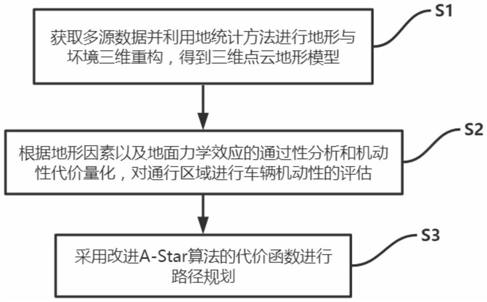
[0056] Please refer to figure 1 , in an embodiment of the present invention, a ground vehicle path planning method based on mobility assessment, comprising:

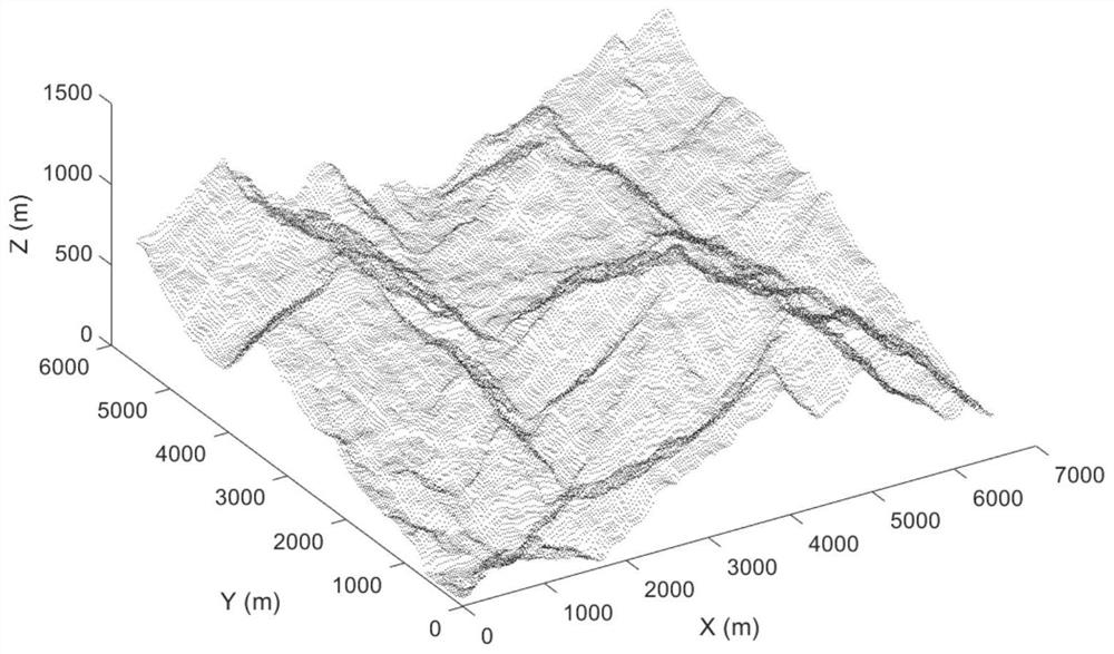
[0057] S1. Obtain multi-source data and use geostatistical methods to perform three-dimensional reconstruction of terrain and environment to obtain a three-dimensional point cloud terrain model. The multi-source data includes acquisition of remote sensing elevation terrain data, land use data, and soil t...


PUM


Abstract

The invention discloses a ground vehicle path planning method based on maneuverability evaluation, which comprises the following steps: multi-source data is acquired and terrain and environment three-dimensional reconstruction is performed by using a geostatistics method to obtain a three-dimensional point cloud terrain model, and the multi-source data comprises remote sensing elevation terrain data, land utilization data, soil type distribution data and vehicle data; according to trafficability analysis and maneuverability cost quantification of topographic factors and a terrains effect, vehicle maneuverability evaluation is carried out on the traffic area; and path planning is carried out by adopting a cost function of an improved A-Star algorithm. According to the method, the three-dimensional point cloud terrain model is reconstructed by acquiring multi-source data, vehicle maneuverability evaluation is carried out after terrain and soil data analysis, and finally, an optimal planned path is acquired according to an improved A-Star algorithm. The problem that the path planning technology of the special operation vehicle in a field environment without a road network is deficient is solved. Visual three-dimensional visualization display is provided, and a decision maker is assisted in analysis and optimization after path planning.

Description

technical field [0001] The invention relates to the technical field of vehicle route planning, in particular to a ground vehicle route planning method based on maneuverability evaluation. Background technique [0002] At present, with the acceleration of urban development, the digital map technology for urban road networks has become quite mature, and vehicles can carry out effective path planning between the starting point and the target according to specific urban scenes. However, in the field environment without road network, the path planning technology for special operation vehicles is relatively scarce. For example, in the military field, military vehicles will face various unknown and complex ground environments in the field. In order to ensure military tactical mobility, first The mobility of vehicles in the area should be evaluated and route planning should be carried out. The mobility of a vehicle is affected by factors such as terrain, soil, and vehicle parameter...

Claims


Application Information

Patent Timeline
Patent Type & Authority Applications(China)
IPC IPC(8): G01C21/20G01C21/34
CPCG01C21/20G01C21/3446
Inventor 牛润新华琛余彪郑小坤
Owner HEFEI INSTITUTES OF PHYSICAL SCIENCE - CHINESE ACAD OF SCI
Why Eureka
Try Eureka