Crop leaf area index remote sensing inversion method and system under plot spatial-temporal feature constraint
A leaf area index, spatiotemporal feature technology, applied in image data processing, image analysis, image enhancement and other directions, can solve problems such as poor effect, achieve the effect of good effect and reduce uncertainty
- Summary
- Abstract
- Description
- Claims
- Application Information
AI Technical Summary
Problems solved by technology
Method used
Image
Examples
Embodiment Construction
[0023] The specific embodiments of the present invention will be further described below with reference to the accompanying drawings. It should be noted here that the descriptions of these embodiments are used to help the understanding of the present invention, but do not constitute a limitation of the present invention. In addition, the technical features involved in the various embodiments of the present invention described below can be combined with each other as long as they do not conflict with each other.
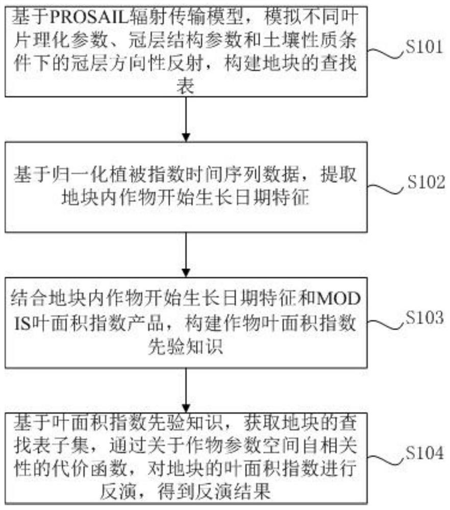
[0024] see figure 1 The schematic flowchart shown in the embodiment of the present invention provides a remote sensing inversion method for crop leaf area index under the constraints of spatial and temporal characteristics of a plot, which includes the following steps:
[0025] S101. Based on the PROSAIL radiative transfer model, simulate canopy directional reflection under the conditions of different leaf physical and chemical parameters, canopy structure parameters...
PUM
 Abstract
Description
Claims
Application Information
 - R&D
- Intellectual Property
- Life Sciences
- Materials
- Tech Scout
- Unparalleled Data Quality
- Higher Quality Content
- 60% Fewer Hallucinations
Browse by: Latest US Patents, China's latest patents, Technical Efficacy Thesaurus, Application Domain, Technology Topic, Popular Technical Reports.
© 2025 PatSnap. All rights reserved.Legal|Privacy policy|Modern Slavery Act Transparency Statement|Sitemap|About US| Contact US: help@patsnap.com


