Terrain prompt implementation method for airborne synthetic vision
A technology of terrain reminder and implementation method, applied in 3D image processing, instrumentation, calculation, etc., can solve the problem of not prompting pilots to pose a threat to flight safety, and achieve the effect of improving safety, easy implementation, and simple algorithm
- Summary
- Abstract
- Description
- Claims
- Application Information
AI Technical Summary
Problems solved by technology
Method used
Image
Examples
Embodiment Construction
[0011] The present invention will be further described in detail below through specific embodiments in conjunction with the accompanying drawings. It should be noted here that the descriptions of these embodiments are used to help the understanding of the present invention, but do not constitute a limitation of the present invention. In addition, the technical features involved in the embodiments of the present invention described below can be combined with each other as long as they do not conflict with each other.
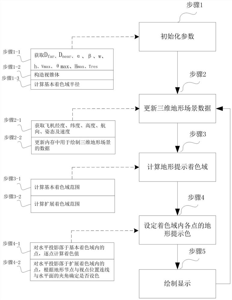
[0012] See Figures 1 to 4 , an implementation method of terrain cues for airborne synthetic vision.
[0013] Include the following steps:
[0014] Step 1: Initialize parameters;
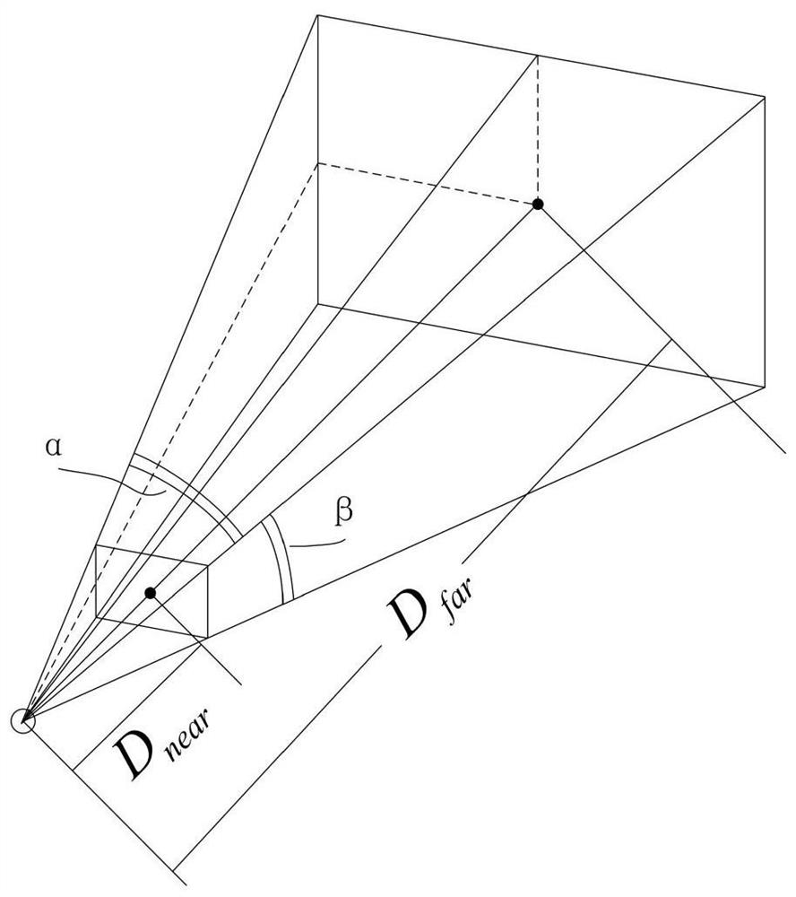
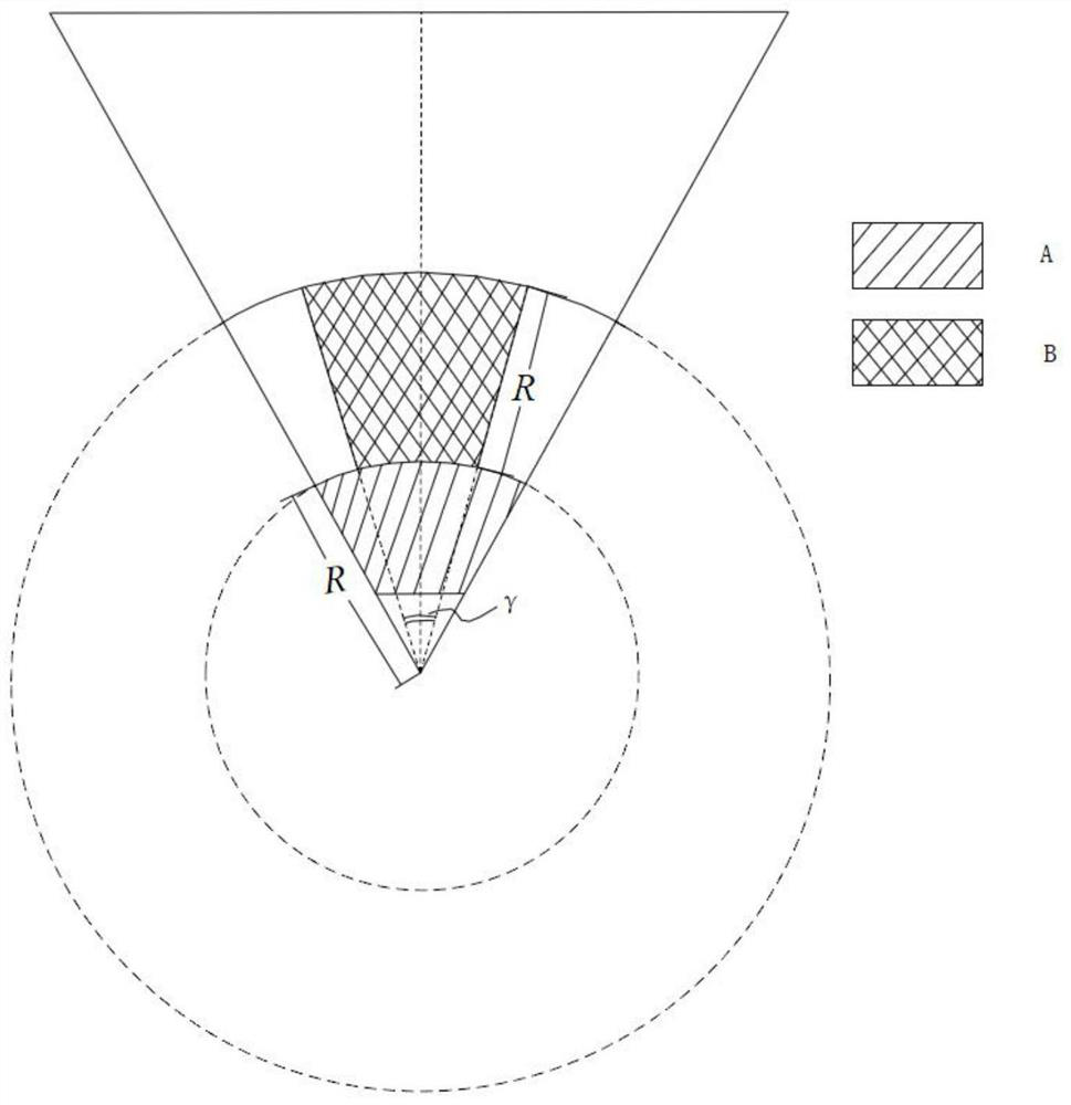
[0015] The step 1 is used to initialize the parameters. The parameters that need to be initialized for the initialization parameters are: the visual frustum parameter: the length of the field of view D far , the distance D from the viewpoint to the near clipping plane near , horiz...
PUM
 Abstract
Description
Claims
Application Information
 - R&D
- Intellectual Property
- Life Sciences
- Materials
- Tech Scout
- Unparalleled Data Quality
- Higher Quality Content
- 60% Fewer Hallucinations
Browse by: Latest US Patents, China's latest patents, Technical Efficacy Thesaurus, Application Domain, Technology Topic, Popular Technical Reports.
© 2025 PatSnap. All rights reserved.Legal|Privacy policy|Modern Slavery Act Transparency Statement|Sitemap|About US| Contact US: help@patsnap.com


