Wheat phenological period real-time classification method based on unmanned aerial vehicle RGB image
A classification method and unmanned aerial vehicle technology, applied to computer parts, instruments, calculations, etc., can solve problems such as lag and inability to provide guidance for field management, achieve low cost, realize real-time discrimination, and overcome hysteresis.
- Summary
- Abstract
- Description
- Claims
- Application Information
AI Technical Summary
Problems solved by technology
Method used
Image
Examples
Embodiment Construction
[0043] Embodiments of the present invention are described in detail below, examples of which are illustrated in the accompanying drawings, wherein the same or similar reference numerals refer to the same or similar elements or elements having the same or similar functions throughout. The embodiments described below with reference to the accompanying drawings are exemplary and are only used to explain the present invention, but not to be construed as a limitation of the present invention.
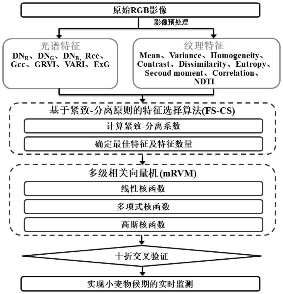
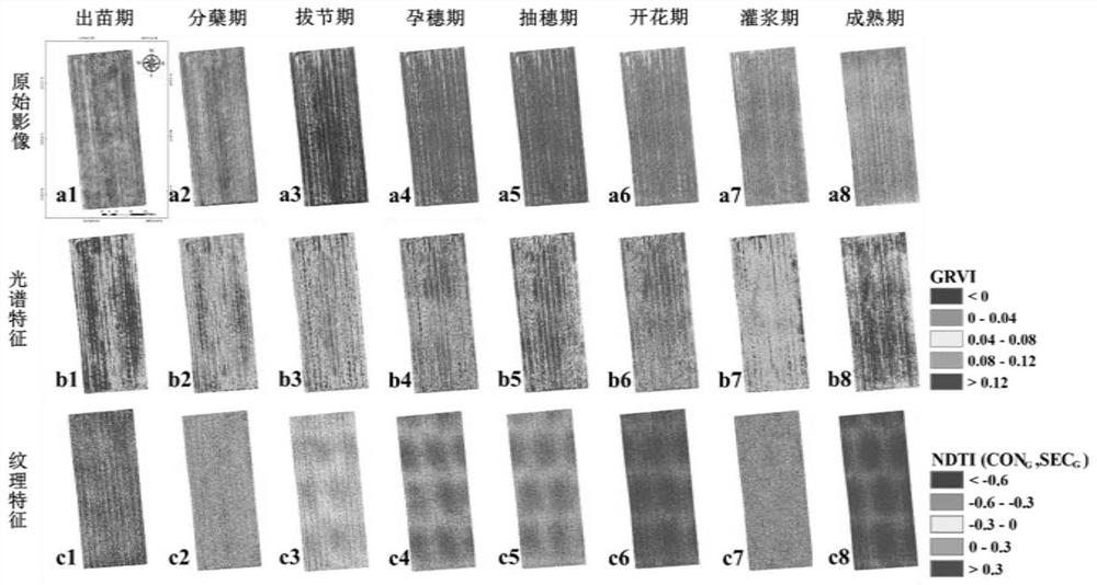
[0044] The implementation of the present invention takes the wheat planting area as an example, and the research area is as follows figure 1 As shown, the drone data used is the RGB camera (FC300X, Shenzhen, China) carried on the DJI Phantom 3 (DJI Phantom 3, Shenzhen, China) to obtain the drone images of the study area. The drone automatically sets the flight path, the field of view is 94°, the flight altitude is 60 to 70 meters, the endurance time is 5-20 minutes, the fixed-point hovering ...
PUM
 Abstract
Description
Claims
Application Information
 - R&D
- Intellectual Property
- Life Sciences
- Materials
- Tech Scout
- Unparalleled Data Quality
- Higher Quality Content
- 60% Fewer Hallucinations
Browse by: Latest US Patents, China's latest patents, Technical Efficacy Thesaurus, Application Domain, Technology Topic, Popular Technical Reports.
© 2025 PatSnap. All rights reserved.Legal|Privacy policy|Modern Slavery Act Transparency Statement|Sitemap|About US| Contact US: help@patsnap.com


