River channel monitoring device and method and computer readable storage medium
A technology for monitoring devices and river channels, applied in the fields of river channel monitoring devices and computer-readable storage media, can solve the problems of high cost, achieve the effects of reducing labor costs, low cost, and improving accuracy
- Summary
- Abstract
- Description
- Claims
- Application Information
AI Technical Summary
Problems solved by technology
Method used
Image
Examples
Embodiment 1
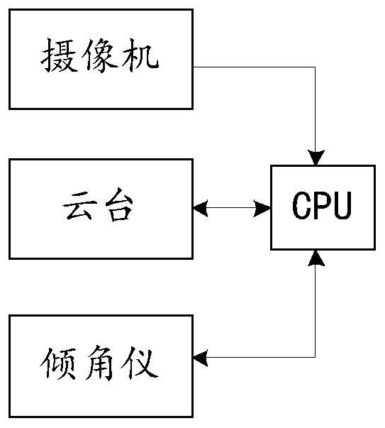
[0063] An embodiment of the present invention provides a river channel monitoring device, which is used to monitor a plurality of preset detection points provided with water gauges on the river channel, such as figure 1 As shown, including camera, PTZ, inclinometer and CPU; PTZ and inclinometer are fixed with the camera, the PTZ is used to control the shooting position of the camera, and the inclinometer is used to detect the tilt angle of the camera along the Y axis; the video of the camera The output terminal is electrically connected with the input terminal of the CPU; the information output terminals of the PTZ and the inclinometer are electrically connected with the input terminal of the CPU, and the output terminals of the CPU are electrically connected with the control terminals of the PTZ and the inclinometer respectively; The tilt angle and the rotation of the pan / tilt allow the camera to collect video data from multiple preset detection points, and the CPU identifies ...
Embodiment 2
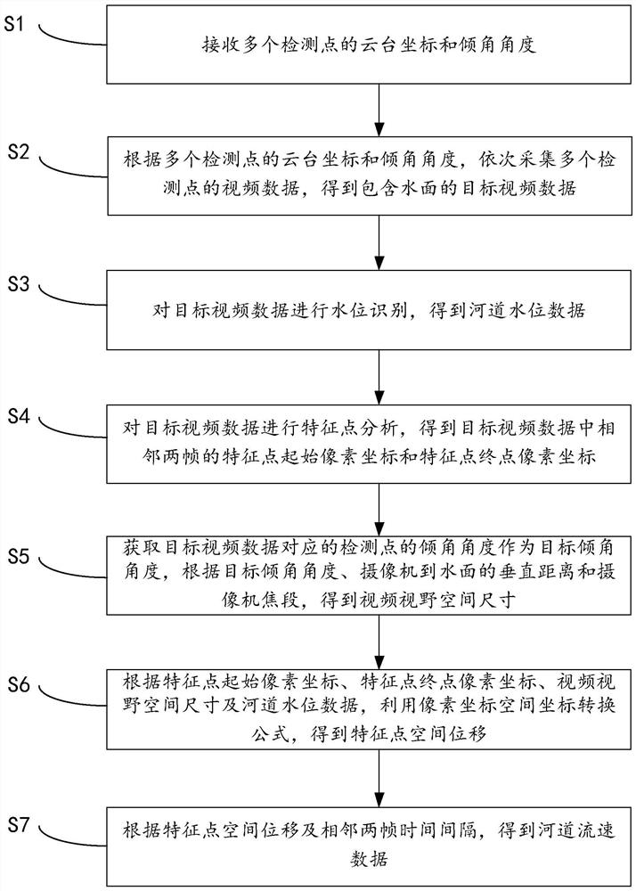
[0069] like figure 2 As shown, an embodiment of the present invention provides a river monitoring method, which is applied to the CPU of the river monitoring device provided in Embodiment 1, and the method includes:
[0070] S1: Receive the gimbal coordinates and inclination angles of multiple detection points.
[0071] S2: According to the PTZ coordinates and inclination angles of the multiple detection points, sequentially collect the video data of the multiple detection points to obtain the target video data including the water surface.
[0072] S3: Perform water level identification on the target video data to obtain river water level data.
[0073] S4: Perform feature point analysis on the target video data to obtain the start pixel coordinates of the feature points and the end pixel coordinates of the feature points of two adjacent frames in the target video data.
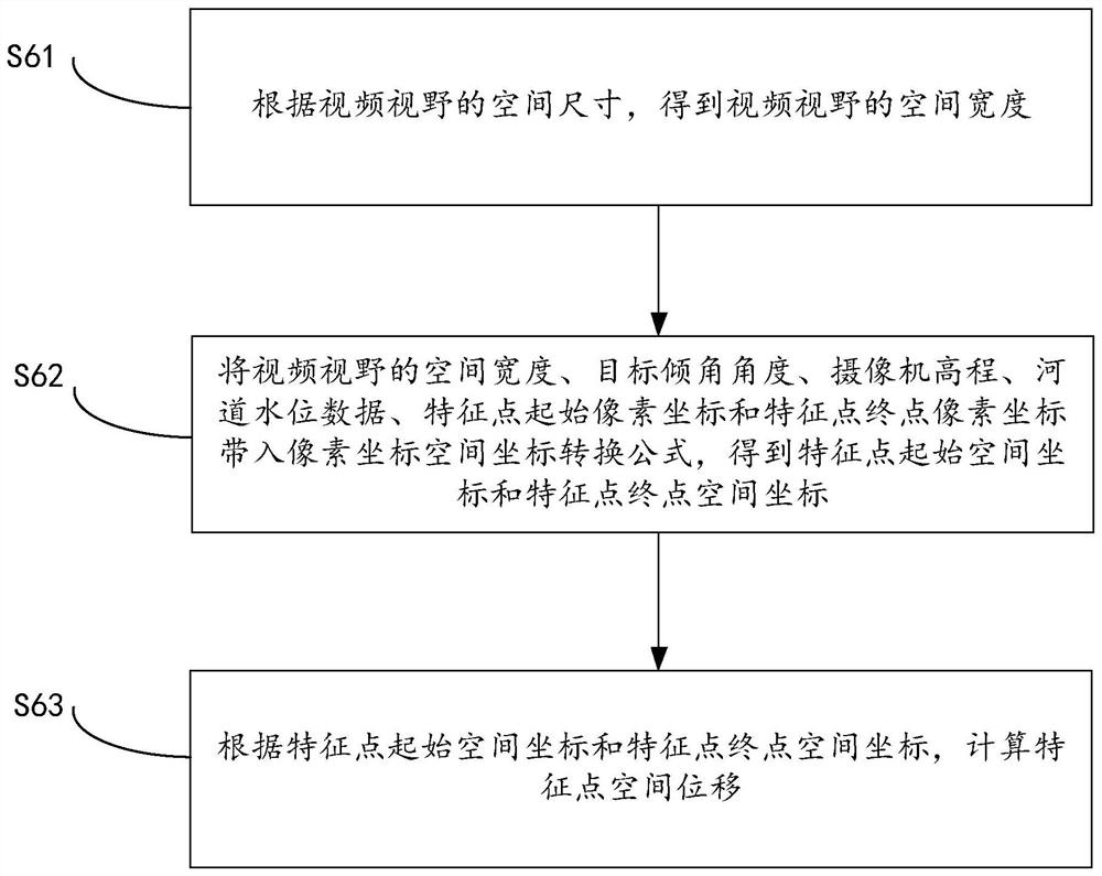
[0074] S5: Obtain the inclination angle of the detection point corresponding to the target video data a...
PUM
 Abstract
Description
Claims
Application Information
 - R&D
- Intellectual Property
- Life Sciences
- Materials
- Tech Scout
- Unparalleled Data Quality
- Higher Quality Content
- 60% Fewer Hallucinations
Browse by: Latest US Patents, China's latest patents, Technical Efficacy Thesaurus, Application Domain, Technology Topic, Popular Technical Reports.
© 2025 PatSnap. All rights reserved.Legal|Privacy policy|Modern Slavery Act Transparency Statement|Sitemap|About US| Contact US: help@patsnap.com


