
Calibration and correction system for satellite position location systems

A technology of frequency and time period, applied in the field of GPS system, can solve the problems such as the deterioration of the efficiency of the frequency locking calibration method

Active Publication Date: 2006-01-25
QUALCOMM INC
View PDF3 Cites 14 Cited by
  • Summary
  • Abstract
  • Description
  • Claims
  • Application Information

AI Technical Summary

Problems solved by technology

Rapid changes in the received cellular carrier frequency, combined with switching the cellular phone transmitter on or off, can cause the efficiency of the frequency lock calibration method to deteriorate

Method used


Image

  • Calibration and correction system for satellite position location systems
  • Calibration and correction system for satellite position location systems
  • Calibration and correction system for satellite position location systems

Examples


Embodiment Construction

[0031] The present invention will be described below in conjunction with the accompanying drawings, in which the same numerals represent the same or similar components.

[0032] Glossary of terms and abbreviations

[0033] In the detailed description, the following terms and abbreviations are used:

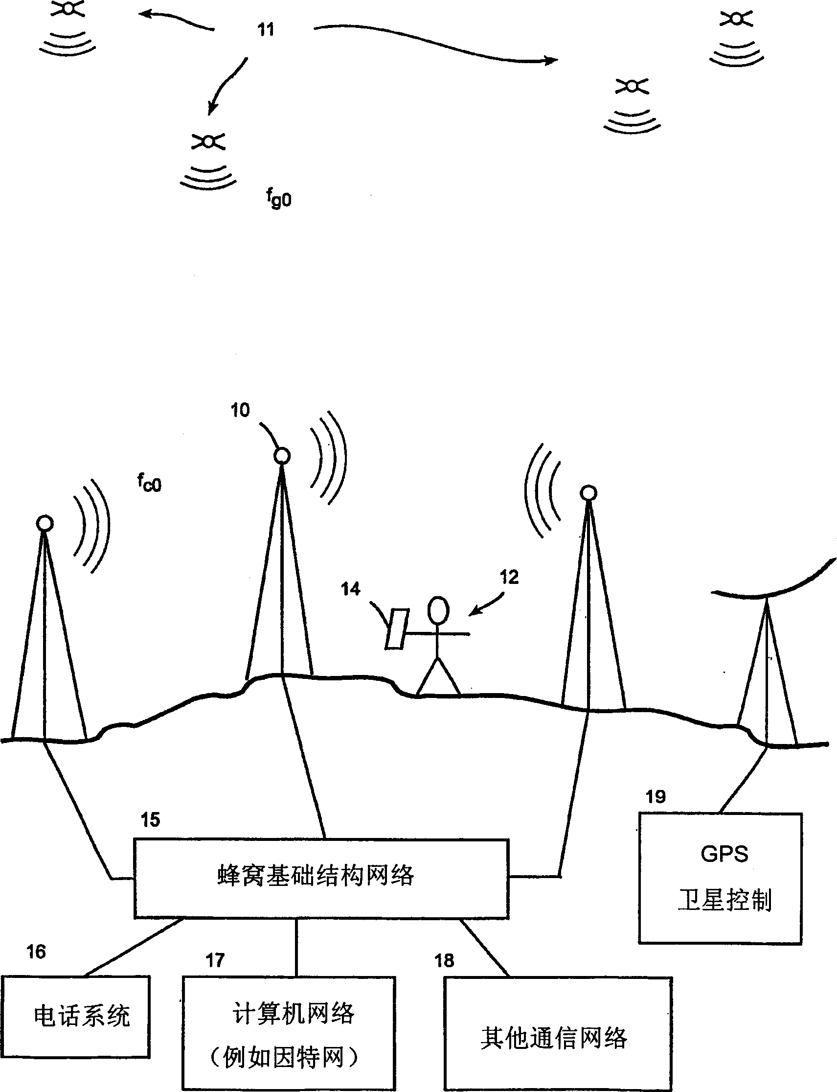
[0034] base station: A station that transmits a precise carrier frequency, such as a base station in a cellular telephone network;

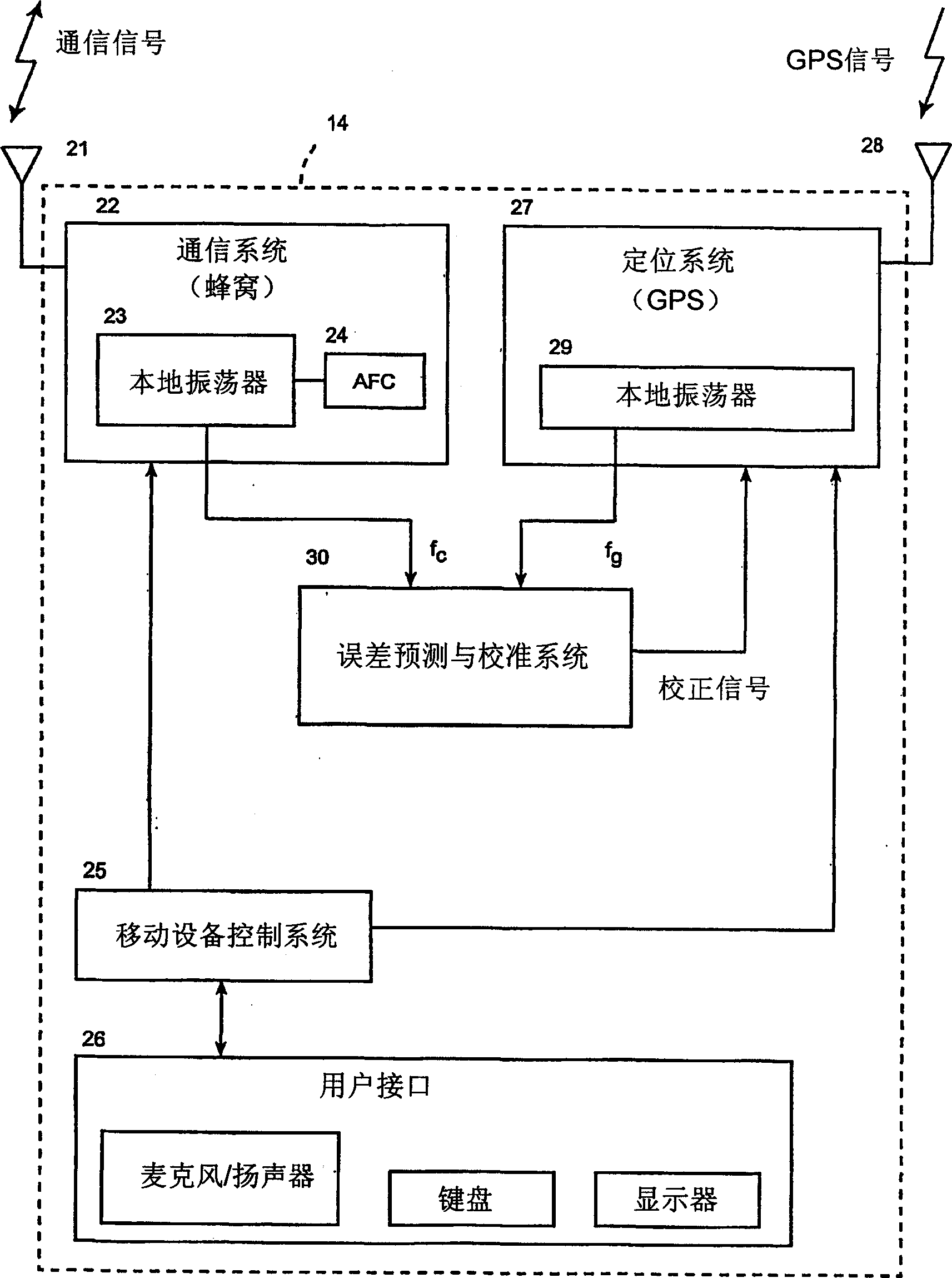
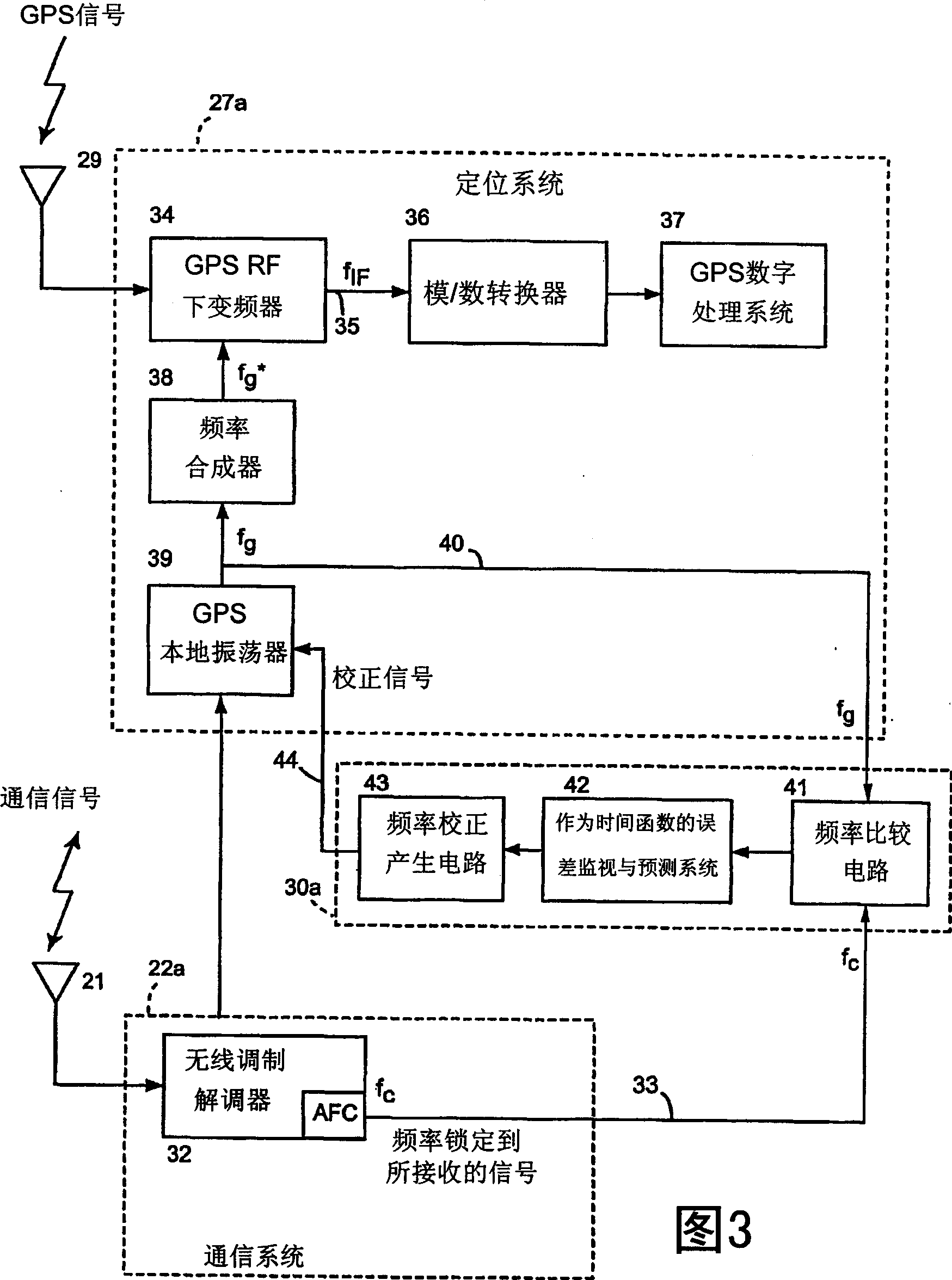
[0035] Calibration: the process of measuring the error of current time and predicting the error of future time;

[0036] Calibration: pertaining to methods of compensating for errors predicted during the calibration process;

[0037] CDMA: code division multiple access;

[0038] FSK: frequency shift keying;

[0039]GPS: Global Positioning System, although the term GPS is often adopted to refer to the US Global Positioning System, the meaning of the term here and the approach to all devices described here apply equally well to other Global Positio...


PUM


Abstract

To provide accurate and quick position measurements in a practical mobile position location system, the GPS receiver is calibrated, a frequency error in the next time period is predicted using a first frequency locked to an externally transmitted signal, and a second frequency is generated by a GPS oscillator. To predict the error in the next time period, several measurements are made over time, error estimations are made, an error function is approximated responsive to the set of error estimations. This predicted error is then used to correct the GPS receiver in the next time period. In one implementation, a multiple function portable device is disclosed for providing cellular communication using a network of cellular stations that operate at predefined ideal cellular frequencies, and also for providing position location using GPS satellites that transmit GPS signals at a predefined GPS frequency.

Description

[0001] related application [0002] This application claims priority to US Provisional Patent Application No. 60 / 433,138, filed December 13,2002. field of invention [0003] The present invention relates to an apparatus and method for calculating the position of a mobile device, such as the GPS system, by using wireless signals. technical background [0004] Existing GPS-based positioning techniques use a network of satellites that transmit signals on predetermined GPS frequencies at known times. GPS receivers on the ground measure the time of arrival of signals from every satellite in the sky that can be "seen". The time of arrival of the signals is used to triangulate the position of the GPS receiver along with the exact location of the satellites and the exact time the signals were transmitted from each satellite. A standard GPS receiver includes a local oscillator for receiving GPS signals from satellites. [0005] Acquisition of signals from GPS satellites is very se...

Claims


Application Information

Patent Timeline
Patent Type & Authority Applications(China)
IPC IPC(8): G01S5/14G01S1/02G06F16/23G06F17/30
Inventor 诺曼·F·克拉斯纳
Owner QUALCOMM INC
Learn More