Ship state symbol identification system based electronic sea chart
A recognition system, electronic chart technology, applied in the direction of electrical digital data processing, special data processing applications, instruments, etc., can solve the problems of existence, lack of graphical recognition standards and specifications, information can not be shared, etc., to improve efficiency and management quality, improve ship management efficiency, and avoid blindness
- Summary
- Abstract
- Description
- Claims
- Application Information
AI Technical Summary
Problems solved by technology
Method used
Image
Examples
Embodiment 1
[0080] Embodiment 1 Nautical chart information display and query
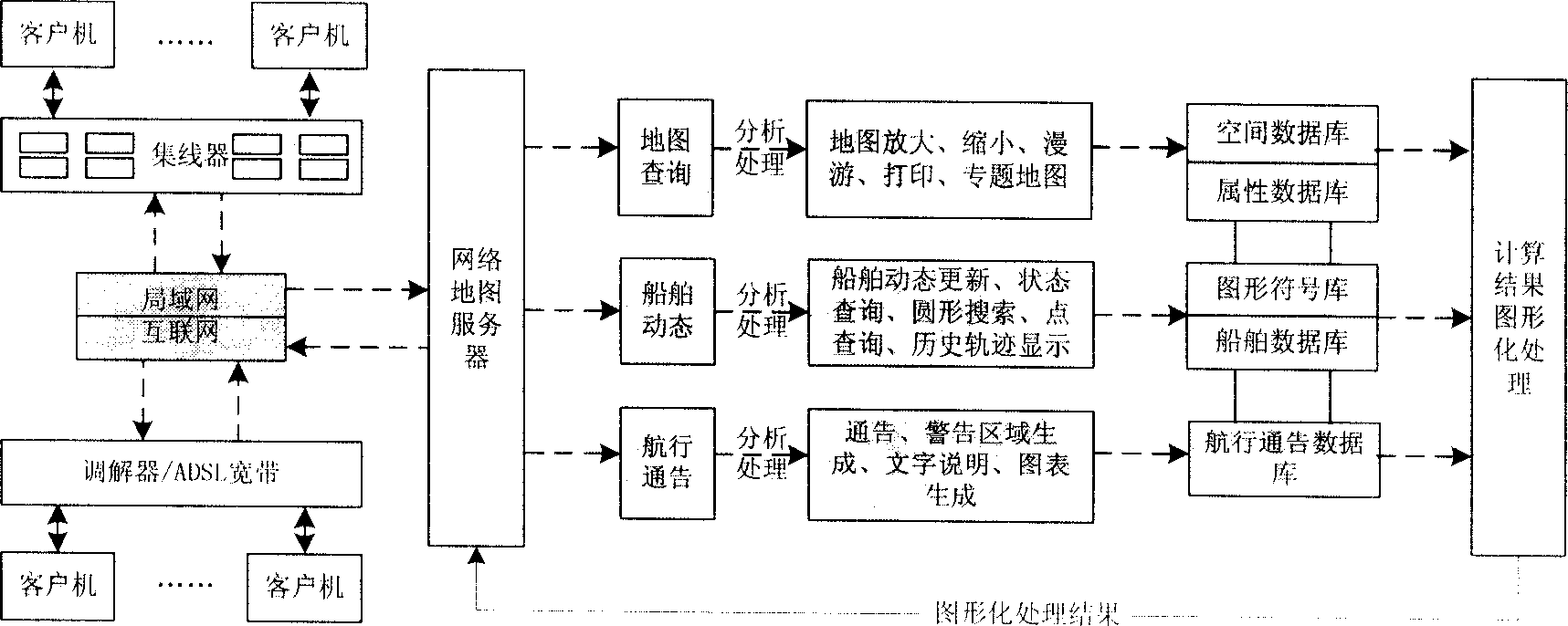
[0081] Provide electronic chart display in Dalian sea area, realize basic functions such as map zoom-in, zoom-out, roaming, geographic location display, etc., and also realize advanced applications such as point, line, surface labeling, distance and area calculation, eagle eye, map printing, etc. Features. Provide map query and conditional query to obtain any chart information, navigation information, and object information. Map query can query any object information within the corresponding map range by clicking, drawing frame selection, circle selection or polygon selection; conditional query can perform fuzzy query and positioning through keywords. The query results are displayed or printed out in graphs and tables.
[0082] The main functions are introduced below.
[0083] 1.1 Display the full chart
[0084] After clicking the button to display the full image, the electronic chart...
Embodiment 2
[0101] Embodiment 2 Ship dynamic information display query
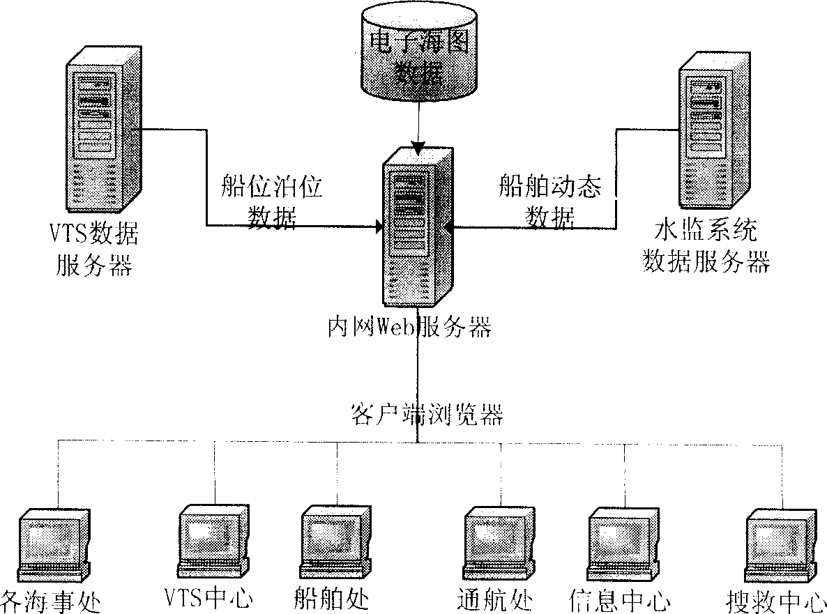
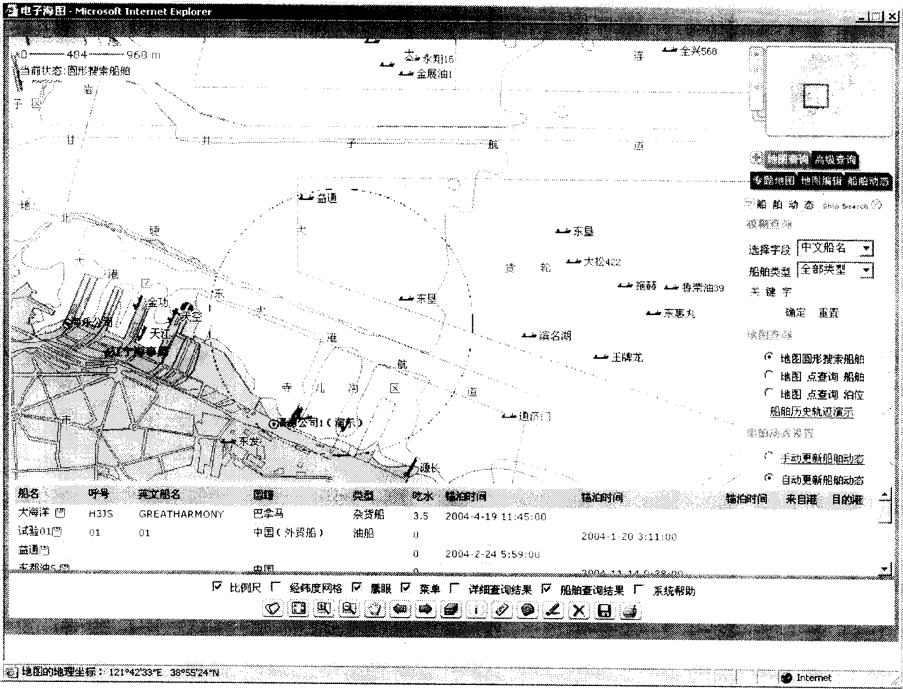
[0102] On the basis of the above-mentioned electronic chart application platform, by receiving ship dynamic data (VTS and water monitoring system) in real time, it can visually display and query ship dynamic information, and can visually display the real-time position and location of all ships in port on the electronic chart. Click on the ship logo to get its general attributes, anchoring status, entry and exit plan and other dynamic information.
[0103] General information of the ship: ship name, call sign, tonnage, nationality, ship type, etc.
[0104] Ship dynamic information: ship position, course, speed, departure port, destination port, entry and exit plan, etc.
[0105] 2.1 Fuzzy query of ship dynamics
[0106] By selecting Chinese and English ship names, call signs, and ship types, and entering keywords, you can perform fuzzy queries on the current ships in the port.
[0107] 2.2 Circular...
Embodiment 3
[0111] Embodiment 3 Berth and anchor position dynamic information display query
[0112] It can visually display the real-time position of all berths and anchorages and the berthing distribution of ships in them on the electronic chart. Click on the berths and anchorages to obtain their general properties, berthing status, berthing plan and other dynamic information of each berth and anchorage . And it can locate the distribution of ships, berths and anchorages that meet the conditions through keyword fuzzy query.
[0113] 3.1 point query berth
[0114] Select the point in the map query to query the berth, and click the berth of the wharf on the map with the left mouse button, and information such as the berth of the wharf and whether the berthing ship is legal will appear.
PUM
 Abstract
Description
Claims
Application Information
 - R&D
- Intellectual Property
- Life Sciences
- Materials
- Tech Scout
- Unparalleled Data Quality
- Higher Quality Content
- 60% Fewer Hallucinations
Browse by: Latest US Patents, China's latest patents, Technical Efficacy Thesaurus, Application Domain, Technology Topic, Popular Technical Reports.
© 2025 PatSnap. All rights reserved.Legal|Privacy policy|Modern Slavery Act Transparency Statement|Sitemap|About US| Contact US: help@patsnap.com


