Real time drawing method of vivid three dimensional land form geograpical model

A three-dimensional terrain and geometric model technology, applied in 3D modeling, 3D image processing, image data processing, etc., can solve the problem of slow terrain model rendering, improve rendering efficiency, simplify terrain models, and manage large scales flexibly and effectively. effect of scale

Inactive Publication Date: 2006-03-29
BEIHANG UNIV
View PDF0 Cites 29 Cited by
  • Summary
  • Abstract
  • Description
  • Claims
  • Application Information

AI Technical Summary

Problems solved by technology

[0005] The technology of the present invention solves the problem: overcomes the deficiencies of the prior art, and provides a real-time rendering method of a realistic three-dimensional terrain geometric model. realistic drawing purpose

Method used


Image

  • Real time drawing method of vivid three dimensional land form geograpical model
  • Real time drawing method of vivid three dimensional land form geograpical model
  • Real time drawing method of vivid three dimensional land form geograpical model

Examples


Embodiment Construction

[0057] The present invention is described in further detail below in conjunction with embodiment.

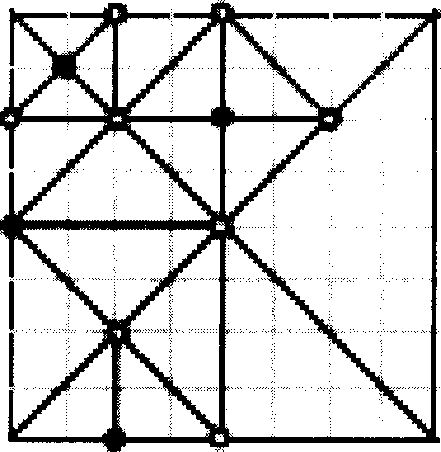
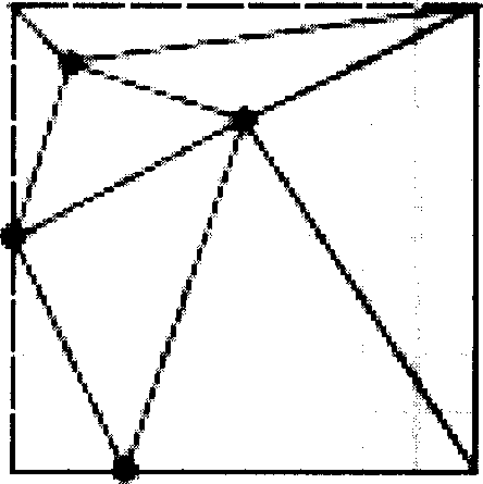
[0058] Take the current original DEM data file reflecting China's topography, which has 1024*1024 vertices horizontally and vertically as an example.

[0059] 1. First preprocess and split the data file. The file is divided into file sequence groups with a size of 256*256, and then the split file group is renamed according to geographic information, and four terrain files are saved. Suppose the file a, b, c, d.

[0060] 2. Then use the terrain scheduling algorithm based on the combination of traditional LRU algorithm and viewpoint interest to perform real-time switching between files to complete the real-time scheduling of terrain files. The traditional LRU algorithm considers the least recently used terrain information, and when there is no space in the buffer, the least recently used terrain blocks are removed from the memory. This approach is widely used in memory scheduler...


PUM


Abstract

The invention is a method for real-time drawing geometric model of realistic 3D topography, characterized in comprising the following steps of: (1) preprocessing topographical data to its structure accord to the follow-up operation; (2) adopting a topographical planning algorithm of making file-file real-time switching based on traditional LRU algorithm and the method of integrating viewpoint interests to complete the real-time planning for large-scale topographical files; (3) simplifying topographical model based on geometric Mip Map topographical network implementing and generating algorithm;(4) displaying topographical feature based on multi-grain GPU topographical Bump Map rendering algorithm; (5) realizing topographical data conversion based on four-tree ergodic topographical partial-replacing algorithm. The invention solves the problem of the drawing speed of topographical model being low, raising the drawing efficiency and achieving the purpose of real-time drawing dynamical topography.

Description

technical field [0001] The invention relates to a real-time rendering method of a three-dimensional terrain geometric model. Background technique [0002] Terrain rendering technology mainly includes terrain resource data organization, rendering data organization, and specific rendering methods used in the rendering process. Terrain resource data organization refers to the storage method for acquired terrain data. According to the different means of obtaining terrain data, typical terrain data is sampled with equidistant surface elevation grid DEM, such as Figure 1a As shown, this part of the data has not been optimized for rendering, and the data volume is large and redundant, but the data accuracy is good, and it is often used in scientific computing or military policy. The drawing data organization reorganizes the obtained resource data for drawing. The purpose of this is to reduce the number of drawing fixed points and improve drawing efficiency without affecting the di...

Claims


Application Information

Patent Timeline
Patent Type & Authority Applications(China)
IPC IPC(8): G06T15/20G06T1/60G06T17/50G06T17/05
Inventor 王莉莉史逊刘贤梅
Owner BEIHANG UNIV
Why Eureka
Try Eureka