Land cover change detection method based on remote sensing image processing
A remote sensing image processing and remote sensing image technology, applied in the field of image processing, can solve the problems of being easily affected by noise, limiting wide application, over-segmentation, etc., and achieving the effect of saving computing time and reducing the amount of calculation.
- Summary
- Abstract
- Description
- Claims
- Application Information
AI Technical Summary
Problems solved by technology
Method used
Image
Examples
Embodiment Construction
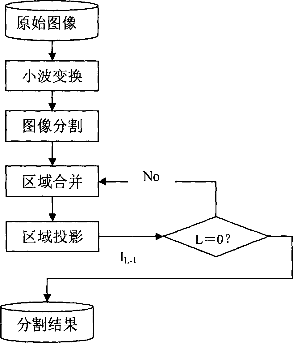
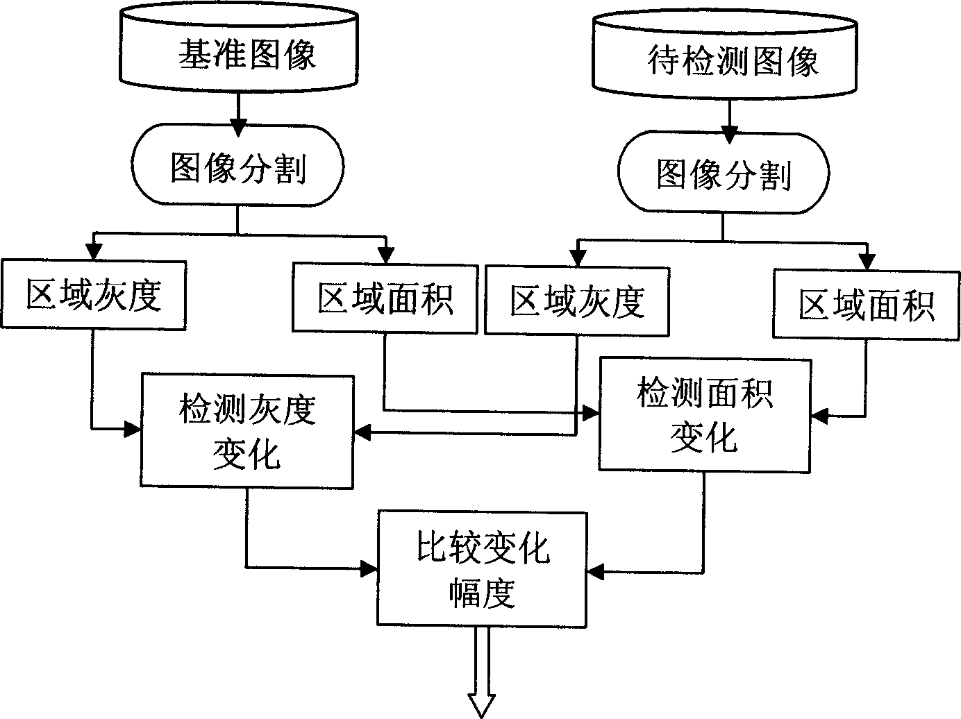
[0035] The implementation example of using the method of the present invention to realize change detection is as follows Figure 1 ~ Figure 3 As shown, it will be described in detail in conjunction with the figure.
[0036] The implementation process of the image segmentation described in the present invention is as follows figure 1 As shown, its working process is:
[0037] 1) Haar wavelet transform is performed on the entire image, and the gradient of the lowest resolution image is calculated;
[0038] 2) Perform initial segmentation with Watersheds transformation on the gradient image to form many initial segmentation regions, and assign a label to each region;
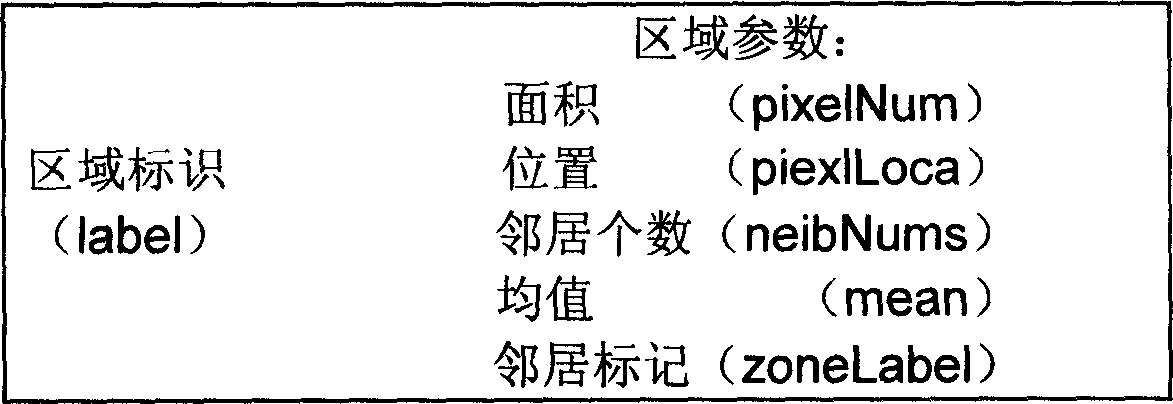
[0039] 3) After the initial segmentation is completed, the feature values of the statistics area include: area, mean value, position, number of neighbors and neighbor label (label);
[0040] 4) Merge segmented regions: Merge regions according to the gray similarity of adjacent regions. If the square difference...
PUM
 Abstract
Description
Claims
Application Information
 - R&D
- Intellectual Property
- Life Sciences
- Materials
- Tech Scout
- Unparalleled Data Quality
- Higher Quality Content
- 60% Fewer Hallucinations
Browse by: Latest US Patents, China's latest patents, Technical Efficacy Thesaurus, Application Domain, Technology Topic, Popular Technical Reports.
© 2025 PatSnap. All rights reserved.Legal|Privacy policy|Modern Slavery Act Transparency Statement|Sitemap|About US| Contact US: help@patsnap.com


