

Method for evaluating GIS-based agricultural non-point pollution production potential index
A technology of non-point source pollution and evaluation method, which is applied in the field of GIS-based evaluation of agricultural non-point source pollution occurrence potential index, which can solve the problems of non-point source pollution control lack of pertinence and effective discount of control measures.
- Summary
- Abstract
- Description
- Claims
- Application Information
AI Technical Summary
Problems solved by technology
Method used
Image

Examples
Embodiment Construction
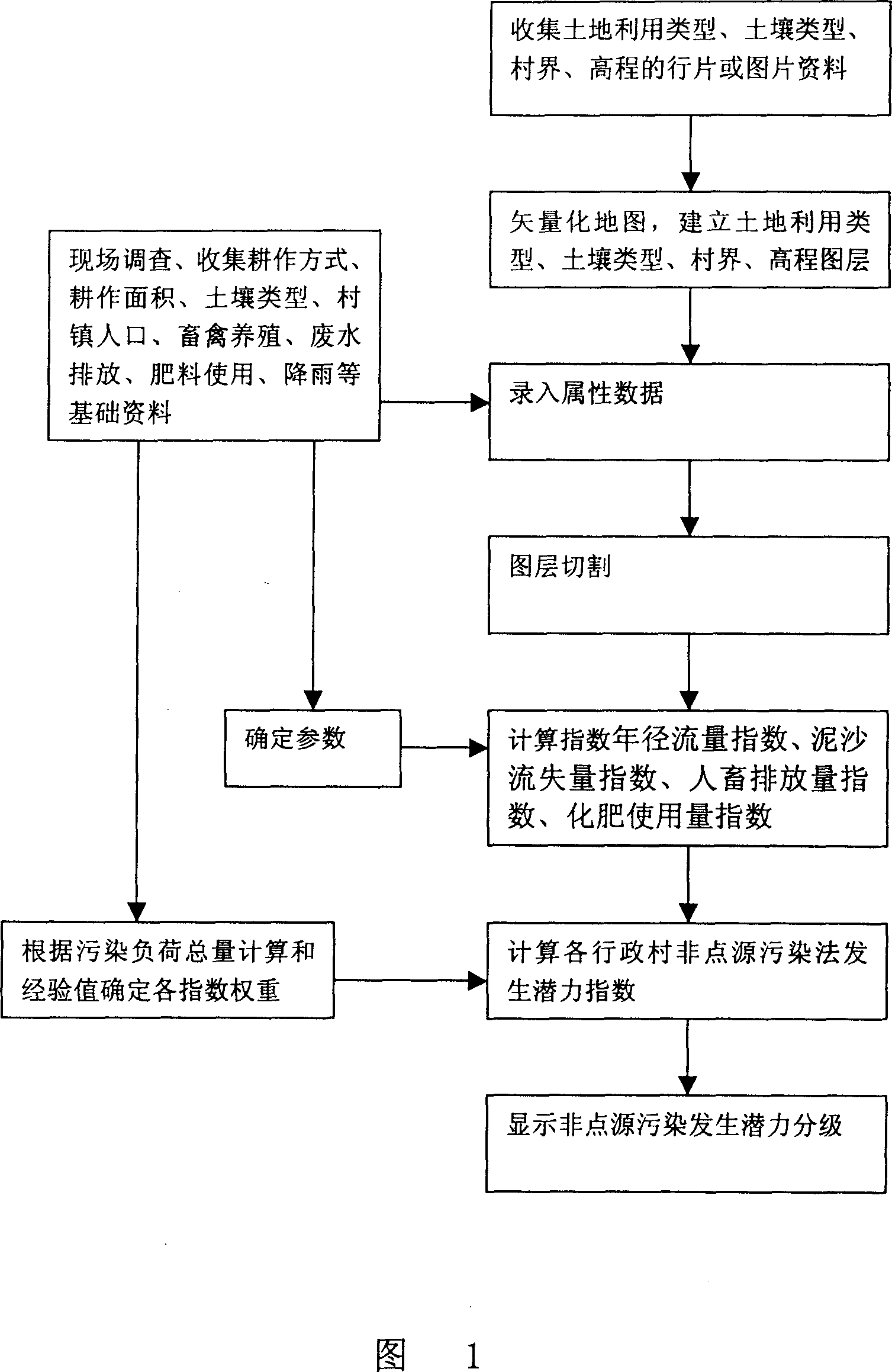
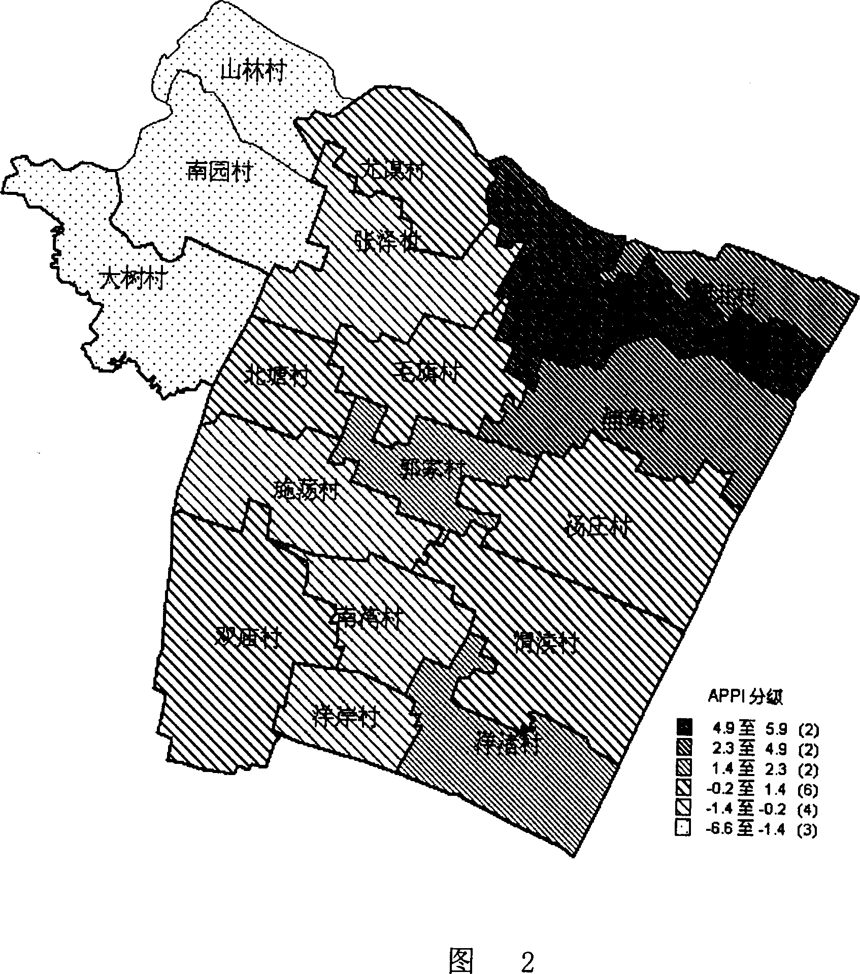
[0072] In order to implement the present invention better, the agricultural non-point source pollution occurrence potential index evaluation method based on GIS has been piloted in Dapu Town, Yixing City, Jiangsu Province,
[0073] Dapu Town has a population of 32,000 and a total land area of 46km 2 , of which the water area is nearly 1,000 hectares, the cultivated land area is 230 hectares, the population density is large, the proportion of land and water is large, and the land utilization rate is high.
[0074] 1 Preliminary data collection
[0075] The village boundary map, soil type map, soil use type map, Dapu elevation map, breeding situation of each village, population data, rainfall and other data of Dapu Town were collected through relevant local departments, some of which were obtained through field investigation.
[0076] 2 Establishment of GIS database
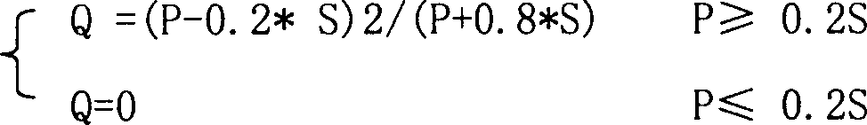
[0077] Use Mapinfo to carry out image registration (WGS84, 50 North) and vectorization on the collected pict...
PUM
 Abstract
Description
Claims
Application Information