

High-precision 3D position-finding system
- Summary
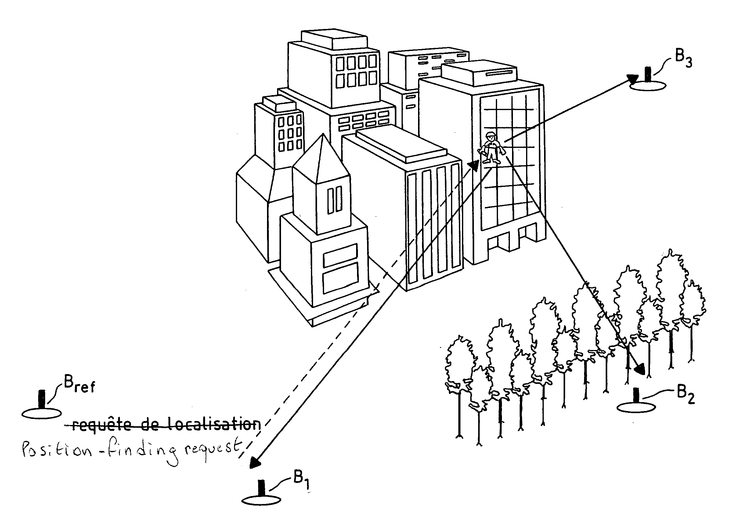
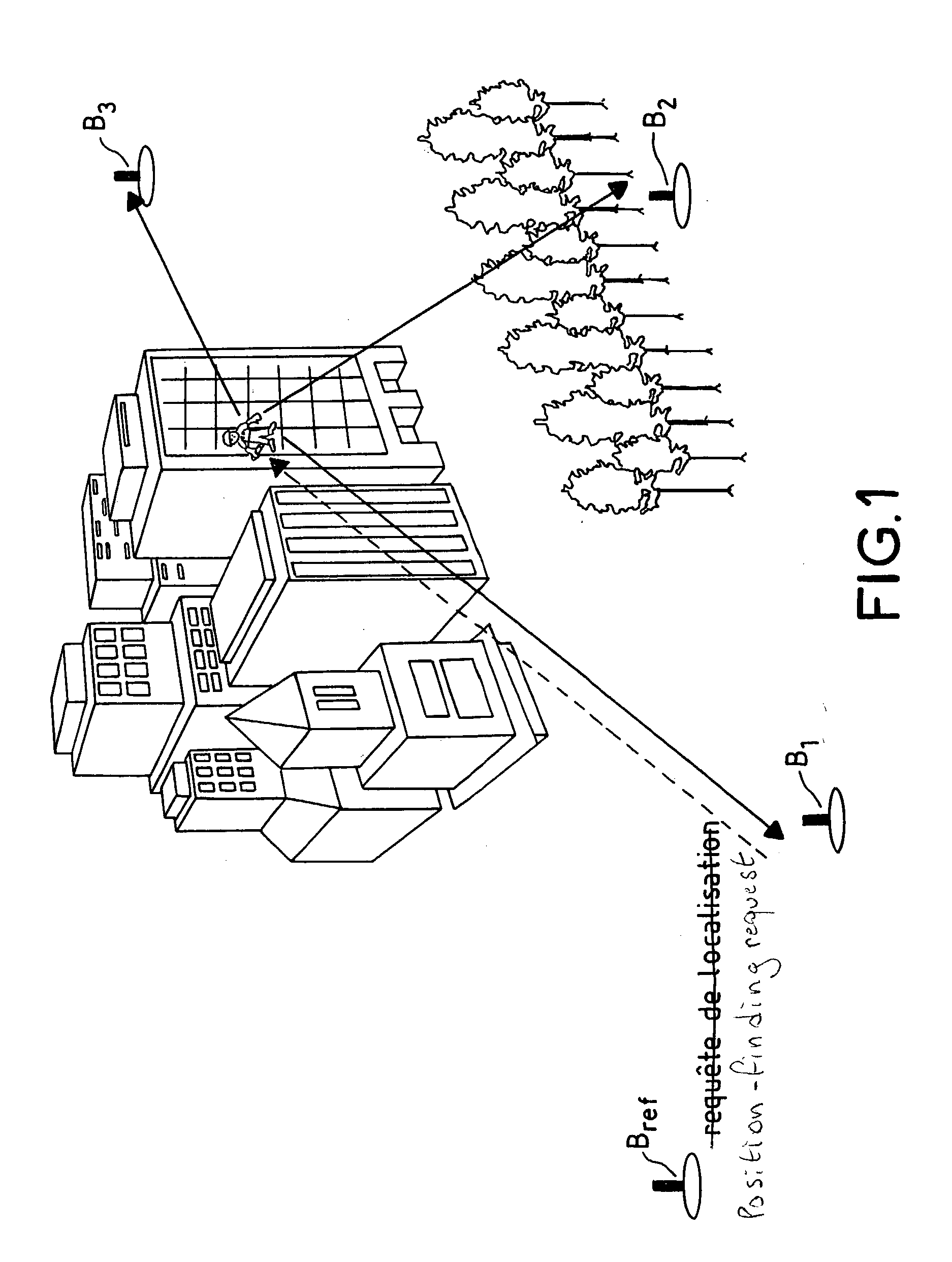
- Abstract
- Description
- Claims
- Application Information
AI Technical Summary
Benefits of technology
Problems solved by technology
Method used
Image

Examples
Embodiment Construction
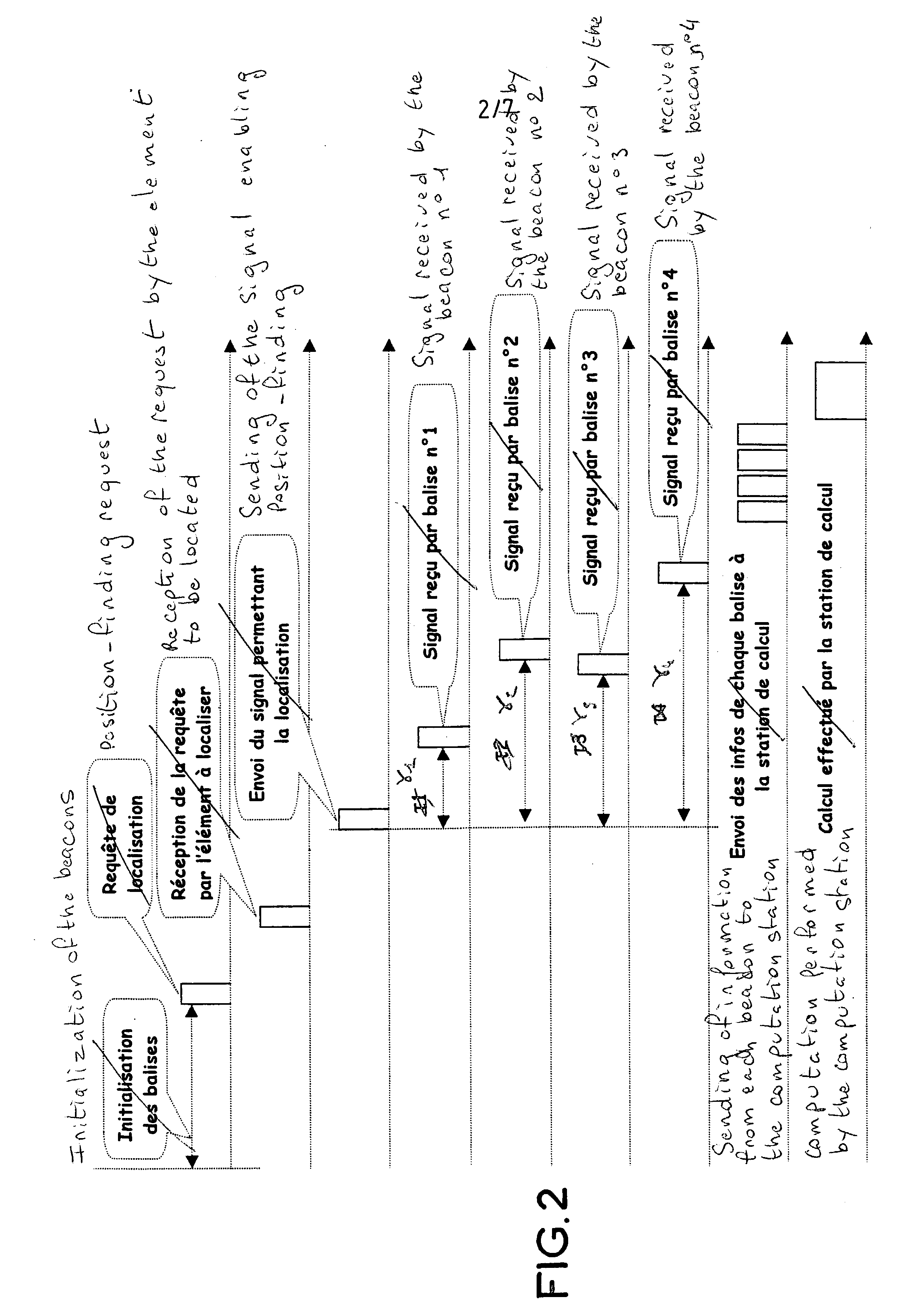
[0115] a=30 cm whence .DELTA..tau..sub.i max=1 ns where a is the distance between the antennas. Should there be four antennas, a corresponds to the side of the square plotted by the four antennas.
[0116] f.sub.i max=66 kHz for d=1000 m and a slope of (20 MHz, 1 ms)=20 10.sup.9 Hz / s, where d is the distance between the element whose position is to be located and the beacon.
[0117] f.sub.i max.DELTA..tau..sub.i max.about.10.sup.-4 hence the term T.sub.2 is negligible.
[0118] .DELTA.f.sub.i max=1 ns*20 10.sup.9=20 Hz
[0119] .DELTA..tau..sub.i max.DELTA.f.sub.i max=negligible
[0120] .DELTA..phi..sub.i max=2.pi.f.sub.c.DELTA..tau..sub.i max: non-negligible due to the carrier frequency.
[0121] Finally, the expression of the signal may be simplified and reduced to the following form: 6 S k( t ) = i = 0 N - 1 a i - j { 2 f i( t - i 2 )+ i } - j { 2 f i t + i} Whence : S 1( t ) = i = 0 N - 1 a i - j { 2 f i( t - i 2 )+ i } S 2( t ) = i = 0 N - 1 a i - j { 2 f i( t - i 2 )+ i } - j { 2 f i 21 t + i...
PUM
 Abstract
Description
Claims
Application Information