
Photo-based mobile deixis system and related techniques

a mobile deixis and mobile technology, applied in the field of location and object awareness systems, can solve the problems of frustrating formulating the right set of keywords, gps receivers are not always user-friendly, maps and tour books often lack detailed information, etc., to improve the eliminate irrelevant images, and improve the effect of available information to a user

Inactive Publication Date: 2005-07-28
MASSACHUSETTS INST OF TECH
View PDF10 Cites 733 Cited by
  • Summary
  • Abstract
  • Description
  • Claims
  • Application Information

AI Technical Summary

Benefits of technology

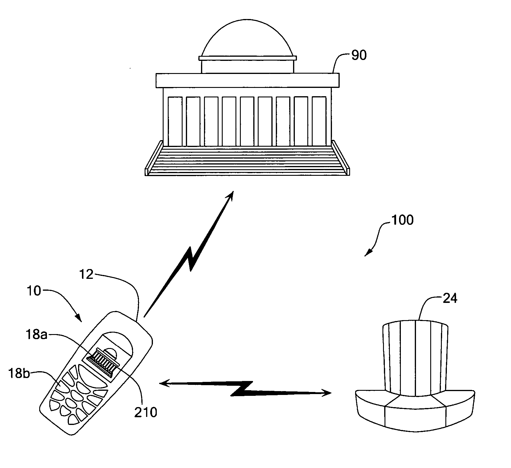
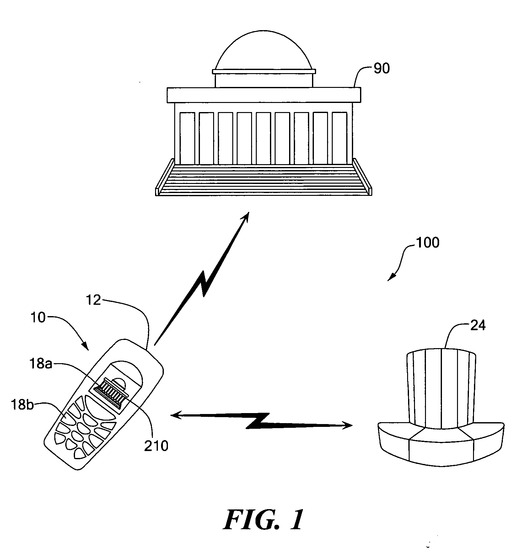
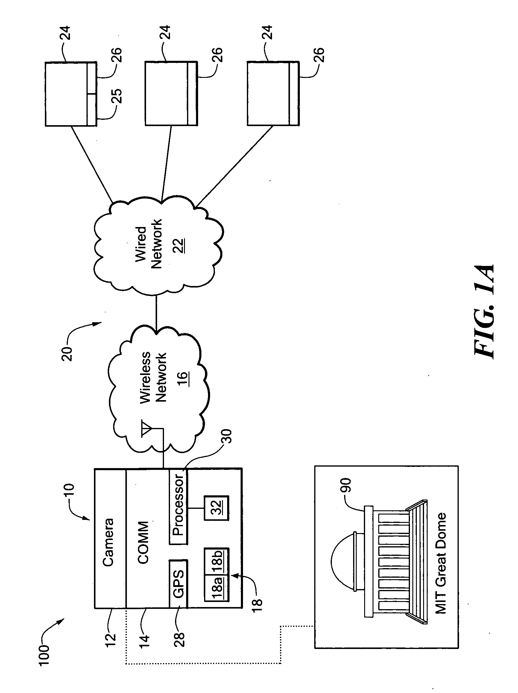
[0006] In accordance with the present invention, a mobile deixis device includes a camera to capture an image and a wireless handheld device, coupled to the camera and to a wireless network, to communicate the image with existing databases to find similar images. The mobile deixis device further includes a processor, coupled to the device, to process found database records related to similar images. The mobile deixis device further includes a display to view found database records that include web pages including images. With such an arrangement, users can specify a location of interest by simply pointing a camera-equipped cellular phone at the location of interest and by searching an image database or relevant web resources, users can quickly identify good matches from several close ones to find the location of interest.
[0007] In accordance with a further aspect of the present invention, the mobile deixis device can communicate with a server database which includes a web site dispersed within the Internet and having keywords linked to each similar image and the server database is capable of initiating a further search using the keywords to find additional similar images. With such an arrangement, images can be used to find keywords that can then be used to find additional images similar to the unknown image to improve the available information to a user.
[0008] In accordance with a still further aspect of the present invention, the computer with the server database in communication with the mobile deixis device is capable of comparing the original image with images resulting from the further search using the keywords to find additional similar images to eliminate irrelevant images. With such an arrangement, irrelevant text based images can be removed to improve the available information to a user.
[0009] In accordance with a still further aspect of the present invention, the mobile deixis device further includes a global positioning system (GPS) receiver to identify the geographical location of the mobile deixis device which can be used to eliminate any similar images that are known not to be located in the geographical location of the mobile deixis device. With such an arrangement, similar images found but not located in the general geographical area of the mobile deixis device can be eliminated to reduce the time needed by a user to identify the his or her location or objects in his or her field of view.

Problems solved by technology

Unfortunately, unless one is skilled in using a geographical map, a GPS receiver is not always user friendly especially in crowded downtown environments.
It has been observed that maps and tour books often lack detailed information and most people do not use them in everyday life, although most people carry a map when traveling to a new location.
Even when a mobile phone was available, it was unlikely to be used to call someone to ask for information.
However, formulating the right set of keywords can be frustrating in certain situations.
The amount of linguistic effort for such verbal-based deixis can be to involving and tedious to be practical.

Method used


Image

  • Photo-based mobile deixis system and related techniques
  • Photo-based mobile deixis system and related techniques
  • Photo-based mobile deixis system and related techniques

Examples


Embodiment Construction

[0019] Before providing a detailed description of the invention, it may be helpful to review the state of the art of recognizing location using mobile imagery. The notion of recognizing location from mobile imagery has a long history in the robotics community, where navigation based on pre-established visual landmarks is a known technique. The latter includes techniques for simultaneously localizing robot position and mapping the environment. Similar tasks have been accomplished in the wearable computing community wherein a user walks through a location while carrying a body-mounted camera to determine the environment. For example, a wearable-museum guiding system utilizes a head-mounted camera to record and analyze a visitor's visual environment. In such a system computer vision techniques based on oriented edge histograms are used to recognize objects in the field of view. Based on the objects seen, the system then estimated the location in the museum and displayed relevant inform...


PUM


Abstract

A mobile deixis device includes a camera to capture an image and a wireless handheld device, coupled to the camera and to a wireless network, to communicate the image with existing databases to find similar images. The mobile deixis device further includes a processor, coupled to the device, to process found database records related to similar images and a display to view found database records that include web pages including images. With such an arrangement, users can specify a location of interest by simply pointing a camera-equipped cellular phone at the object of interest and by searching an image database or relevant web resources, users can quickly identify good matches from several close ones to find an object of interest.

Description

FIELD OF THE INVENTION [0001] This invention relates generally to location and object awareness systems and more particularly to systems and techniques to identify a location or object in a person's field of view. BACKGROUND OF THE INVENTION [0002] When traveling to an unknown location, it is not unusual to be in an environment where one does not know his or her location. In recent years with the availability of global positioning systems (GPS), small hand held GPS receivers have appeared in the consumer market to help find one's location while visiting a strange location. Unfortunately, unless one is skilled in using a geographical map, a GPS receiver is not always user friendly especially in crowded downtown environments. Furthermore, one may know his or her general location, but may be interested in a specific object in his or her field of view. [0003] A deictic (pointing) gesture together with an inquiring utterance of the form “What's that?” are common conversational acts utili...

Claims


Application Information

Patent Timeline
IPC IPC(8): G06F17/30
CPCG06F17/30864G06F17/30277G06F16/532G06F16/951
Inventor DARRELL, TREVOR J.YEH, TOMTOLLMAR, KONRAD
Owner MASSACHUSETTS INST OF TECH
Learn More