
Collision avoidance system having GPS enhanced with OFDM transceivers

a technology of collision avoidance and transceiver, which is applied in the direction of navigation instruments, using reradiation, instruments, etc., can solve the problems of inability to eliminate, multiply or amplify the errors attributed to the gps receiver, and the size of the errors, so as to reduce the number of satellites, increase the accuracy of measurements performed, and facilitate installation or retrofit

Active Publication Date: 2005-12-08
FORD GLOBAL TECH LLC
View PDF17 Cites 41 Cited by
  • Summary
  • Abstract
  • Description
  • Claims
  • Application Information

AI Technical Summary

Benefits of technology

[0009] The embodiments of the present invention provide several advantages. One such advantage is the provision of communicating vehicle information with respect to a host vehicle utilizing orthogonal frequency domain modulation transceivers. In so doing, the stated embodiment aids in the reducing of the number of satellites that need to be visible while increasing the accuracy of the measurements performed.
[0010] Another advantage provided by an embodiment of the present invention, is the provision of an OFDM based object information system that is self-contained and packaged to be easily installed or retrofit into various vehicles.
[0011] Yet another advantage provided by an embodiment of the present invention, is the provision of a an OFDM based object information system that is in communication with other onboard vehicle systems, such as a navigation system, a telematics system, and a collision warning, avoidance, and countermeasure system.

Problems solved by technology

However, the errors attributed to the GPS receivers cannot be eliminated by such a subtraction and the errors, as a result, are multiplied or amplified in determining position.
The size of these errors is sensitive to the geometric relationship between GPS satellites being used.
Buildings, overpasses, foliage, and terrain may limit the number of satellites that are “visible” to the receivers of a GPS.
Thus, these limitations reduce the effectiveness of current GPSs in determining vehicle PVT data for the purposes of vehicle safety, navigation, and Telematics.

Method used


Image

  • Collision avoidance system having GPS enhanced with OFDM transceivers
  • Collision avoidance system having GPS enhanced with OFDM transceivers
  • Collision avoidance system having GPS enhanced with OFDM transceivers

Examples


Embodiment Construction

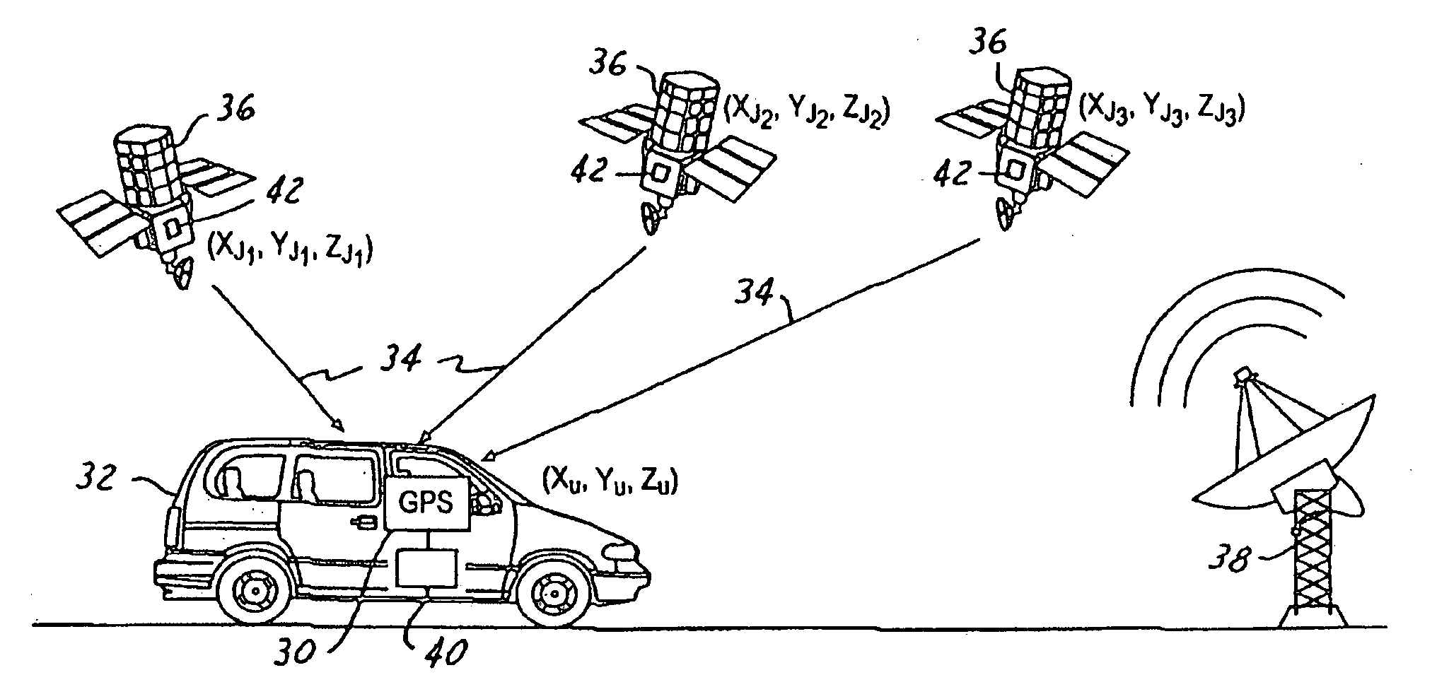
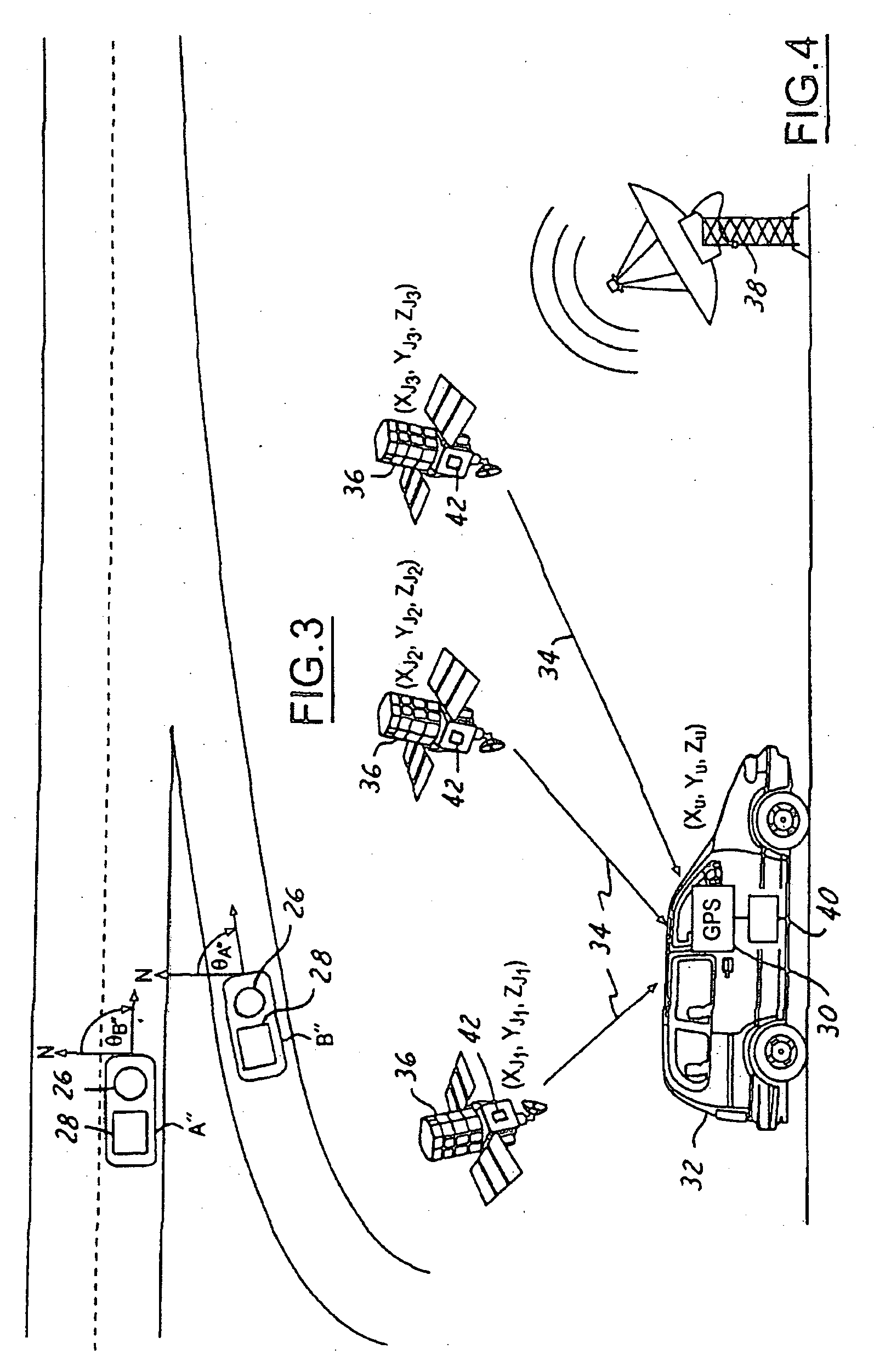
[0024] GPS errors are normally categorized as either system errors or user errors. System errors are errors that arise from a GPS system itself. The system errors, for example, can include synchronization errors between satellites, synchronization errors with a central clock, inaccuracies in satellite PVT data, number of visible satellites at any given time, velocity and timing aspects within the satellites, and accuracy of the timing signal shape. Also, the relative position of the satellites affects geometric dilution of precision (GDOP), which amplifies range errors. Range errors refer to the distance between the satellites and the GPS receivers. Small angle between the range lines causes high GDOP. High GDOP refers to magnification in measurements errors in the length of the range lines due to the satellites being located near the horizon.

[0025] User errors are errors that can be minimized within the GPS receivers. User errors include receiver errors and environmental errors. R...


PUM


Abstract

An object relative status determination system (54) for a vehicle (52) includes an orthogonal frequency domain modulation (OFDM) transceiver (56) that generates an object range signal (83). The system (54) may also include a global navigation system (GNS) (58) that receives a satellite range signal (70). A controller (66) is coupled to the OFDM transceiver (56) and the GNS (58) and determines object information relative to the vehicle (52) in response to the object range signal (83) and the satellite range signal (70).

Description

TECHNICAL FIELD [0001] The present invention relates to collision warning, avoidance, and countermeasure systems for an automotive vehicle. More particularly, the present invention is related to systems and methods of determining positions and velocities of vehicles relative each other. BACKGROUND OF THE INVENTION [0002] Collision warning, avoidance, and countermeasure systems are becoming more widely used. Collision warning systems are able to detect an object within proximity of a host vehicle and assess whether the object detected is an obstacle and poses a threat to the host vehicle. These systems also provide a vehicle operator knowledge and awareness of obstacles or vehicles within a close proximity in time such that the operator may perform actions to prevent colliding with the detected obstacles. Countermeasure systems exist in various passive and active forms. Some countermeasure systems are used in the prevention of a collision others are used in the prevention of an injur...

Claims


Application Information

Patent Timeline
Patent Type & Authority Applications(United States)
IPC IPC(8): G01S13/931G01S1/00G01S5/00G01S5/02G01S19/05G01S19/51
CPCG01S5/0072G01S5/0257G01S13/931G01S2013/936G01S2013/9353G01S2013/9316G01S2013/932
Inventor MACNEILLE, PERRYMILLER, RONALD
Owner FORD GLOBAL TECH LLC
Learn More