Spectral geographic information system

a geographic information system and spectral technology, applied in the field of spectral geographic information system, can solve the problems of difficult analyzing and displaying data, inability to achieve many remote sensing tasks which are impractical or impossible, and inability to directly apply commonly used image analysis techniques

Active Publication Date: 2006-05-04
THE BOEING CO
View PDF12 Cites 18 Cited by
  • Summary
  • Abstract
  • Description
  • Claims
  • Application Information

AI Technical Summary

Problems solved by technology

In remote sensing image analysis, the difficulty arises in the fact that a scene pixel is mixed linearly or nonlinearly by different materials resident in the pixel where direct applications of commonly used image analysis techniques generally do not work well.
Many remote sensing tasks which are impractical or impossible can be accomplished with HSI.
Due to the large amount of data associated with HSI technology, analyzing and displaying this data is difficult and processor intensive.

Method used


Image

  • Spectral geographic information system
  • Spectral geographic information system
  • Spectral geographic information system

Examples


Embodiment Construction

[0026] The following detailed description is of the best currently contemplated modes of carrying out the invention. The description is not to be taken in a limiting sense, but is made merely for the purpose of illustrating the general principles of the invention, since the scope of the invention is best defined by the appended claims.

[0027] The system described herein is suitable for use with Hyperspectral Imaging (HIS) applications where the collection of geographic imaging data is used for the location of specific target types. More specifically, the system lends itself particularly well to the identification and location of military targets typically associated with air to ground geographic imaging technology.

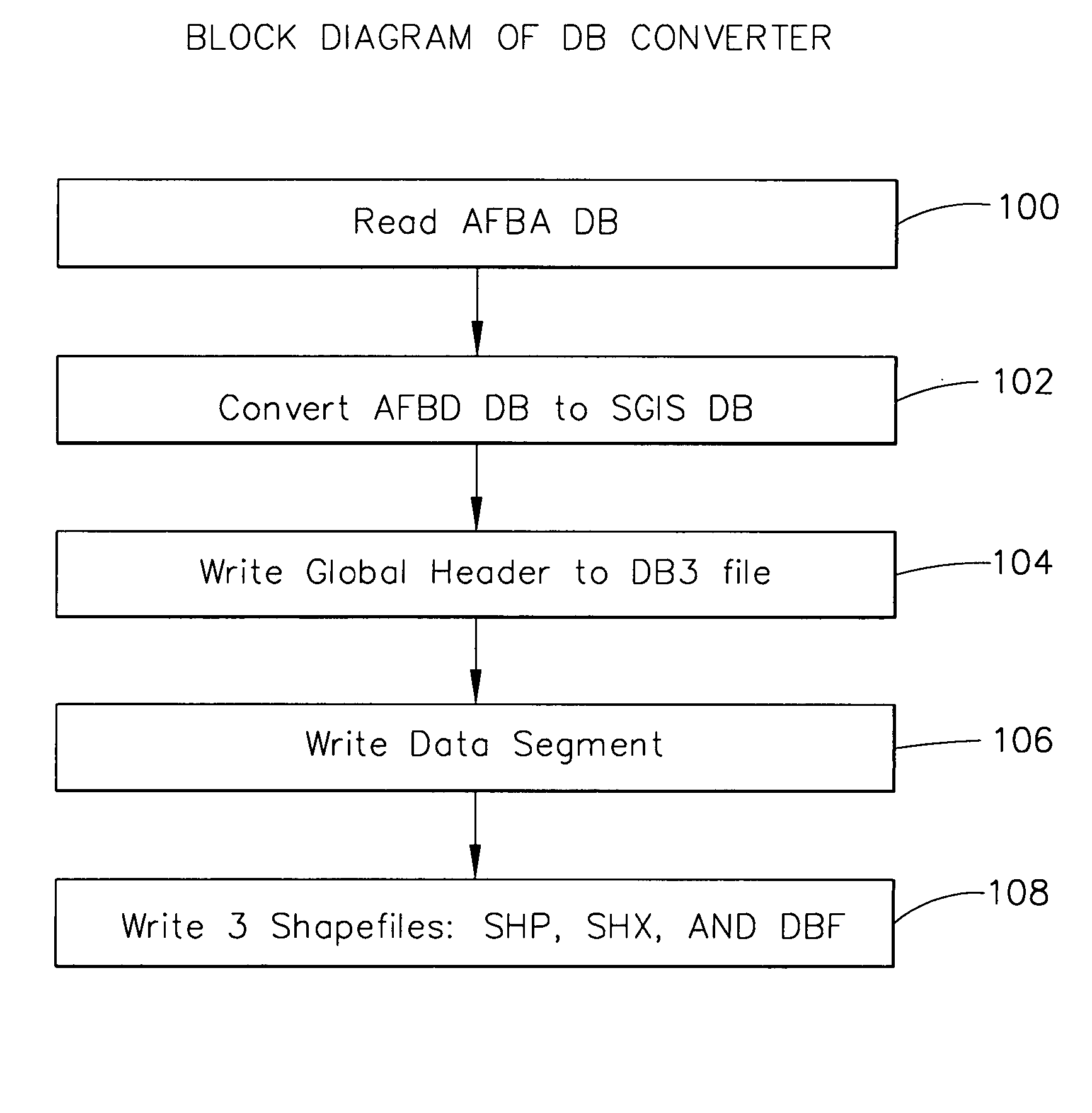
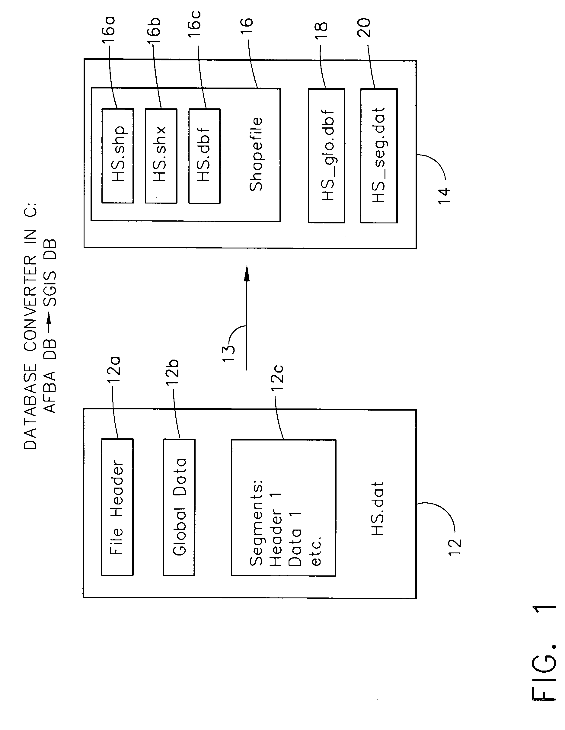
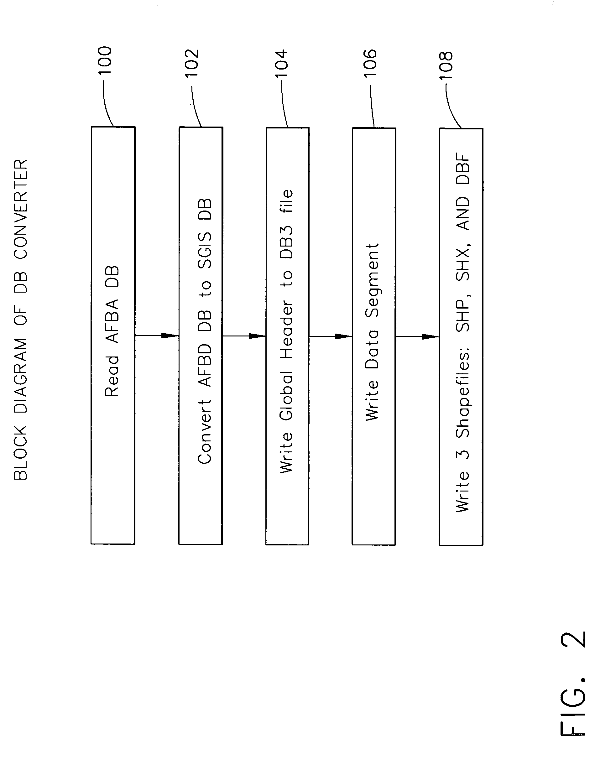
[0028] The system described herein differs from the prior art because it provides a means to translate large graphic image data files into a compact, highly efficient database file structure that provides for the real time analysis and display of hyperspectral image data....


PUM


Abstract

A system for the conversion, analysis and display of geographic imaging data is provided which allows for the efficient location of various targets based on user selectable search criteria. The system provides a means to convert large image database information to a more compact and efficient structure employing the use of a shape library and an associated shape index.

Description

BACKGROUND OF THE INVENTION [0001] This invention relates to a system specifically adapted for use in spectral geographic information systems. More particularly, this invention relates to a system configured to translate large information databases into a more compact database for analysis using various hyperspectral techniques to facilitate the location of targets. [0002] Hyperspectral imagery consists of hundreds of “spectra,” or measurements of reflected or emitted energy. Hyperspectral sensors scan many channels across a relatively narrow bandwidth and provide detailed information about target spatial and spectral patterns. Absorption and emission bands of given substances often occur within very narrow bandwidths. They allow high-resolution, hyperspectral sensors to distinguish the properties of the substances to a finer degree than an ordinary broadband sensor. The intensity of this energy can be measured at various wavelengths. Many objects and substances have spectral charac...

Claims


Application Information

Patent Timeline
Patent Type & Authority Applications(United States)
IPC IPC(8): G06K9/36G06K9/46G06V20/13
CPCG06K9/0063G06V20/13
Inventor PORTIGAL, FREDTELGARSKY, RASTISLAV
Owner THE BOEING CO
Why Eureka
Try Eureka