

Fast fourier transform with down sampling based navigational satellite signal tracking
a fourier transform and satellite signal technology, applied in the direction of automatic control, measurement devices, instruments, etc., can solve the problems of weak signals, inconvenient use of most of these techniques, and increase the cost of extra subscriptions and base stations, so as to reduce computational costs, high frequency resolution, and high frequency resolution
- Summary
- Abstract
- Description
- Claims
- Application Information
AI Technical Summary
Benefits of technology
Problems solved by technology
Method used
Image

Examples
Embodiment Construction
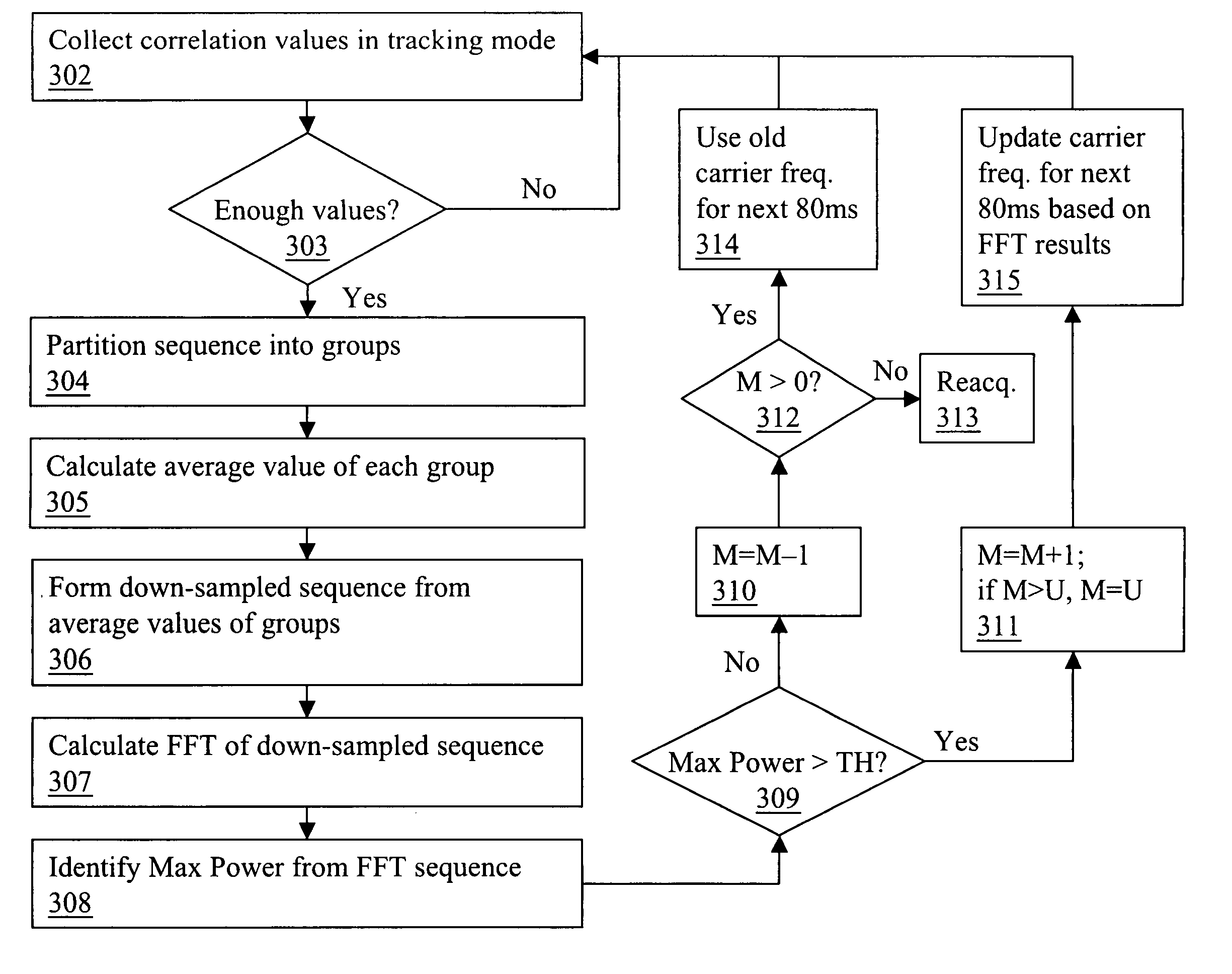
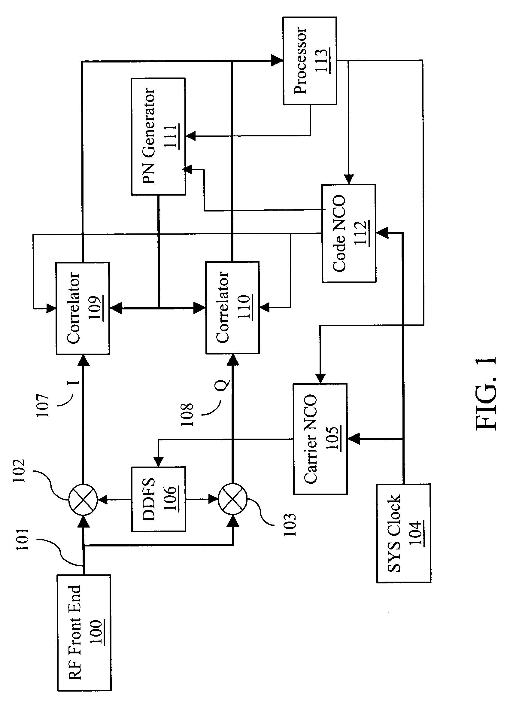
[0015] A preferred embodiment of a receiver according to the present invention is illustrated in FIG. 1. An intermediate frequency (IF) signal input 101 enters a baseband section of the receiver from an analog-to-digital converter (ADC) output of a conventional RF front-end 100. The IF input is multiplied in IF mixers 102 and 103 in-phase and in quadrature, respectively, with a local frequency signal generated by a direct digital frequency synthesizer (DDFS) 106. This mixing involves multiplying the ADC output 101 by the local DDFS frequency in-phase which generates the in-phase (I) component 107. In a parallel path the same signal 101 is multiplied by the DDFS frequency in quadrature (i.e., with a phase shift of 90 degrees) to produce quadrature (Q) component 108. The DDFS 106 is driven by a carrier numerically controlled oscillator (NCO) 105. In addition, carrier NCO 105 receives phase and frequency corrections from a processor 113. Because of this correction, the DDFS frequency a...
PUM
 Abstract
Description
Claims
Application Information