
Vehicle dynamic navigation system and method

a dynamic navigation and vehicle technology, applied in the field of vehicle dynamic navigation method and system, can solve the problems of long information transmission time, driver may have to spend a longer time, and long journey duration

Inactive Publication Date: 2008-05-08
XINGYI SCI & TECH
View PDF5 Cites 16 Cited by
  • Summary
  • Abstract
  • Description
  • Claims
  • Application Information

AI Technical Summary

Problems solved by technology

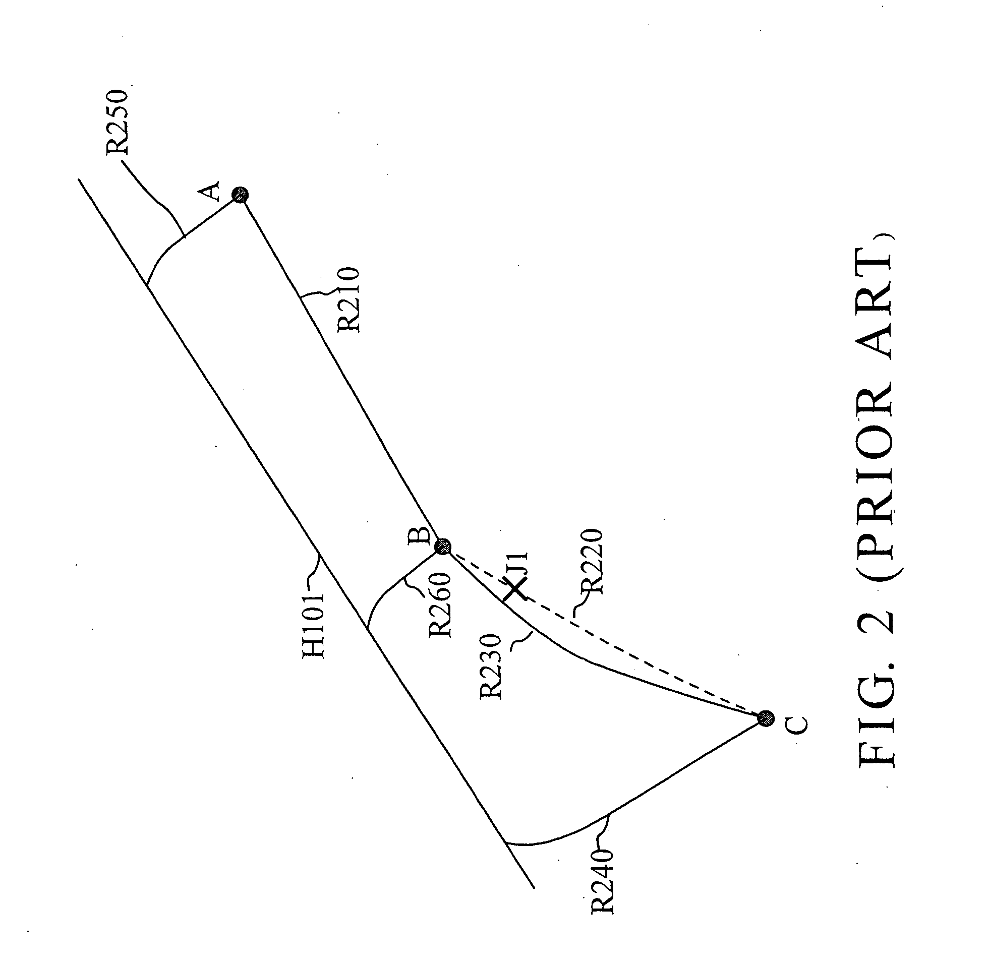
However, a conventional navigation system simply considers the shortest path from the location of departure to the location of destination without taking traffic-problem locations or actual traffic conditions into account when proposing a suggested travel path, and the suggested travel path may be the shortest path in distance but the duration of the journey may be very long.
That is, the driver may have to spend a longer time to reach the destination through the suggested travel path because of factors unknown.
However, when traffic jams have occurred in many places due to extraordinary conditions, or when traveling in very large territory area where traffic information is complex, the information transmission time will be long, adding an economic burden to the driver or causing the driver to be unable to get away from the jammed road segment.
1. It cannot provide detailed traffic jam information in real time.
Therefore, this method cannot eliminate the problem of high transmission charge due to the large amount of traffic jam information.
3. The remote server must compute and compare all possible paths, and the on-vehicle main unit can propose the travel path only after download of the traffic jam information from the remote server, thereby resulting in the following problems:a. Increase of the driver's waiting time during navigation.b. High probability of machine shutdown due to overload of the remote server.c. Low marketability due to high construction cost of the remote server.
4. It cannot obtain the traffic jam information when not in the navigation mode.
5. It does not provide an option for allowing the driver to decide whether or not to avoid the path having a traffic jam.

Method used


Image

  • Vehicle dynamic navigation system and method
  • Vehicle dynamic navigation system and method
  • Vehicle dynamic navigation system and method

Examples


Embodiment Construction

[0028]FIG. 3 is a system block diagram of a vehicle dynamic navigation system according to the present invention. As illustrated, the dynamic navigation system comprises an input device 310, a GPS (global positioning system) 320, an electronic map database 330, a display screen 340, a speaker 341, a wireless transceiver 350, an on-vehicle main unit 360, and a memory device 370.

[0029]The input device 310 is adapted for inputting a start point S of a trip, an end point E of the trip, and an update interval t. The GPS 320 is adapted to output the vehicle's current position Pc. In other embodiments, the start point S of the trip can be the vehicle's current position Pc outputted by the GPS 320. The update interval t can be stored in the memory device 370.

[0030]The electronic map database 330 has stored therein multiple items of road map information. The road map information includes the names of multiple roads, and the coordinates of the start point and end point of each of the roads.

[0...


PUM


Abstract

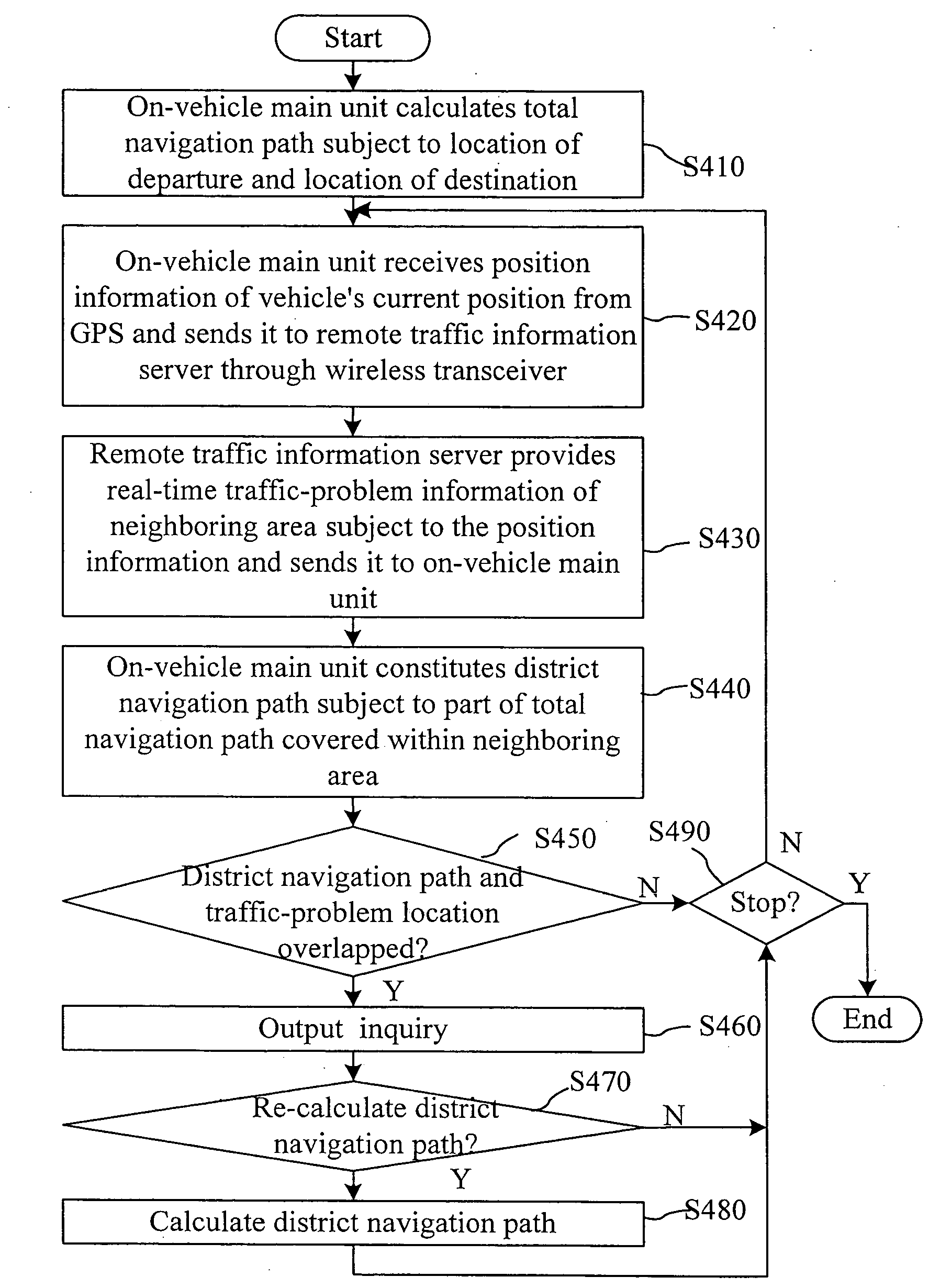
A vehicle dynamic navigation method and system in which an on-vehicle main unit calculates a total navigation path subject to the set start location and destination, and transmits a position information indicative of the vehicle's current position received from a global positioning system through a wireless transceiver to a remote traffic information server so as to obtain a real-time traffic-problem location data of a neighboring area from the remote traffic information server, and then constitutes a district navigation path based on the part of the total navigation path within the neighboring area, and then determines whether the district navigation path and the traffic-problem location data overlap each other, and then re-proposes the district navigation path when the district navigation path and the traffic-problem location data are found to overlap.

Description

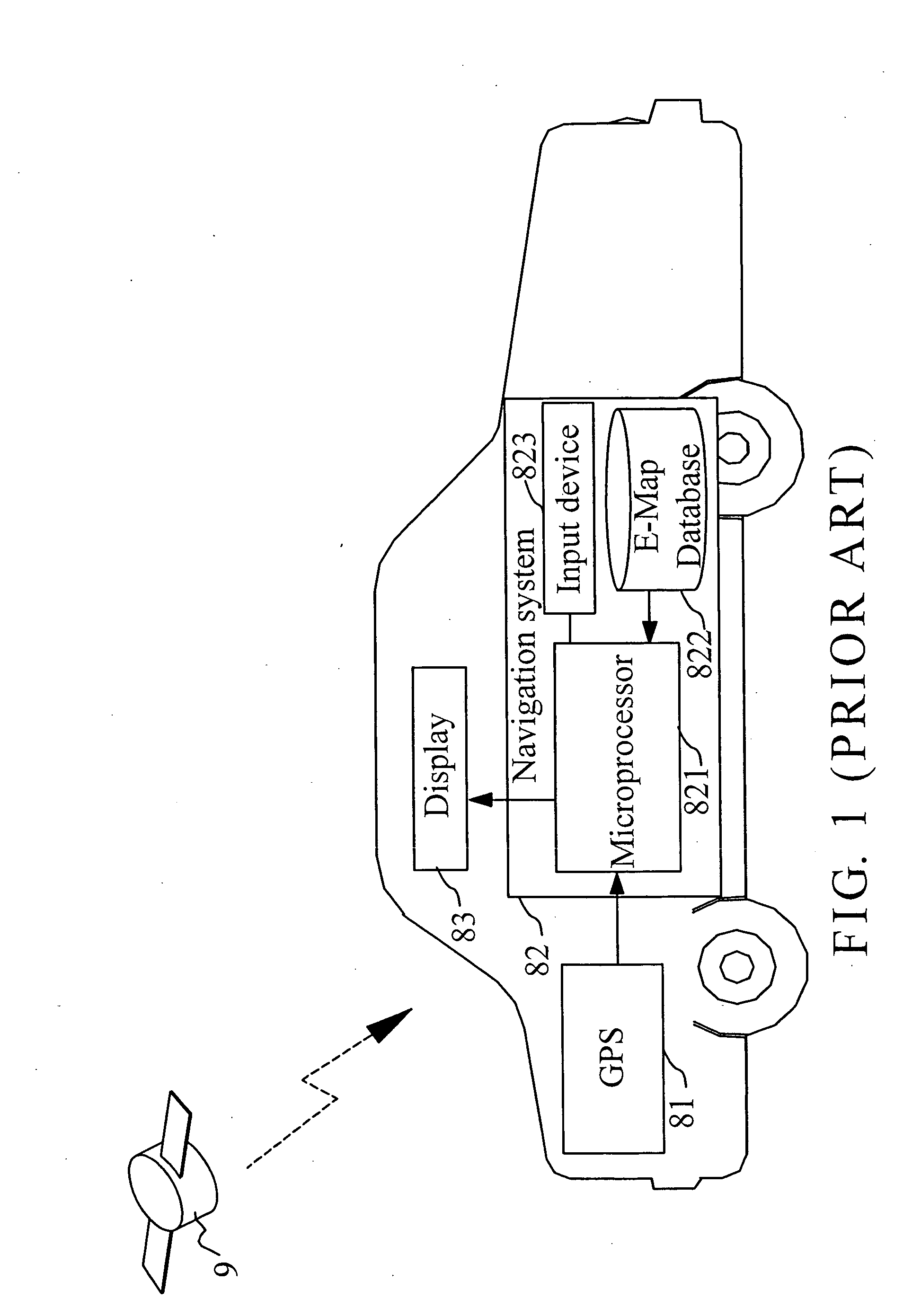
BACKGROUND OF THE INVENTION[0001]1. Field of the Invention[0002]The present invention relates to the vehicle navigation technology and more particularly, to a vehicle dynamic navigation method and system.[0003]2. Description of Related Art[0004]FIG. 1 shows a vehicle carrying a convention navigation system. The navigation system comprises a GPS (Global Positioning System) 81, a navigation device 82, and a display 83. The GPS 81 receives signals from multiple global position satellites 9 for calculating the coordinates of the vehicle's current position. The microprocessor 821 of the navigation device 82 compares the coordinates of the vehicle's current position to the built-in electronic map database 822 to determine the corresponding location of the vehicle's current position on map data in the electronic map database 822, and then shows a sign and the map data on the display 83, for enabling the driver to know the road on which the vehicle is traveling and actual location of the ve...

Claims


Application Information

Patent Timeline
Patent Type & Authority Applications(United States)
IPC IPC(8): G01C21/34
CPCG01C21/3492G01C21/3415G01C21/30G01C21/36G08G1/09626G08G1/096833G06Q50/40
Inventor CHEN, KUO-RONGLEE, CHUN-CHUNGYANG, MING-WEN
Owner XINGYI SCI & TECH
Learn More