
Navigation apparatus used in-vehicle

a navigation apparatus and in-vehicle technology, applied in navigation instruments, instruments, transportation and packaging, etc., can solve the problems of time-consuming and laborious driving special vehicles around an extensive road network to collect mapping information, and the accuracy of digital maps may not be guaranteed. , the completeness, quality and current validity of such information cannot be guaranteed, so as to improve the quality and accuracy of digital maps. , the effect of simplifying the burden of collecting and updating

Inactive Publication Date: 2011-09-15
TOMTOM INT BV
View PDF51 Cites 35 Cited by
  • Summary
  • Abstract
  • Description
  • Claims
  • Application Information

AI Technical Summary

Benefits of technology

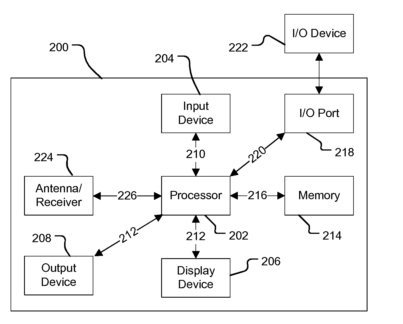
[0024]The present invention is based on the surprising appreciation that supplementary map information can be inferred by analysing statistically information generated from standard sensors of a typical vehicle. These sensors have previously been dismissed as a reliable source of mapping information, because the sensor outputs are affected by a wide variety of different driving conditions and driving events, and different vehicles use different types of sensors. However, statistical analysis to identify information patterns, can yield supplementary road information that is surprisingly accurate.
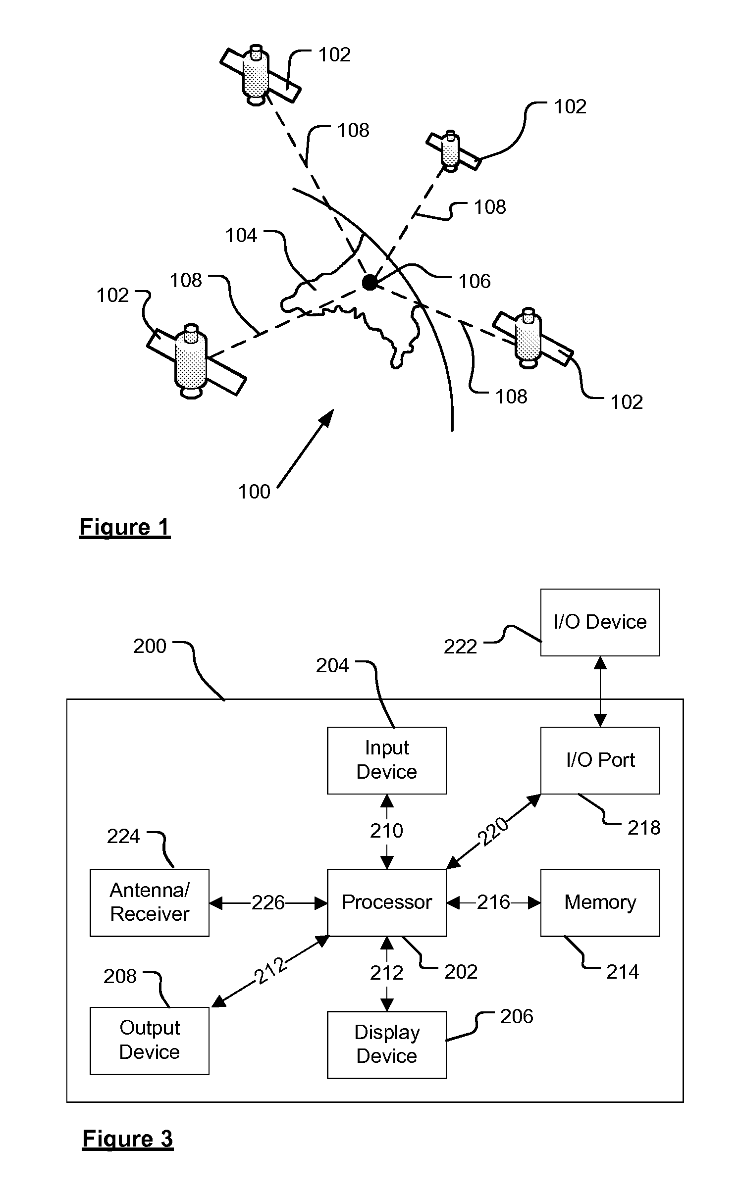
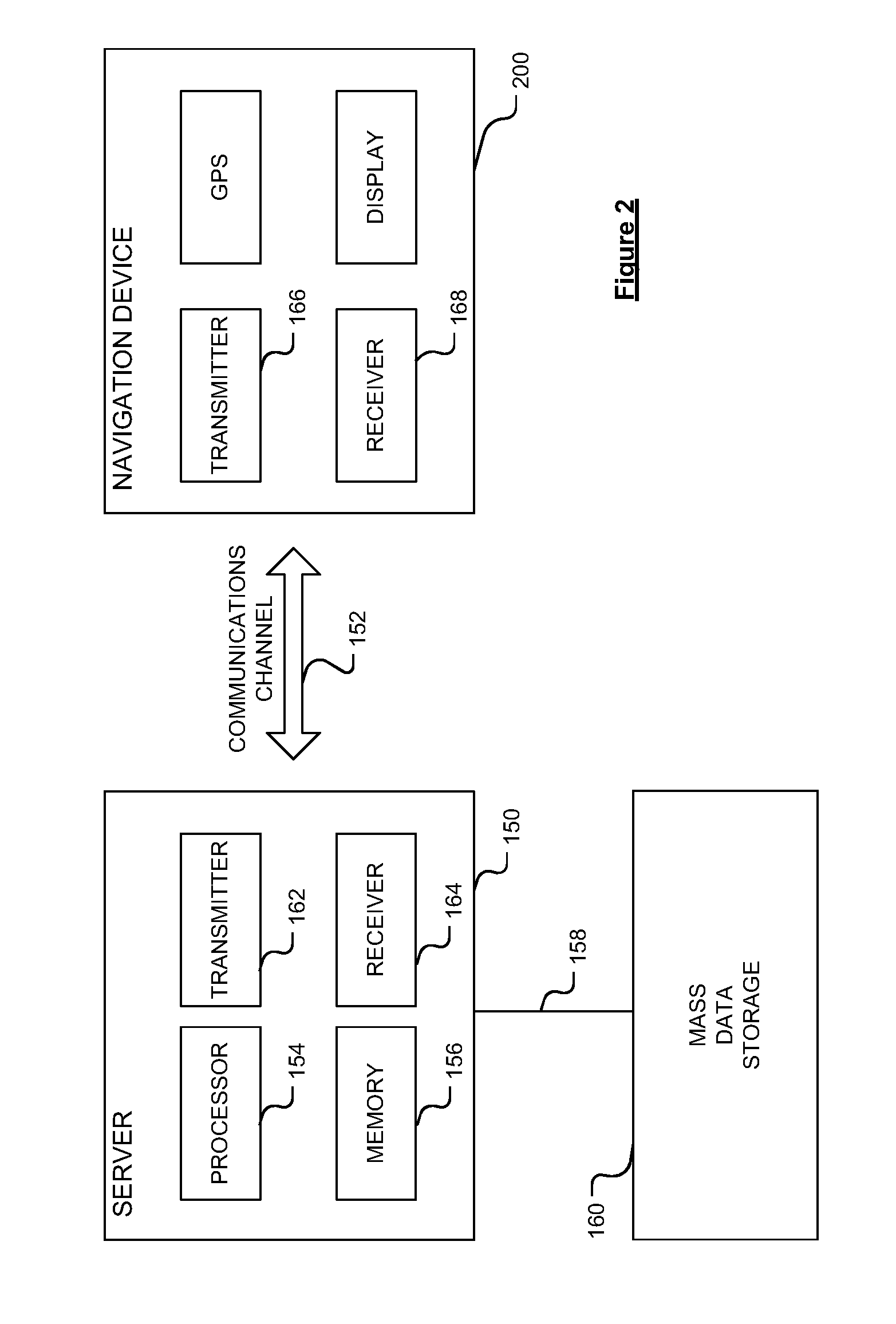
[0029]One technique of the present invention is for a navigation device used in-vehicle (either docked with a vehicle or being part of integral in-vehicle equipment) to log information obtained from the on-board vehicle sensors normally used to monitor or aid vehicle performance. The logged information is later uploaded to a server via data communications channel. The server preferably receives similar information from other navigation devices used in other vehicles. Statistical analysis of the uploaded information is used to infer accurate supplementary road information. The supplementary road information can be used to generate warnings of driving hazards, and to aid route calculations with a preference for route safety.
[0041]It is thus possible to provide an apparatus and method capable of deriving supplementary road information from standard in-vehicle sensors that are not configured or intended for mapping. This simplifies the burden of collecting and updating supplementary map information, as such information can be inferred from information fed back by navigation devices to a server. The supplementary map information can be used to improve the quality and accuracy of digital maps, and enable a variety of safety advantages to be achieved when planning a route.

Problems solved by technology

However, the completeness, quality and current validity of such information may not be guaranteed.
However, a typical vehicle only has dedicated sensors for monitoring and aiding the performance of that vehicle, not mapping-capable measurement sensors.
Equipping such vehicles with the necessary additional measurement sensors and cameras for collecting map information is expensive.
Moreover, driving the special vehicles around an extensive road network to collect mapping information is time-consuming and laborious.

Method used


Image

  • Navigation apparatus used in-vehicle
  • Navigation apparatus used in-vehicle
  • Navigation apparatus used in-vehicle

Examples


Embodiment Construction

[0066]Throughout the following description identical reference numerals will be used to identify like parts.

[0067]Embodiments of the present invention will now be described with particular reference to a PND. It should be remembered, however, that the teachings of the present invention are not limited to PNDs but are instead universally applicable to any type of processing device that is configured to execute navigation software in a manner configured for in-vehicle use so as to provide route planning and navigation functionality. It follows therefore that in the context of the present application, a navigation device is intended to include (without limitation) any type of route planning and navigation device, irrespective of whether that device is embodied as a PND, a vehicle such as an automobile, or indeed a portable computing resource, for example a portable personal computer (PC), a mobile telephone or a Personal Digital Assistant (PDA) executing route planning and navigation s...


PUM


Abstract

A navigation apparatus includes a processing resource that is operably coupled to a data store including digital map data. A location determination unit is also provided and capable of determining a location. In at least one embodiment, the navigation apparatus receives information from at least a vehicle: steering sensor for sensing an angular position of the vehicle steering control. Information relating to the sensed parameters is logged by the navigation apparatus while driving. Upon subsequent uploading of the information to a server, the information is analysed statistically, and combined with similar information obtained from other navigation devices. The statistical analysis enables supplementary road information to be derived, such as road lane width; Such supplementary road information is added to the digital map to facilitate greater safety awareness and route planning.

Description

FIELD OF THE INVENTION[0001]The present invention relates to the field of navigation devices for in-vehicle use, and methods associated therewith. Such devices may, for example, be installed as integral vehicle equipment, or may be portable devices configured or configurable for in-vehicle use.BACKGROUND TO THE INVENTION[0002]Portable computing devices, for example Portable Navigation Devices (PNDs) that include GPS (Global Positioning System) signal reception and processing functionality are well known and are widely employed as in-car or other vehicle navigation systems.[0003]In general terms, a modern PND comprises a processor, memory (at least one of volatile and non-volatile, and commonly both), and map data stored within said memory. The processor and memory cooperate to provide an execution environment in which a software operating system may be established, and additionally it is commonplace for one or more additional software programs to be provided to enable the functional...

Claims


Application Information

Patent Timeline
Patent Type & Authority Applications(United States)
IPC IPC(8): G01C21/26B62D15/02
CPCG01C21/32G08G1/096811G08G1/0104G01C21/3844G01C21/3819G01C21/3837G01C21/3848G01C21/28G01C21/387G01C21/3885
Inventor ABEN, SJOERDTHOMASSEN, ERIKDE HASS, TEUN
Owner TOMTOM INT BV
Learn More