
Location point determination apparatus, map generation system, navigation apparatus and method of determining a location point

a technology of location point and map, applied in the direction of navigation instruments, maps/plans/charts, instruments, etc., can solve the problems of limited number of named areas that can be processed, limited process of manual assignment, and high cost, so as to increase the accuracy of location points assigned, the effect of efficient and cost-effectiv

Active Publication Date: 2012-05-31
TOMTOM GLOBAL CONTENT
View PDF6 Cites 20 Cited by
  • Summary
  • Abstract
  • Description
  • Claims
  • Application Information

AI Technical Summary

Benefits of technology

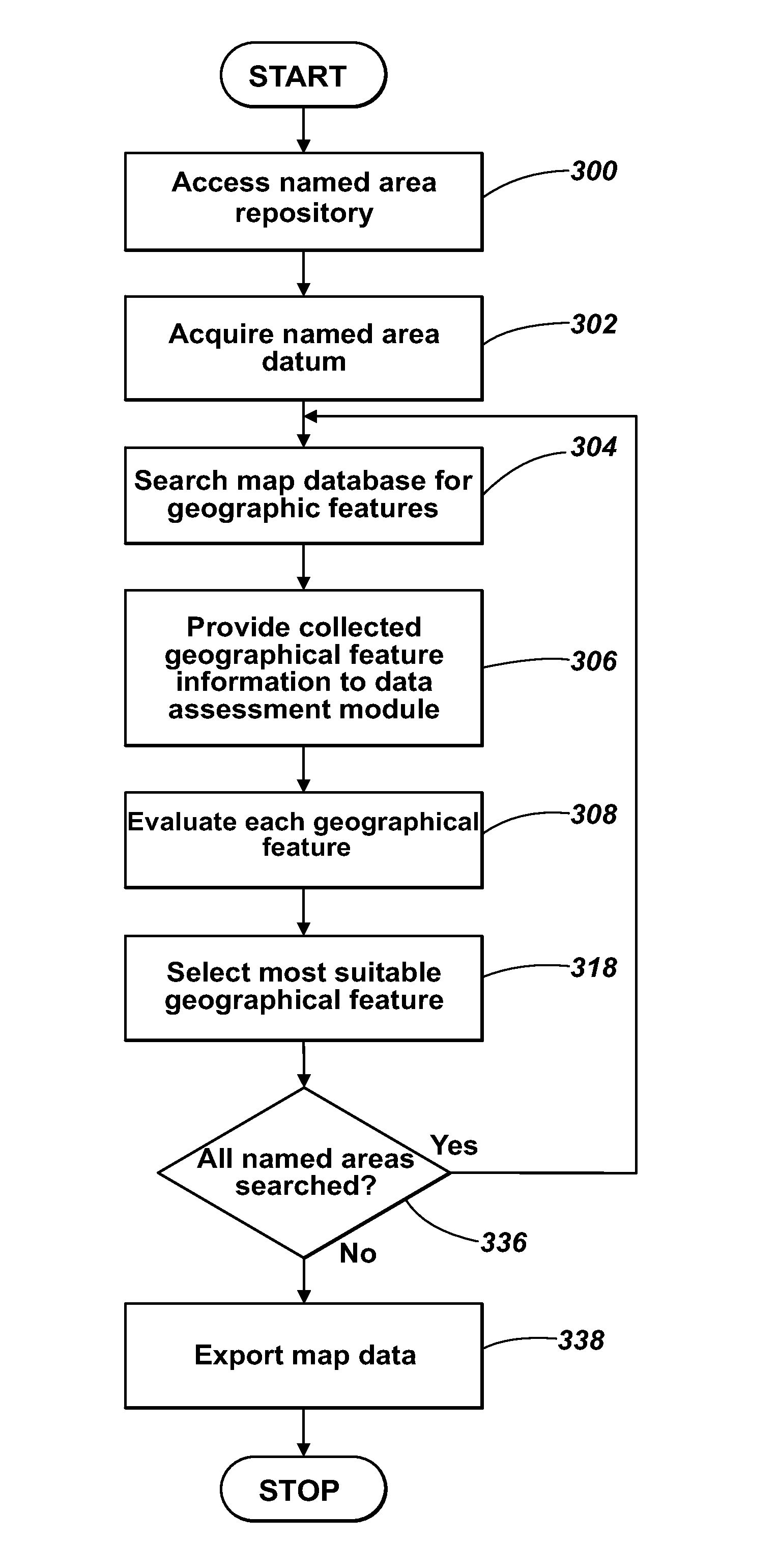
[0037]It is thus possible to provide a location point determining apparatus, a map generation system, a navigation apparatus and method of determining a location point that are capable of assigning location points to a large number of named areas in a fully automated manner, as well as in an efficient and cost-effective manner. Furthermore, the accuracy of the location points assigned is increased because the location points being assigned are within the named area to which the location points are to relate. The flexibility mentioned above relates to the ability of the point location determination technique to be used not only for map product generation, but also for runtime navigation applications where a user specifies a named area and the navigation apparatus determines a location point representative of the named area. Evaluation of feature attributes can thus be customised by a user depending upon different user needs, for example navigation assistance when driving or walking.

Problems solved by technology

However, identifying a specific location, in terms of longitude and latitude coordinates, in order to represent a named area, is a challenge faced by creators of digital maps, because it is not easy to select and assign coordinates to identify a location that is most appropriate to represent the named area when a large number of candidate locations exist.
However, the process of manual assignment is limited by the limitations of manual labour, for example complexity of rules to be performed and any associated calculations, but is also an expensive process on account of the use of the manual labour.
Consequently, the number of named areas that can be processed is limited and map databases are often incomplete and comprise named areas for which navigation destinations are not assigned.
Furthermore, manual selection of the most suitable location can be subjective.
The use of the manual process also limits the assignment of navigation destinations to the map editing environment.
This can result in undesirable instances of mis-navigation if the assigned navigation destination is used.
Consequently, the context of the navigation destinations is not appropriate for all types of navigation, such as pedestrian navigation.

Method used


Image

  • Location point determination apparatus, map generation system, navigation apparatus and method of determining a location point
  • Location point determination apparatus, map generation system, navigation apparatus and method of determining a location point
  • Location point determination apparatus, map generation system, navigation apparatus and method of determining a location point

Examples


Embodiment Construction

[0052]Throughout the following description identical reference numerals will be used to identify like parts.

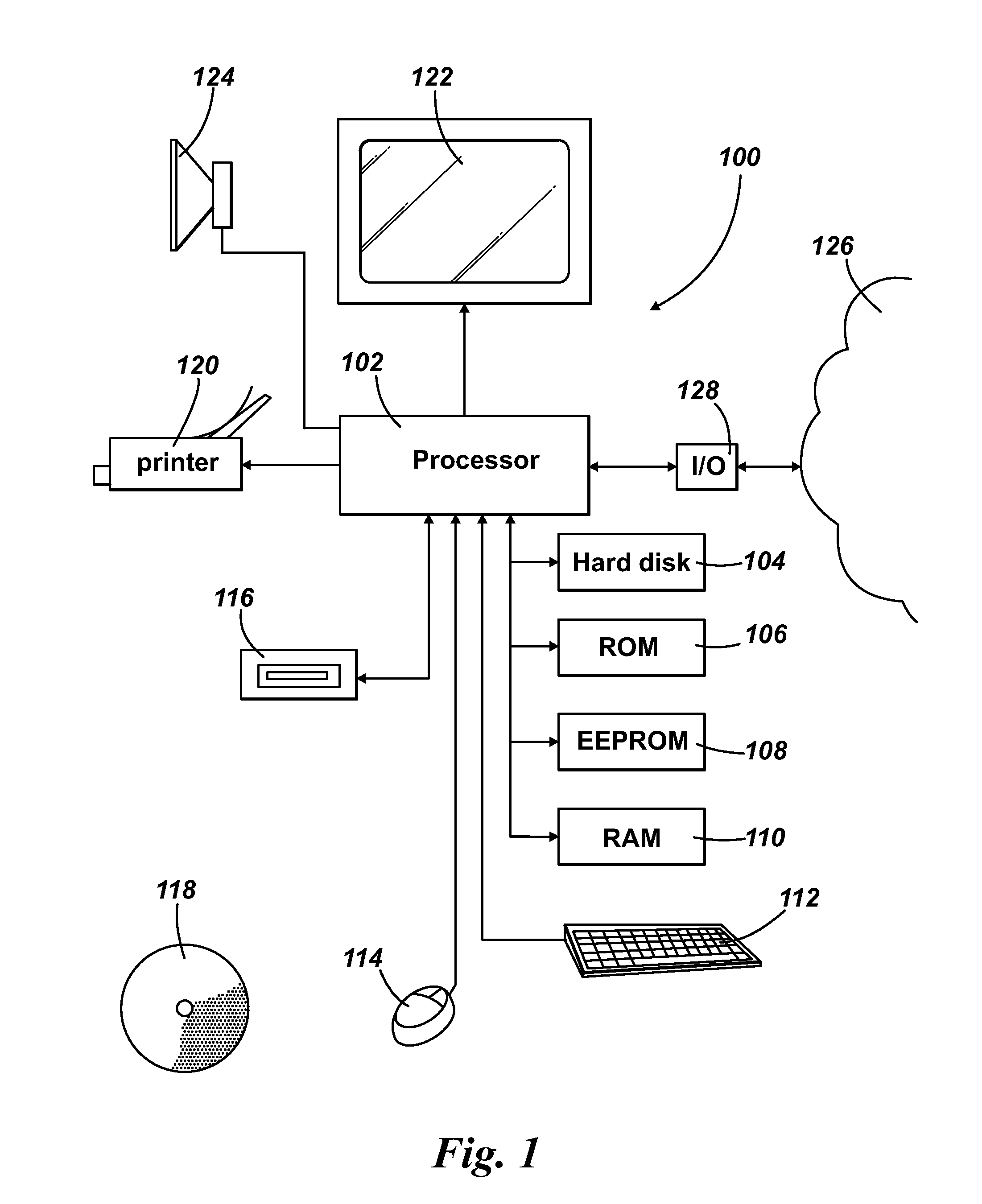
[0053]Referring to FIG. 1, an overview is given of a computing arrangement 100 comprising a processing resource 102, for example a processor, such as a microprocessor.

[0054]The processor 102 is coupled to a plurality of storage components, including a hard disk drive 104, a Read Only Memory (ROM) 106, an Electrical Erasable Programmable Read Only Memory (EEPROM) 108, and a Random Access Memory (RAM) 110. Not all of the memory types described above need necessarily be provided. Moreover, these storage components need not be located physically close to the processor 102 but can be located remotely from the processor 102.

[0055]The processor 102 is also coupled to one or more input devices for inputting instructions and data. by a user, for example a keyboard 112 and a mouse 114. Other input devices, for example a touch screen input unit, a trackball and / or a voice recognition uni...


PUM


Abstract

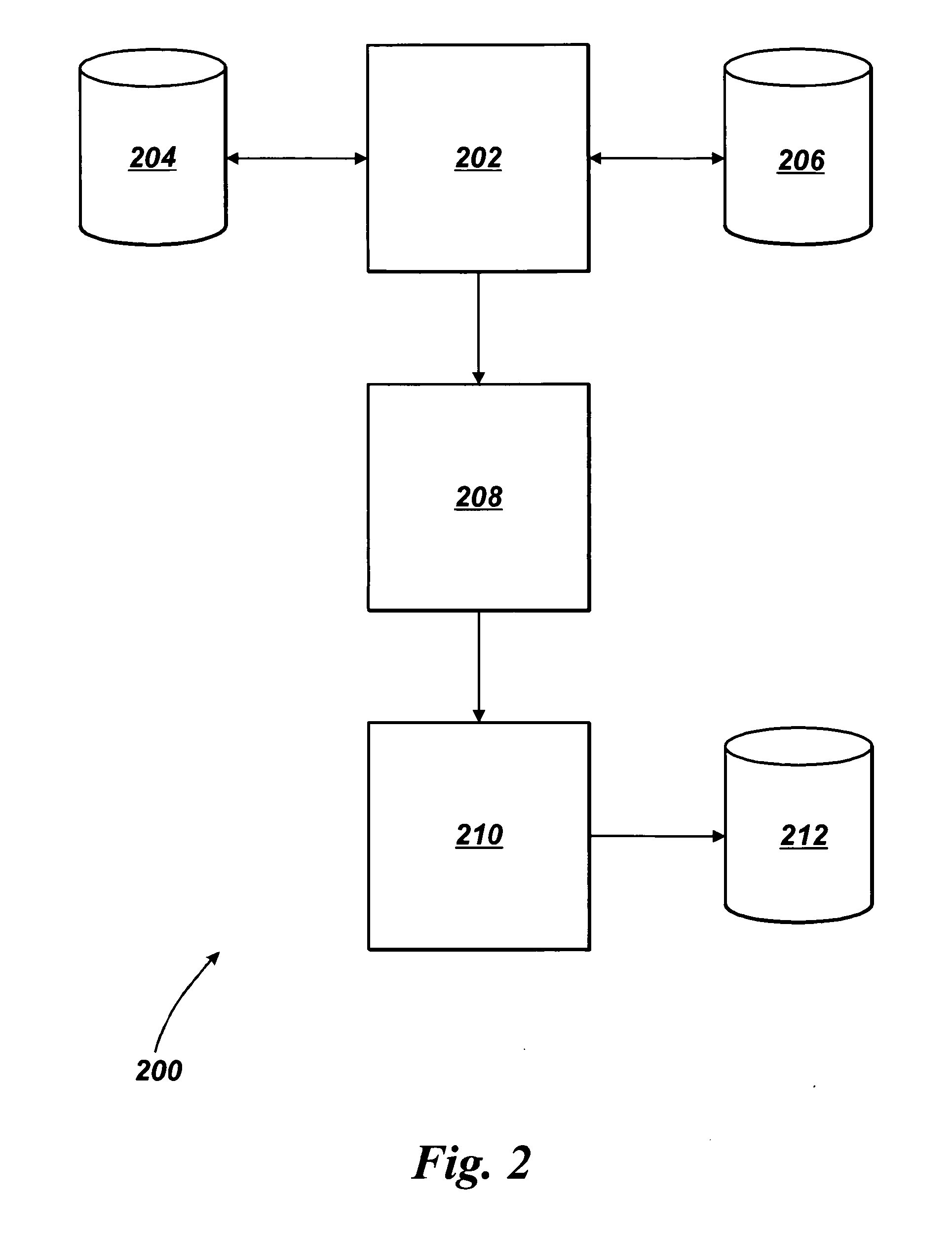
A location point determination apparatus comprises a geographic feature harvesting module (202) arranged to access and collect, when in use, geographic feature information associated with a predetermined named area datum. The apparatus also comprises a data assessment module (208) arranged to receive the geographic feature information collected by the geographic feature harvesting module and to evaluate from the geographic feature information collected in respect of at least one attribute of each geographic feature associated with the geographic feature information. The apparatus further comprises a selection module (210) arranged to select a geographic feature from the geographic features evaluated in accordance with a predetermined criterion associated with the evaluation of the geographic feature information.

Description

FIELD OF THE INVENTION[0001]The present invention relates to a location point determination apparatus of the type that, for example, processes map data in order to provide a location point representative of a named area. The present invention also relates to a map generation system of the type that, for example, processes map data in order to provide a location point representative of a named area for generation of a map product. The present invention also relates to a navigation apparatus of the type that, for example, provides a location point representative of a named area specified by a user. The present invention further relates to a method of determining a location point, the method being of the type that, for example, processes map data in order to provide a location point representative of a named area.BACKGROUND TO THE INVENTION[0002]In the field of Geographic Information Systems (GIS), it is known to capture, analyse, manage, and present data associated with locations. In ...

Claims


Application Information

Patent Timeline
IPC IPC(8): G06F17/30
CPCG01C21/32G09B29/102G06F17/30241G06F16/29G01C21/3867
Inventor JOHNSON, TERRY WILLIAM
Owner TOMTOM GLOBAL CONTENT
Learn More