
GPS correction system and method using image recognition information

a correction system and image recognition technology, applied in the field of global positioning system (gps) correction system and method using image recognition information, can solve the problems of inability to accurately recognize a traveling lane, high cost of dgps device, and inability to accurately calculate a traveling lane. , to achieve the effect of accurate calculation of a traveling lane, improved function of navigation devices, and high precision

Active Publication Date: 2014-01-30
PLK TECH
View PDF9 Cites 31 Cited by
  • Summary
  • Abstract
  • Description
  • Claims
  • Application Information

AI Technical Summary

Benefits of technology

The present invention allows for accurate calculation of a vehicle's traveling lane by matching line recognition information with stored or received line characteristic information. This eliminates the need for a high-price DGPS device and improves the function of navigation devices. Additionally, the position of a vehicle can be corrected with high precision through correcting a lateral position and estimating a longitudinal position using a line change record. This allows for accurate position tracking even in areas where GPS signals are not available.

Problems solved by technology

Thus, when the vehicle departs from the fixed lane, an accident may occur.
In general, conventional GPS devices have a positional deviation of 20 to 30 m. Thus, the conventional GPS devices cannot precisely recognize a traveling lane.
However, the DGPS device is very expensive.
Thus, when the DGPS device is mounted in a vehicle, the price of the vehicle rapidly increases.
That is, there is a fundamental limit in mounting an autonomous navigation system using the DGPS device on a vehicle.

Method used


Image

  • GPS correction system and method using image recognition information
  • GPS correction system and method using image recognition information
  • GPS correction system and method using image recognition information

Examples


Embodiment Construction

[0027]Exemplary embodiments of the present invention will be described below in more detail with reference to the accompanying drawings. The present invention may, however, be embodied in different forms and should not be constructed as limited to the embodiments set forth herein. Rather, these embodiments are provided so that this disclosure will be thorough and complete, and will fully convey the scope of the present invention to those skilled in the art.

[0028]Throughout the disclosure, like reference numerals refer to like parts throughout the various figures and embodiments of the present invention. The drawings attached to the disclosure are provided for convenience of description, and the shapes and relative scales thereof may be exaggerated or omitted.

[0029]When the exemplary embodiments are described in detail, duplicated descriptions or descriptions of techniques obvious to those skilled in the art will be omitted. Furthermore, when it is described that one element comprise...


PUM


Abstract

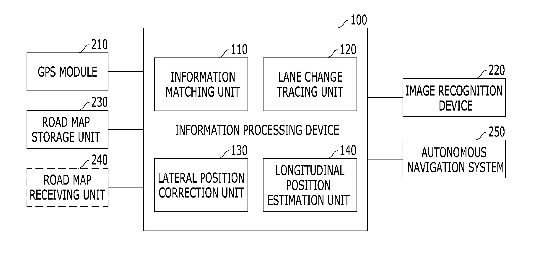
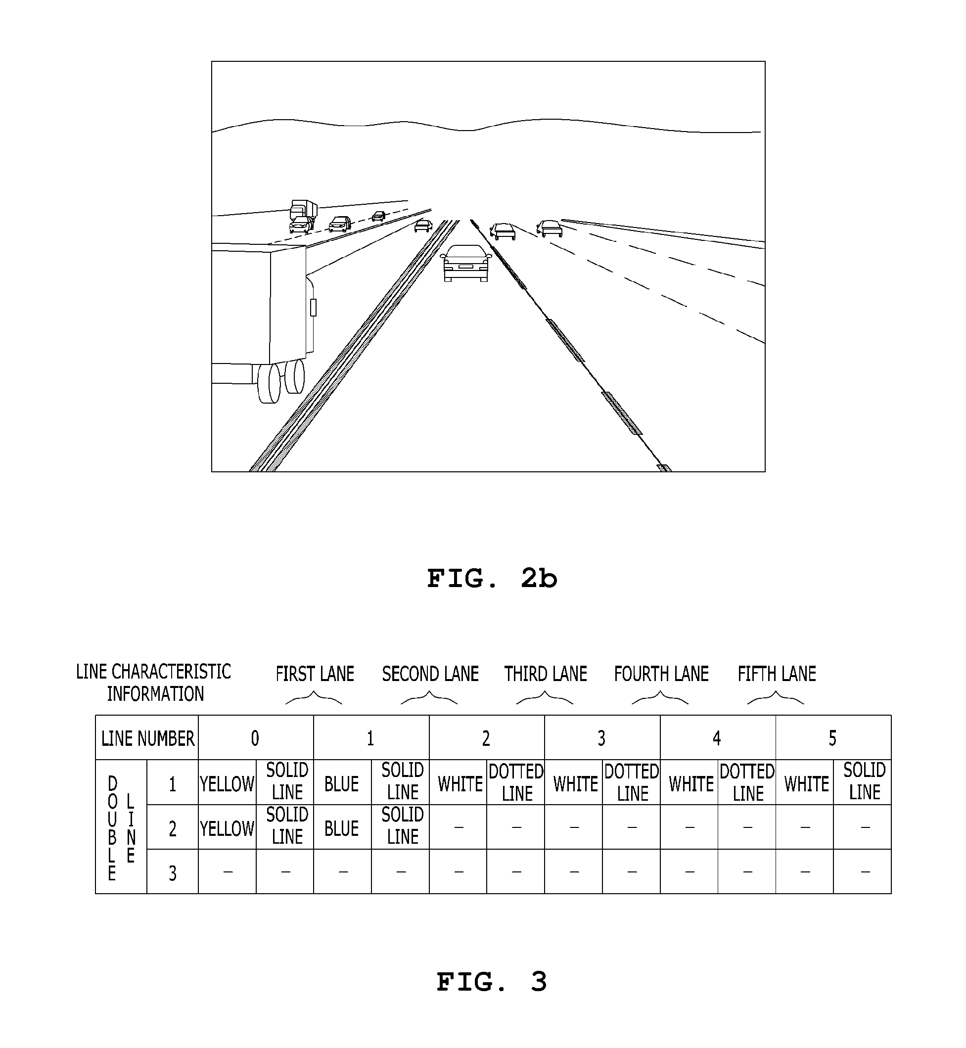
Provided is a GPS correction system and method which corrects position information obtained from a low-precision GPS device using image recognition information. The GPS correction system using image recognition system includes: a GPS module; an image recognition device having a line recognition function; a road map storage unit configured to store road map information including line characteristic information or a road map receiving unit configured to receive the road map information; and an information processing device configured to compare the line recognition information acquired through the image recognition device to the line characteristic information, correct a current position measured by the GPS module, and calculate traveling lane information.

Description

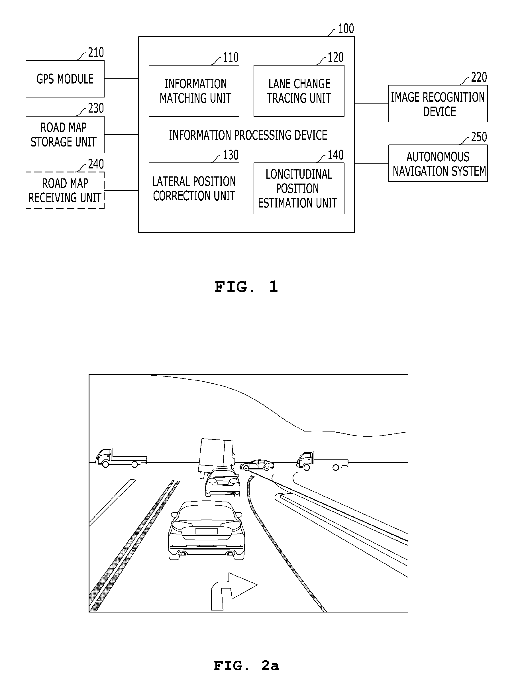
TECHNICAL FIELD[0001]The present invention relates to a global positioning system (GPS) correction system and method using image recognition information, which is capable of implementing high-precision GPS performance such as a differential GPS (DGPS) device through a low-precision GPS device, thereby promoting the introduction of autonomous navigation system.BACKGROUND[0002]Recently, much research has been conducted on autonomous navigation of a vehicle. Typically, autonomous navigation means that an ECU mounted in a vehicle controls the vehicle to travel from a specific start point to an end point on a road according to predetermined logic, using GPS position information and various sensors based on road map information.[0003]The autonomous navigation must be able to be applied to arbitrary roads including a crossroad, a forked road, and a tunnel as well as a straight road. Thus, the ECU must accurately recognize a traveling lane on a road. For example, when a vehicle is to make a...

Claims


Application Information

Patent Timeline
IPC IPC(8): G01C21/30
CPCG01C21/30G05D1/0246G06V20/588G01C21/005G06V20/56B60W2420/403
Inventor PARK, KWANG ILLIM, SANG MOOKKIM, JIN HYUCK
Owner PLK TECH
Learn More