Method and apparatus for reducing satellite position message payload by adaptive data compression techniques

Active Publication Date: 2014-09-11
SUBCARRIER SYST
View PDF28 Cites 33 Cited by
  • Summary
  • Abstract
  • Description
  • Claims
  • Application Information

AI Technical Summary

Benefits of technology

The patent text describes a method to compress and encode GNSS satellite signals using unique parameters for each signal. These parameters can be shared among multiple signals, and can be transmitted using an index to a shared table of parameters. The data elements can be decomposed into long-term values that change slowly or not at all, and short-term values that change quickly. These values can be transmitted frequently, and the reconstitutable data elements can match the original data elements within a certain precision. The data can also be transmitted as residuals to provide quick corrections in case of changes. Overall, the method achieves efficient compression and encoding of GNSS satellite signals, reducing the amount of data transmitted and allowing for quicker data recovery in case of data starvation or transmission failures.

Problems solved by technology
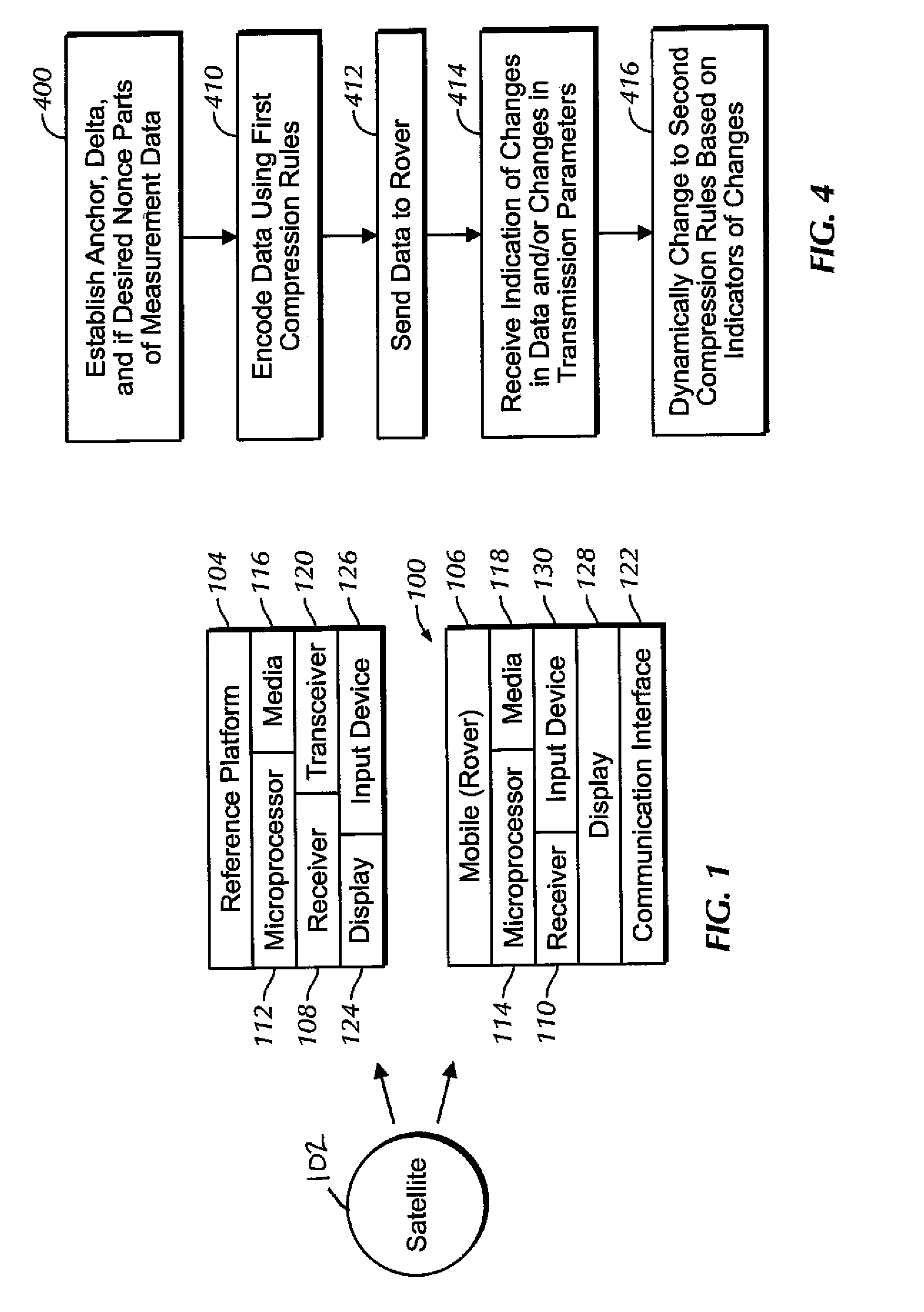
Thus, the problem addressed herein is to generate and transmit the essential error correction information to the rover devices without using excessive bandwidth, but using as much bandwidth as is available to enhance accuracy, and to do so in a way that adapts to changing conditions instead of employing a one-size-fits-all compression technique.

Method used


Image

  • Method and apparatus for reducing satellite position message payload by adaptive data compression techniques
  • Method and apparatus for reducing satellite position message payload by adaptive data compression techniques
  • Method and apparatus for reducing satellite position message payload by adaptive data compression techniques

Examples


an example

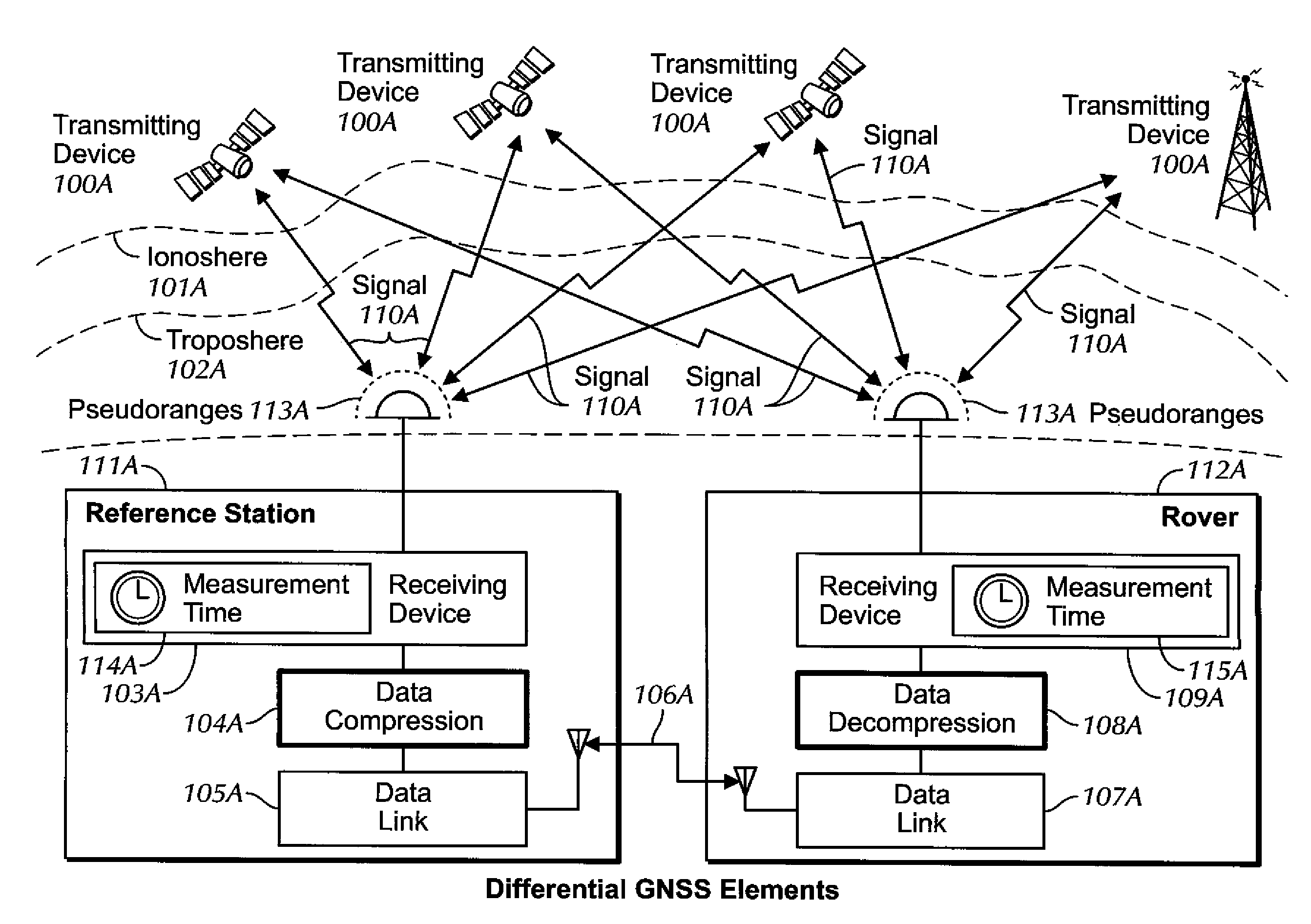
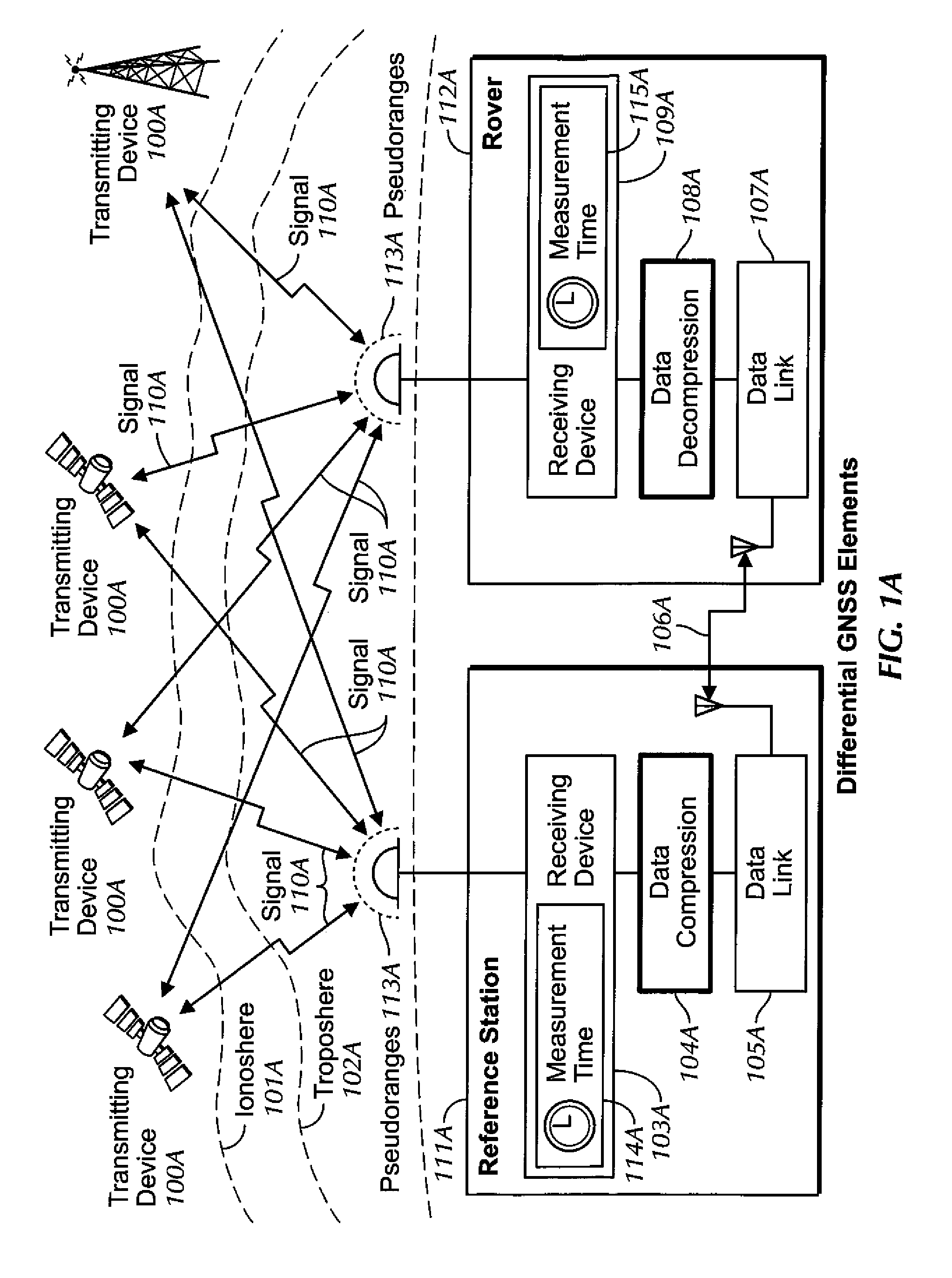
[0144]The data presented Table 1 are used to formulate a non-limiting example of principles discussed above. The first column is a count of the seconds from an arbitrary starting point at 5:30 AM, the second column contains the Time of Day (TOD) in seconds from GPS midnight, while the final column contains the observed pseudorange from the observer's position to the satellite, at that time, in units of meters. The data follow the convention of RINEX with a resolution of 0.001 meter, even though the original source data (RTCM 3.x message in this case) can have a different resolution (e.g., 2 cm).

TABLE 1Representative Pseudorange values froma satellite for a segment of the orbitClockC1TimeTODMeasurement(sec)(sec)(meters)−3019,77025,154,990.420−2919,77125,154,287.540−2819,77225,153,584.620−2719,77325,152,881.640−2619,77425,152,178.660−2519,77525,151,475.620−2419,77625,150,772.560−2319,77725,150,069.440−2219,77825,149,366.260−2119,77925,148,663.100−2019,78025,147,959.900−1919,78125,147,...


PUM


Abstract

An adaptive method by which Differential GNSS corrections may be compressed. Each measurement datum to be transmitted to a rover for satellite navigation purposes is decomposed into two parts, namely, an anchor value and a delta value, and in some instances an added third part termed a nonce value is used. Encoding parameters such as the number of bits assigned to each part of the measurement datum, the order of the models used to convey positional data, and scaling constants in the models, are adjusted adaptively based on changing data and / or transmission medium characteristics. Adaptive compression also allows for anomalous conditions such as out-of-range data values to be handled gracefully.

Description

I. FIELD OF THE INVENTION[0001]The present application relates generally to reduction of Differential Global Navigation Satellite Systems (GNSS) message payload by adaptive compression techniques.II. BACKGROUND OF THE INVENTION[0002]Global Navigation Satellite Systems (GNSS) have grown beyond GPS and GLONASS with the deployment of new designs including the Japanese QZSS, European Galileo, and Chinese COMPASS systems, all of which follow the same fundamental methods of operation and position determination based on RF radio wave ranging techniques. The use and availability of various corrections to aid in the accuracy obtained from a satellite in a GNSS have grown as well.[0003]To improve the accuracy obtainable for positioning and navigation data using a GNSS receiver, various techniques are employed. Some of these involve algorithmic improvements internal to the devices, others involve aiding the device with externally provided information. At a broad level these latter items fall o...

Claims


Application Information

Patent Timeline
IPC IPC(8): G01S19/07
CPCG01S19/07G01S19/071G01S19/074H03M7/30
Inventor KELLEY, DAVID CHARLESBERCHIN, GREGORY JOHN
Owner SUBCARRIER SYST
Why Eureka
Try Eureka