

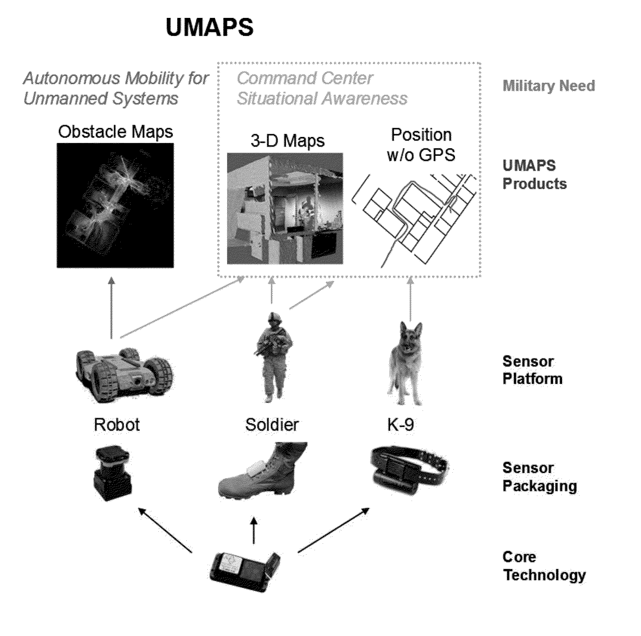
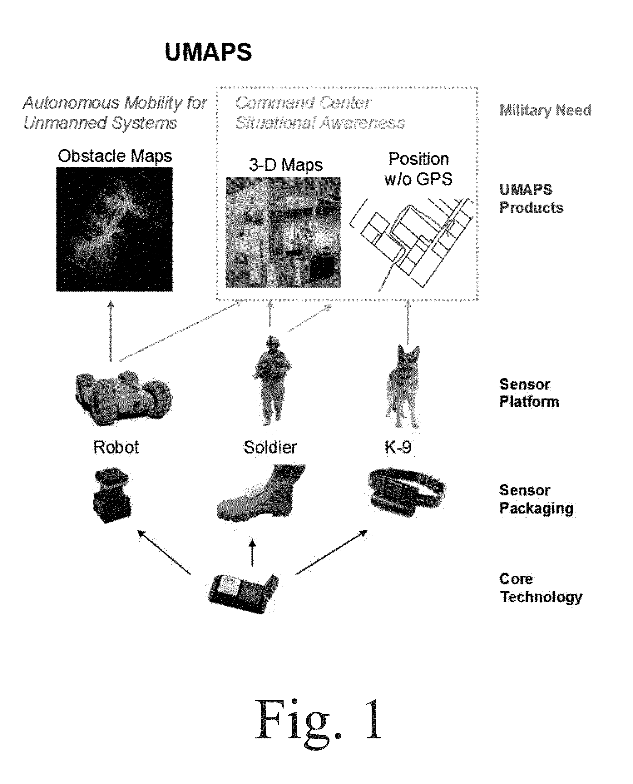
System and Method for Urban Mapping and Positioning
a technology for urban mapping and positioning, applied in the field of mapping and geolocation, can solve the problem that small ugvs rarely have any autonomous capabilities, and achieve the effect of improving global accuracy and increasing situational awareness
- Summary
- Abstract
- Description
- Claims
- Application Information
AI Technical Summary
Benefits of technology
Problems solved by technology
Method used
Image

Examples
operational example
[0066]FIG. 12 shows a conceptual example of how the spring network will work. The yellow and blue paths are two separate runs by the AUGV. The AUGV will compute its relative localization solution using its inertial sensors and available odometry. At Spring A in the figure during the first (yellow) run, the AUGV may get a poor GPS update, so it inserts a weak spring into the network, slightly pulling its path toward that solution. At the end of the run, it inserts Spring B by registering some local sensor data to aerial imagery. The registration algorithm reports high confidence, so the spring is strong. Since it has a confident absolute position solution, it geo-tags some local sensor data and stores it for a future run. During the next (blue) run, the AUGV is able to register its position to some DTED data because of a unique change in elevation and inserts Spring C. Nearby, Spring D is inserted by registering the local LIDAR sensor data to some aerial LIDAR in a stored database. A...
military embodiment
[0079]The present invention, in a military embodiment, is an accurate, distributed navigation system for determining the location of soldiers as they carry out a mission, even in GPS-denied areas. The present invention, sets up virtual “springs” between one soldier's navigation solution and other soldiers' navigation solutions, GPS data, radio ranging information, and / or known or predetermined landmarks.
[0080]During a mission, knowing a soldier's location is fundamental information required for crucial functions such as navigation, maneuverability, and coordination with other warfighters. Using GPS, the position of a soldier is relatively easy to determine without complex computations or communications. Unfortunately, dismounted soldiers frequently need to localize their position in GPS-denied environments such as mountainous terrain, valleys, caves, or urban canyons. The present invention, integrates a combination of sources to determine the most accurate location of the entire tea...
PUM
 Abstract
Description
Claims
Application Information