

Instantaneous Isochron Attribute-based Geobody Identification for Reservoir Modeling
an attribute-based geobody and reservoir technology, applied in the field of instantaneous isochron attribute-based geobody identification for reservoir modeling, can solve the problems of increasing the time required for analyst identification of regions of interest, burdensome dynamic simulation of geocellular models,
- Summary
- Abstract
- Description
- Claims
- Application Information
AI Technical Summary
Benefits of technology
Problems solved by technology
Method used
Image

Examples
Embodiment Construction
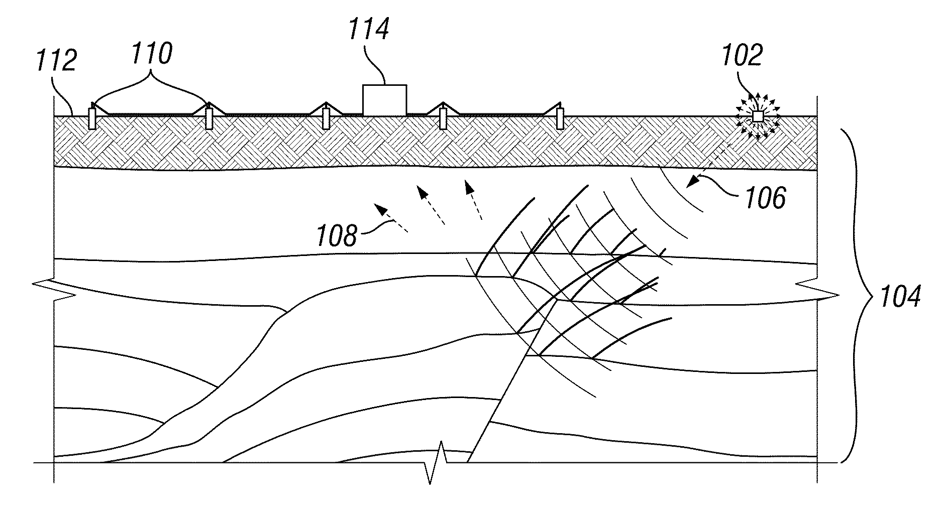
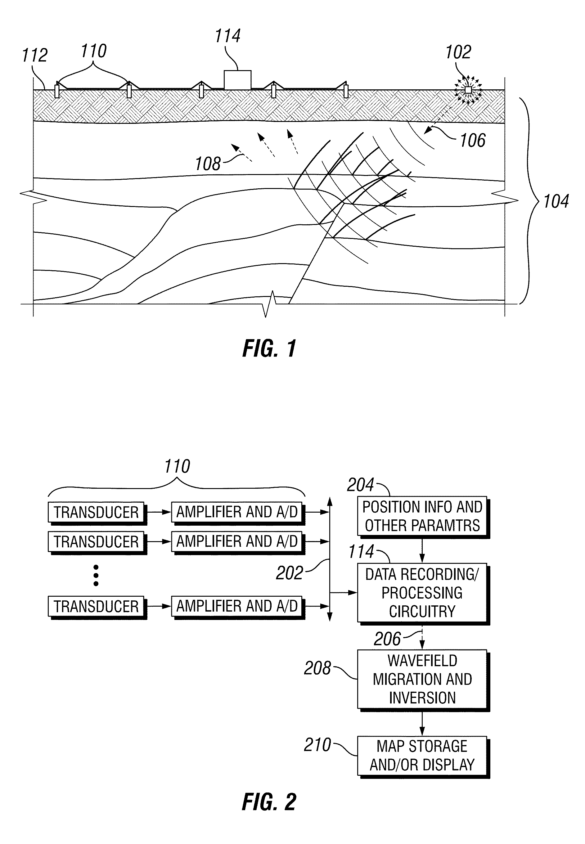
[0019]Seismic surveys can be performed on land or in water. As indicated in FIG. 1, an energy source 102 near the region of interest 104 generates waves 106 that propagate into the region of interest and reflect from internal features such as bed boundaries. Eventually the reflected waves 108 reach an array of receivers 110 on the surface 112. A recording system 114 captures the received signals for storage and processing. The process is repeated with many different source positions and optionally with different receiver positions. Although various methods exist for converting the received wave signals into an image of the subsurface structure, the most popular such techniques employ finite difference wave field modeling, a process that propagates waves forward or backward in time using discrete time steps and fast approximations of wave function derivatives.
[0020]Accordingly, the seismic imaging process may be embodied in a system and context such as that shown in FIG. 2. An array ...
PUM
 Abstract
Description
Claims
Application Information