
Method of measuring state of drone

a drone and state technology, applied in the field can solve the problems of reducing the accuracy of drone state information measured or estimated using drone sensors, affecting the accuracy of drone state measurement, so as to prevent accidental collision, accurate measurement, and accurate measurement

Inactive Publication Date: 2016-10-06
KOREA UNIV RES & BUSINESS FOUND
View PDF2 Cites 12 Cited by
  • Summary
  • Abstract
  • Description
  • Claims
  • Application Information

AI Technical Summary

Benefits of technology

The present patent is about a method to accurately measure the state of a drone to prevent collisions and accidents while executing missions. It uses sensor error correction information generated remotely to measure the drone's state and increase efficiency of the mission. The technical effect is to increase safety and reliability of drone missions.

Problems solved by technology

However, because the drones are basically assumed to be manipulated by people at close distances, they need to directly manipulate the drones based on geographical features / facility information about flight places and this becomes a heavy burden for operators.
In the case of the drone, a weight capable of being carried by the drone is limited due to limited thrust.
Because of this, the accuracy of information about a state of the drone measured or estimated using the sensors mounted in the drone is degraded and this becomes a factor of preventing the drone from performing a given mission at an accurate position in a specific region.
This may become a factor in a collision between the drones and a collision with an environmental object or a facility.
However, because a user needs to directly set a flight path and a destination even in the above-described case and the GCS does not have information about a flight environment or peripheral facilities and does not utilize the information, the information needs to be considered when the user sets the path.
For example, although the GCS provides a function of displaying peripheral geography based on a satellite photo or map, information about an altitude in a peripheral environment or a facility is absent in the satellite photo or the map and it is difficult to support path setting based on the geographical information.
In addition, there is no function of simultaneously managing drones in an environment in which a plurality of drones are used in one region.
Accordingly, when the GCS is utilized, it is difficult to prevent a drone from colliding with an environmental object, a facility, or another drone when the drones perform the mission.

Method used


Image

  • Method of measuring state of drone
  • Method of measuring state of drone
  • Method of measuring state of drone

Examples


Embodiment Construction

[0032]While the invention can be modified in various ways and take on various alternative forms, specific embodiments thereof are shown in the drawings and described in detail below as examples. There is no intent to limit the invention to the particular forms disclosed. On the contrary, the invention is to cover all modifications, equivalents, and alternatives falling within the spirit and scope of the appended claims. Elements of the example embodiments are consistently denoted by the same reference numerals throughout the drawings and detailed description.

[0033]It will be understood that, although the terms “first,”“second,”“A,”“B,” etc. may be used herein in reference to elements of the invention, such elements should not be construed as limited by these terms. For example, a first element could be termed a second element, and a second element could be termed a first element, without departing from the scope of the present invention. Herein, the term “and / or” includes any and al...


PUM


Abstract

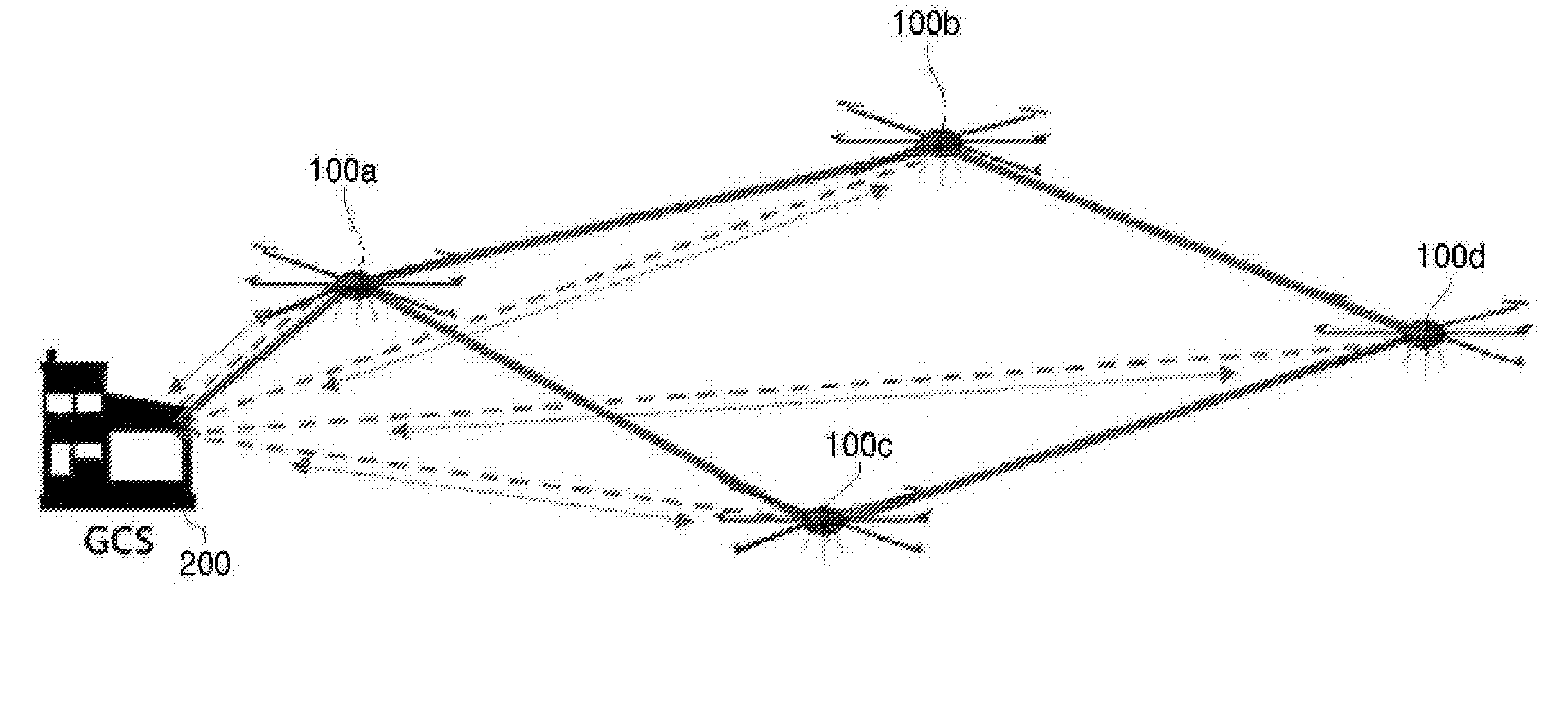
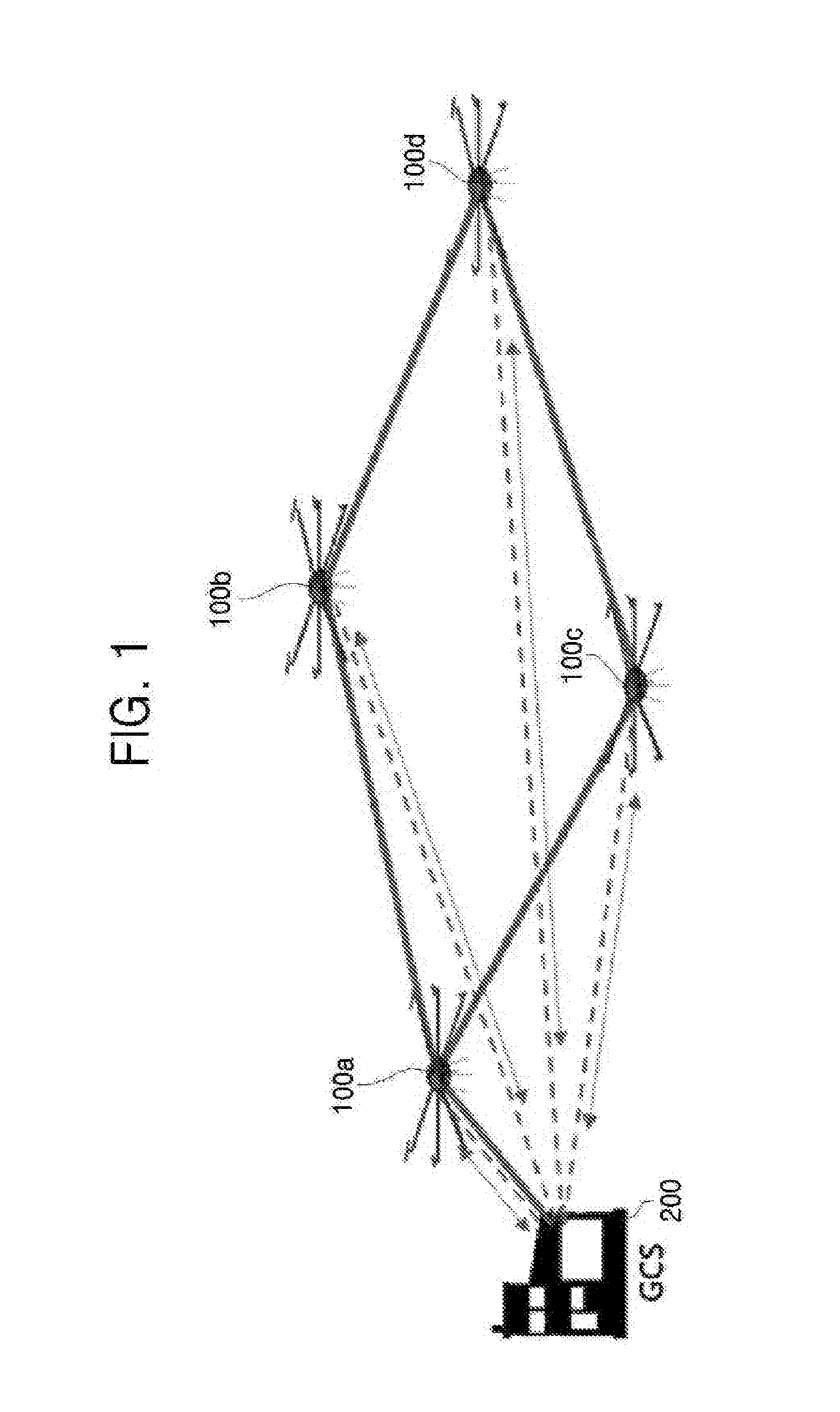
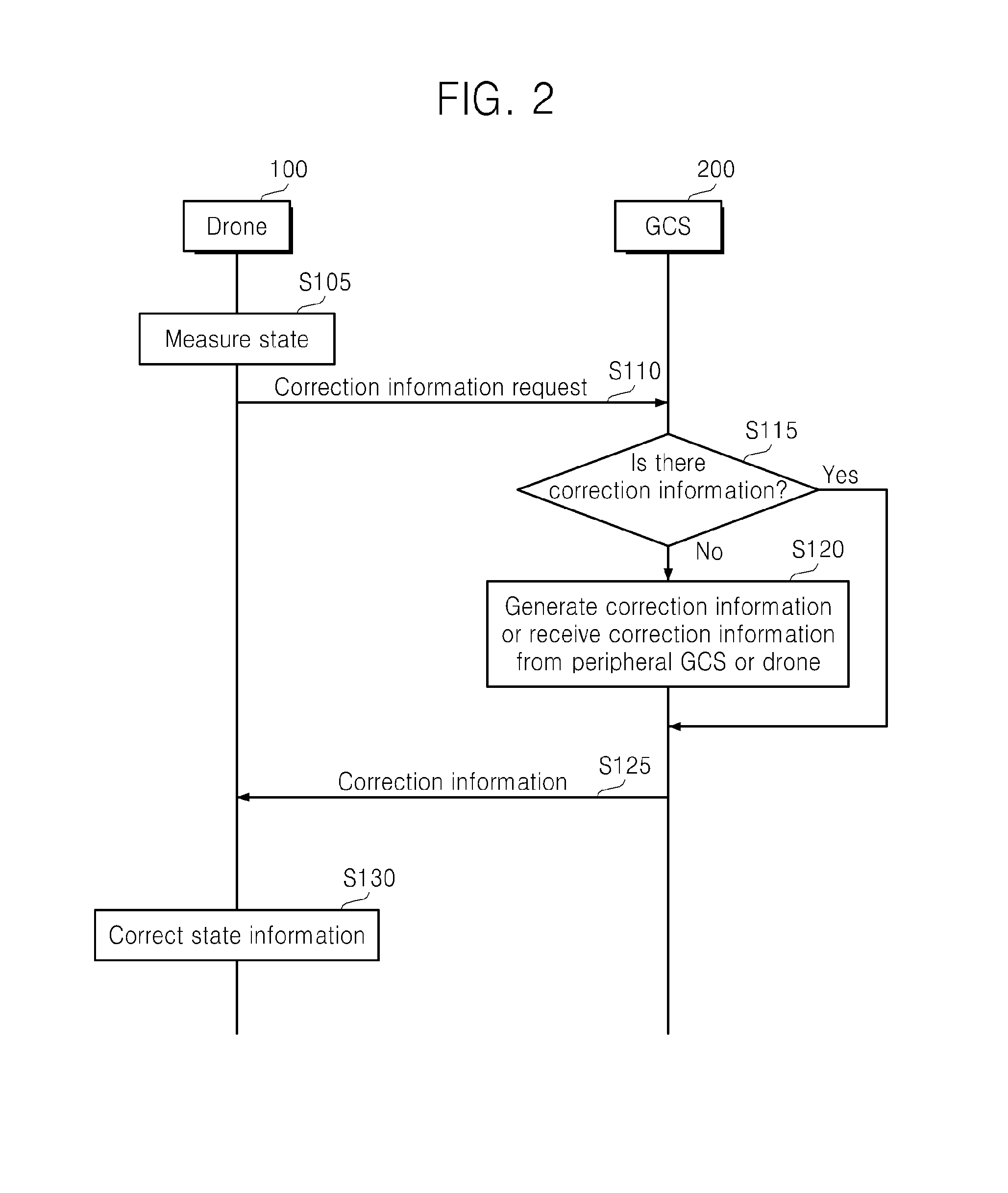
Disclosed is a method of measuring a state of a drone. The method of measuring the state of the drone in a state in which a plurality of drones and a ground control station (GCS) are connected through a wireless network includes measuring, by a first drone, its own state based on collected information, requesting, by the first drone, a second drone or the GCS connected through the network to provide correction information and receiving the correction information from the second drone or the GCS, and comparing, by the first drone, information about the measured state with the received correction information, analyzing an error, and correcting the error.

Description

CROSS-REFERENCE TO RELATED APPLICATION[0001]This application claims priority to and the benefit of Korean Patent Application No. 2015-0046276, filed on Apr. 1, 2015, the disclosure of which is incorporated herein by reference in its entirety.BACKGROUND[0002]1. Field of the Invention[0003]The present disclosure relates to a method of measuring a state of a drone. More particularly, the present disclosure relates to a drone state measurement method of enabling each drone to accurately measure its own state so as to properly perform a mission assigned to the drone in a drone fleet system constituted of a plurality of drones which are unmanned flight vehicles.[0004]2. Discussion of Related Art[0005]Drones include all flight vehicles which are remotely controlled or fly according to prior information in a state in which nobody boards the vehicle such as an unmanned aerial vehicle (UAV), an unmanned plane, and an unmanned flight vehicle. A drone fleet system refers to a group of drones an...

Claims


Application Information

Patent Timeline
IPC IPC(8): G08G5/00G08G5/04G01S19/13B64C39/02
CPCG08G5/0069B64C39/024B64C2201/146G01S19/13G08G5/04G08G5/0013G08G5/0026G01S19/07G01S19/41B64U2201/20G05D1/0291
Inventor KIM, HWANG NAMYOO, SEUNG HOLEE, SUK KYUJUNG, JONG TACKKIM, KANG HOCHUNG, ALBERT YONG JOONLEE, JI YEON
Owner KOREA UNIV RES & BUSINESS FOUND
Learn More