Online street safety map system displaying crime density and traffic accident data

a technology of traffic accident data and map, applied in the field of interactive street safety map, can solve the problems of subjective judgment not bringing accurate results pertaining to crime-related information, mapping system has difficulty in displaying large amount of location data onto a map, system would have difficulty clearly showing a number of crime points in areas, etc., to achieve the effect of improving public safety

Active Publication Date: 2017-05-11
PARK SANG JUN
View PDF1 Cites 12 Cited by
  • Summary
  • Abstract
  • Description
  • Claims
  • Application Information

AI Technical Summary

Benefits of technology

[0010]The present invention effectively provides crime and traffic accident information along street segments. The present invention is more effective than the prior art, because the invention conveys which street

Problems solved by technology

This subjective judgment does not bring accurate results pertaining to crime-related information.
Furthermore, a mapping system with a ‘dot’ feature does not show accumulated crime/traffic incidents at the same place.
In addition, such mapping system has difficulty in displaying large amount of location data onto a map.
Such system would have difficulty clearly showing a number of crime points in areas with high crime density, especially when a map is zoomed out.
In other words, the crime points would be lumped together as the individual dots blur, which would make finding out an exact point difficult.
Most providers of crime data do not release detail geolocation to protect privacy.
Further, a heat map provides a smoothly tapered surface that only shows high clustered crime and traffic accident approximat

Method used


Image

  • Online street safety map system displaying crime density and traffic accident data
  • Online street safety map system displaying crime density and traffic accident data
  • Online street safety map system displaying crime density and traffic accident data

Examples


Embodiment Construction

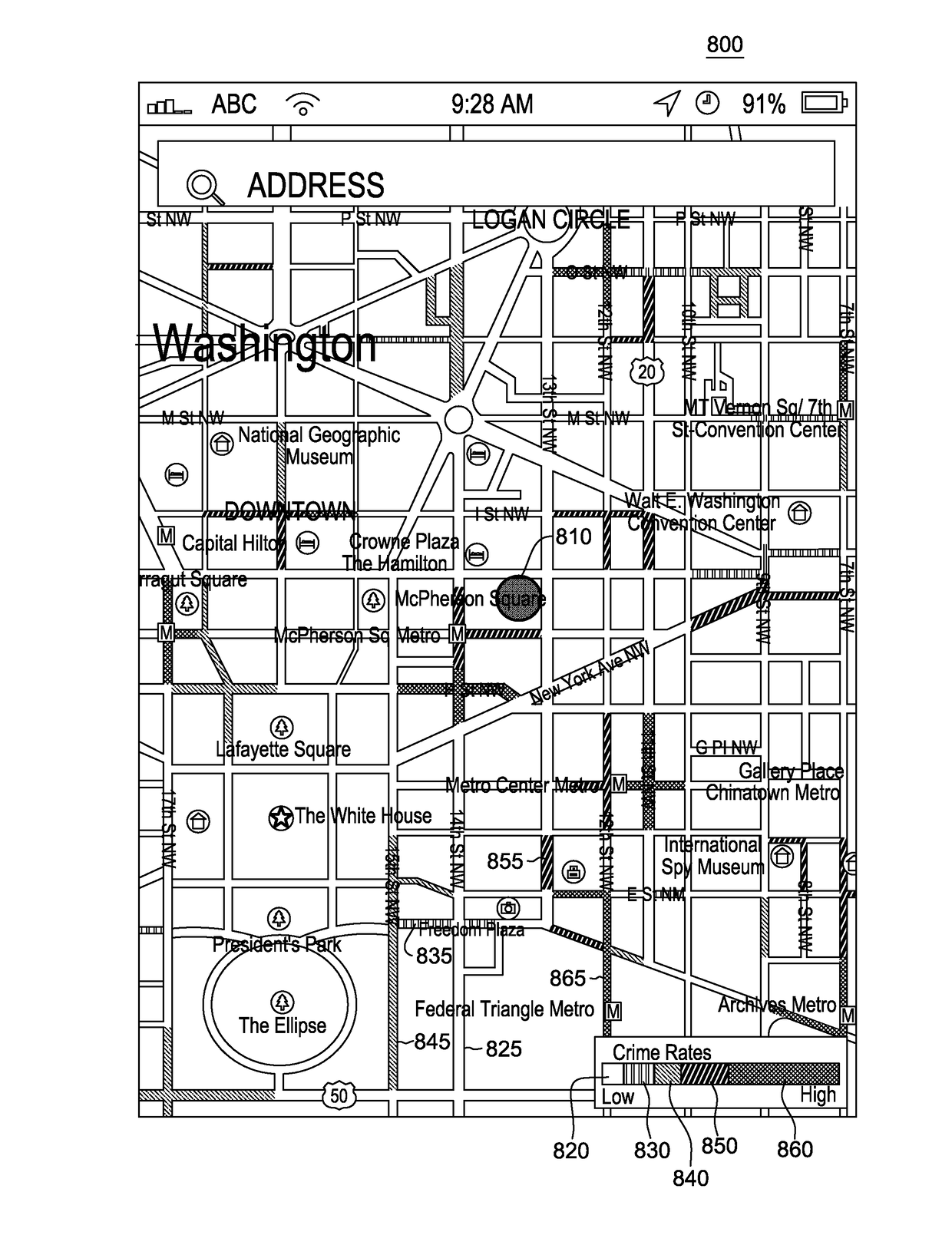
[0027]The present invention provides a traveler with crime and traffic accident density along streets, presented in both street and aerial views of a graphic representational map.

[0028]Global positioning system (GPS) receivers, navigation systems, and mobile devices enable access to an online street safe map provided by the present invention from any mobile network environments and transmit mobile device's location information to the online street safety map server and receive local crime and traffic accident information to system users simultaneously.

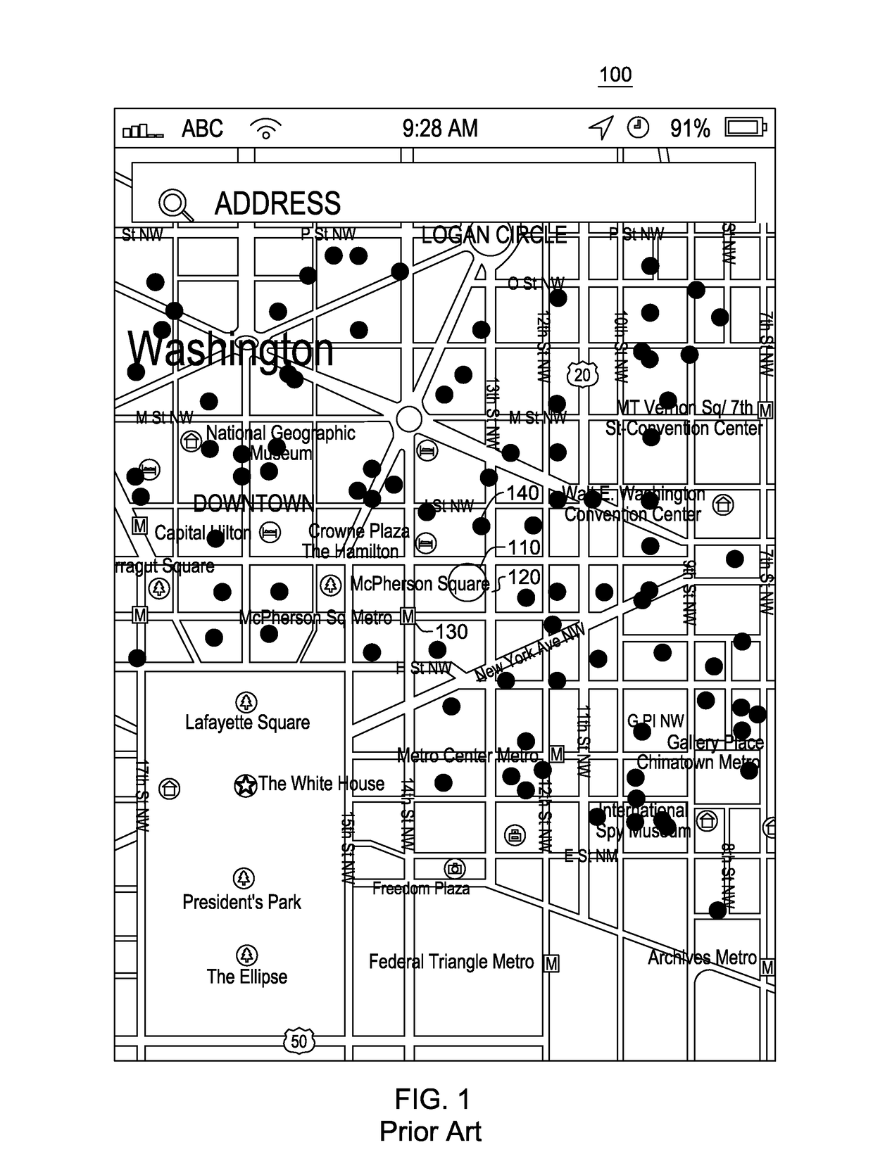
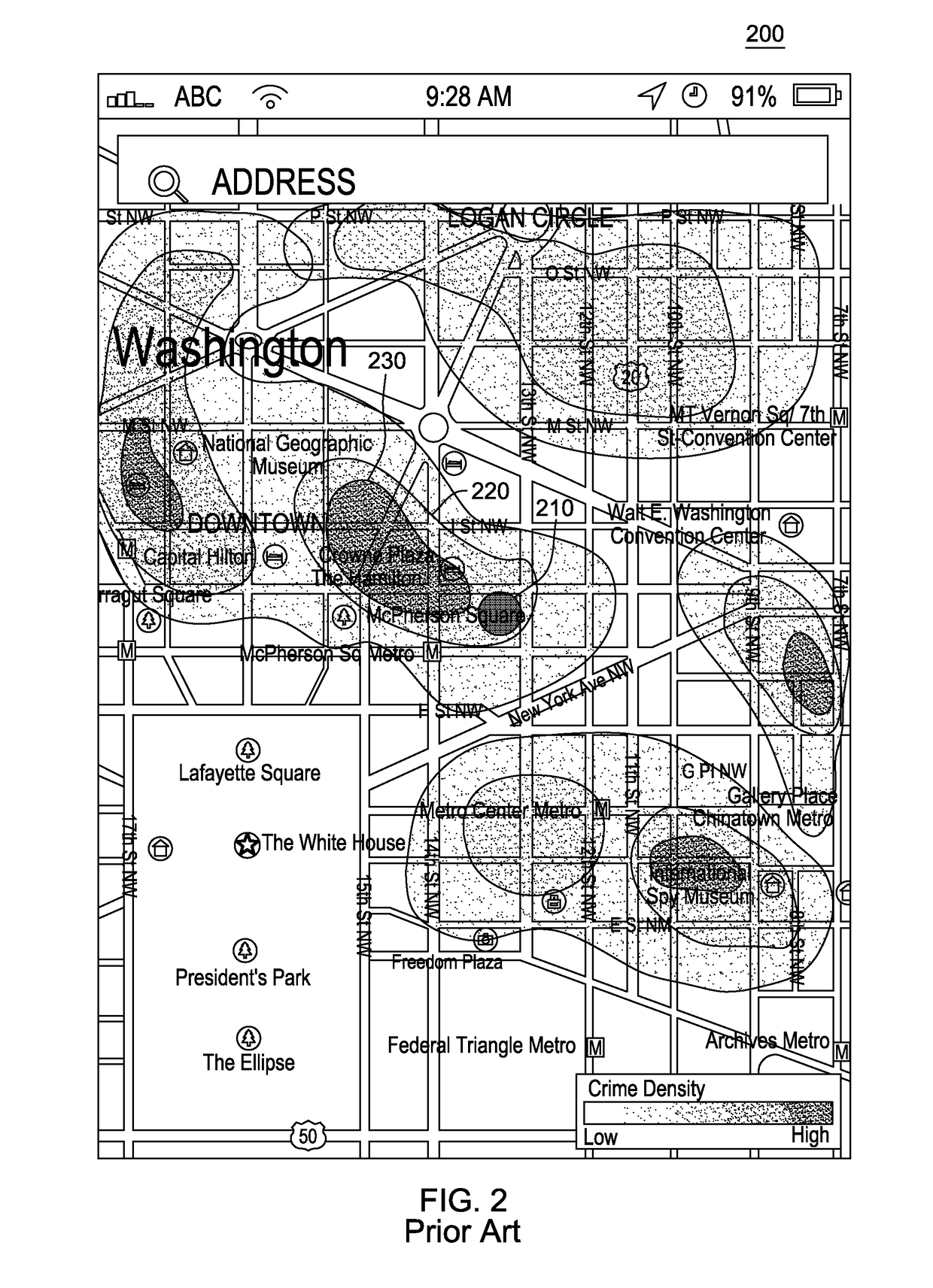
[0029]The system improves public perception of crime and traffic accident risk areas and prevents victimization from the lack of risk location information. The present invention permits visualization of crime and traffic incidents at street segments separated by intersections. Street segment display is beneficial because crime and traffic accidents occur on a street by street basis due to societal and environmental differences, among o...


PUM


Abstract

An interactive street safety map system for internet, GPS, and mobile users is disclosed. The system is designed to identify crime and traffic accidents information at street level. Each street segment on the map indicates low to high density of crime and traffic accidents in different colors in order to improve public perception of safety on each of the streets displayed. The system includes crime and traffic accident data, and the system users can query the data for their interest locations, crime types, crime date and time of occurrence, and the number of crime incidents and traffic accidents. Ultimately, the online street safety map allows users to choose relatively low risk of crime and traffic accident streets for their own safety. The system harvests crime and traffic information data from police departments through Computer-Aided Dispatch (CAD), Recorded Management Systems (RMS), and other crime and traffic information sharing services.

Description

FIELD OF THE INVENTION[0001]The present application discloses a system for displaying crime data on a map. In particular, the present invention is directed toward an interactive street safety map designed to identify crime and / or traffic accidents along street segments.BACKGROUND OF THE INVENTION[0002]FIG. 1 is a copy of a prior art screen image from a web mapping service that displays a mobile device user's present location and his / her surrounding streets. As shown in FIG. 1, a user's location 110 is denoted by a dot on the map of the display 100. The user's location 110 is shown relative to street 120 (e.g., 13th St NW) and point of interest 130 (e.g., McPherson Square Metro station) that are proximal to the user's location 110. In addition, criminal activity is indicated by dots 140 throughout the map. Crime mapping systems that display crimes as dots 140 may be effective to show all crime / traffic incidents as single events. Information about each incident, including the type of ...

Claims


Application Information

Patent Timeline
IPC IPC(8): G01C21/36G06F17/30G06Q50/26G09B29/00
CPCG01C21/3694G01C21/3697G06Q50/265G06F17/30061G06F17/30241G09B29/007G08G1/09G06F16/29G06F16/444
Inventor PARK, SANG JUN
Owner PARK SANG JUN
Why Eureka
Try Eureka