Augmented communication and positioning using unmanned aerial vehicles

a technology of unmanned aerial vehicles and communication, applied in vehicle position/course/altitude control, process and machine control, instruments, etc., can solve the problems of affecting the reliability of wireless communication, affecting the clear line of communication, and existing solutions are expensive and time-consuming. achieve the effect of gps satellite signal connectivity and audio wireless communication signal

Inactive Publication Date: 2017-05-25
CATERPILLAR INC
View PDF28 Cites 48 Cited by
  • Summary
  • Abstract
  • Description
  • Claims
  • Application Information

AI Technical Summary

Benefits of technology

[0006]In one aspect, the present disclosure is directed to a system for augmenting wireless communication and satellite positioning for machines at a worksite. The system may include one or more unmanned aerial vehicles (UAV) configured to be remotely operated above an area encompassing the worksite. Each of the UAV may include a real time kinematic (RTK) global positioning system (GPS) onboard the UAV for determining the position of the UAV relative to a base station located at a known location. Each of the UAV may further include a machine vision module configured to detect an object on the ground at the worksite. The RTK GPS onboard each UAV may further determine the global coordinates of the detected object in 3D space using the position of the UAV. Each UAV may be controlled by a flight control module configured to receive information on the current position of one or more machines operating at the worksite, and real-time machine wireless communication and satellite positioning requirements for the one or more machines, and control flight of the UAV to a position where the UAV can augment wireless communication signal and GPS satellite signal connectivity to meet the machine wireless communication and satellite positioning requirements.

Problems solved by technology

Rough terrain, or other naturally-occurring or man-made geographical features, structural objects, and other stationary or mobile obstacles may interfere with reliable wireless communications and GPS signals used for accurate location and control of machines operating at the worksite.
However, with the terrain and other potential obstacles constantly changing at a mine site, the existing solutions are expensive and time consuming.
The complex terrains and other obstacles at a mine site or other worksite can also interfere with a clear line-of-sight between machines operating at the worksite and satellites needed for accurate location of the machines through GPS signals.
The system of the '150 publication does not provide a means for also improving the reliability of wireless communications between machines and base stations operating on the ground, and for positioning the unmanned aircraft based on changing terrain and other obstacles on the ground, as well as the specific real-time needs of individual machines operating at a worksite, in order to maintain the best possible connectivity with individual mobile machines.

Method used


Image

  • Augmented communication and positioning using unmanned aerial vehicles
  • Augmented communication and positioning using unmanned aerial vehicles
  • Augmented communication and positioning using unmanned aerial vehicles

Examples


Embodiment Construction

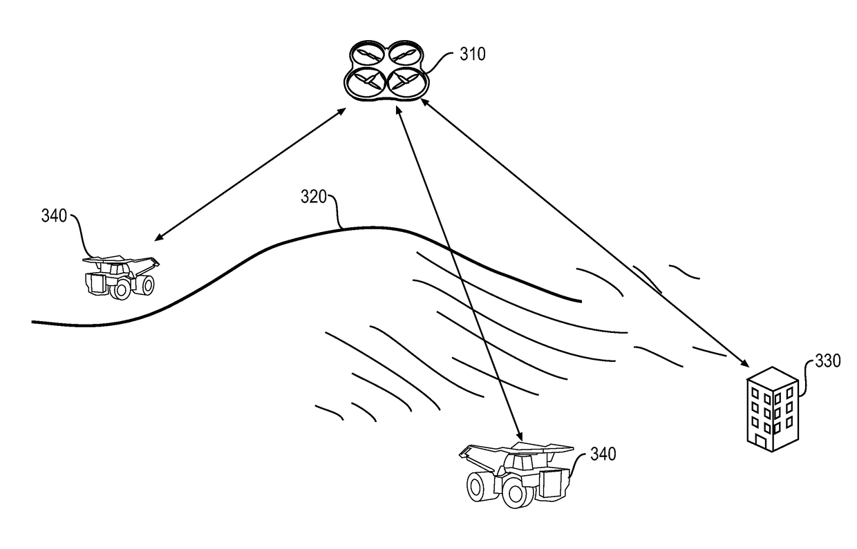
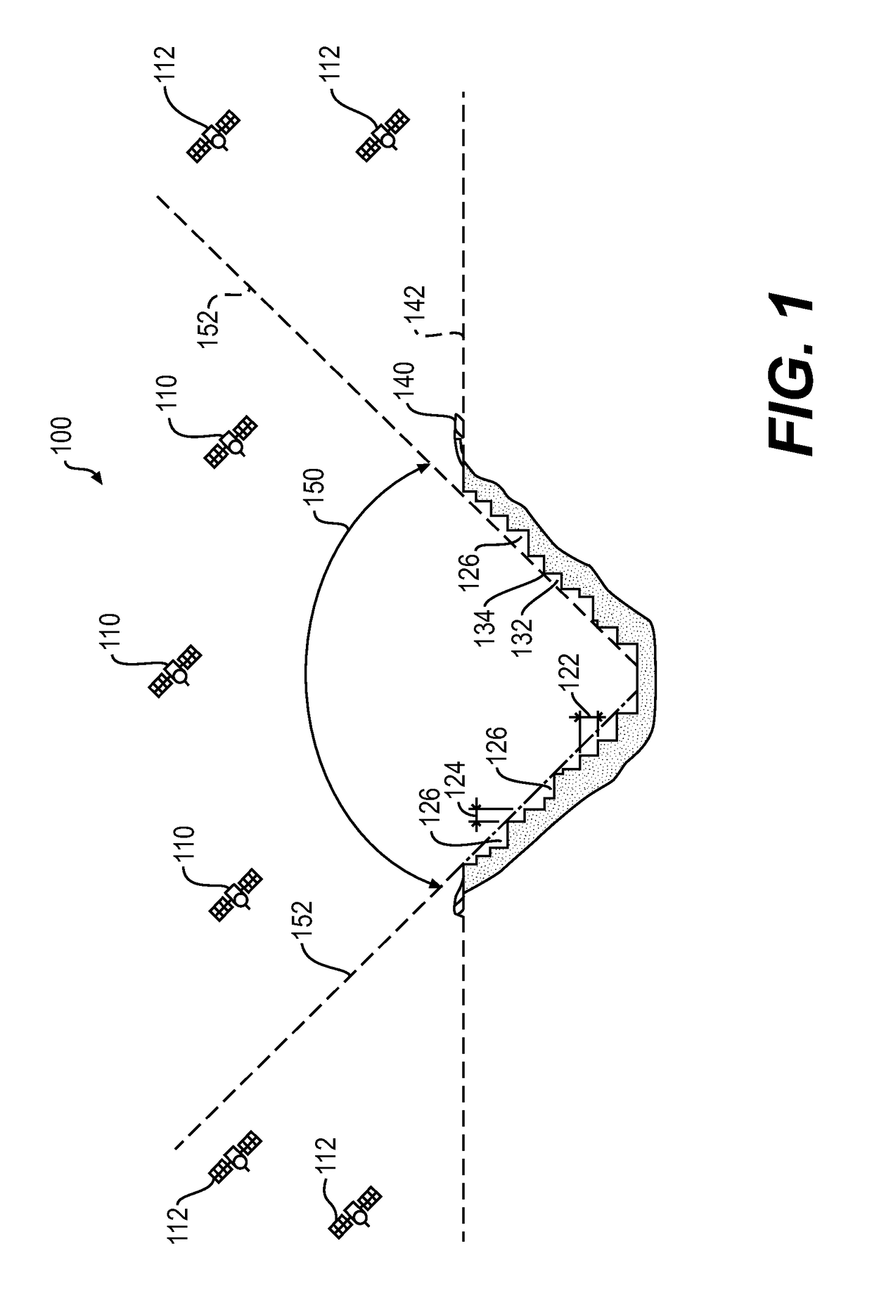
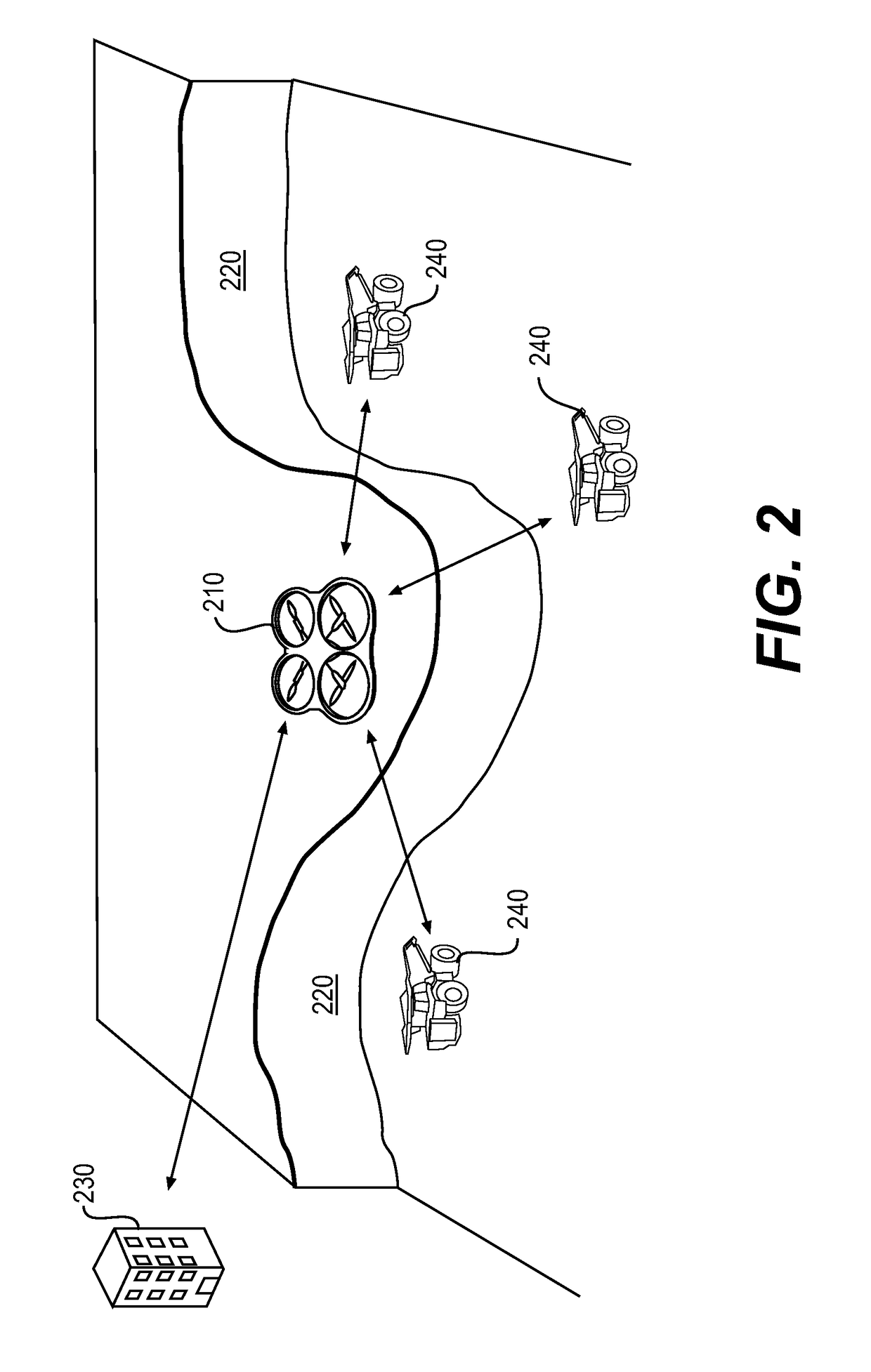
[0012]FIG. 1 illustrates an exemplary worksite 100 at which a plurality of mobile machines may be performing various tasks. The worksite 100 shown in FIG. 1 is an open pit mine. In various alternative implementations, the worksite 100 may include, for example, an open pit mine, a landfill, a quarry, a construction site, or any other type of worksite having terrain traversable by one or more mobile machines. The tasks being performed by the machines may be associated with altering the geography at the worksite 100, or building various structures, and may include a hauling operation, a grading operation, a leveling operation, a plowing operation, a bulk material removal operation, or any other type of operation. As each machine operates at the worksite 100, the shapes, dimensions, and general positions of the terrain and various structures may change.

[0013]In the illustrated example of an open pit mine, removal of material from the sides of the open pit mine may result in the creation...


PUM


Abstract

A system for augmenting wireless communication and satellite positioning for machines at a worksite includes one or more unmanned aerial vehicles (UAV) configured to be remotely operated above an area encompassing the worksite. Each of the UAV includes a real time kinematic (RTK) global positioning system (GPS) onboard the UAV for determining the position of the UAV relative to a base station located at a known location, and a machine vision module for detecting an object on the ground at the worksite. The RTK GPS onboard each UAV determines the global coordinates of the detected object in 3D space using the position of the UAV. A flight control module receives information on current position of one or more machines operating at the worksite, and machine wireless communication and satellite positioning requirements in real-time from the one or more machines, and controls flight of at least one UAV to a position where the at least one UAV can augment wireless communication signal and GPS satellite signal connectivity to meet the machine wireless communication and satellite positioning requirements.

Description

TECHNICAL FIELD[0001]The present disclosure relates generally to augmented communication and positioning of mobile vehicles, and more particularly, to augmented communication and positioning of mobile vehicles using unmanned aerial vehicles.BACKGROUND[0002]Terrain at a worksite commonly undergoes geographic alteration by machines through, for example, digging, grading, leveling, or otherwise preparing the terrain for various uses or removing material from the ground. Rough terrain, or other naturally-occurring or man-made geographical features, structural objects, and other stationary or mobile obstacles may interfere with reliable wireless communications and GPS signals used for accurate location and control of machines operating at the worksite. Some current solutions to the problem of “blind areas” or “dead zones” for wireless communications include deploying and maintaining multiple communication base stations. However, with the terrain and other potential obstacles constantly c...

Claims


Application Information

Patent Timeline
Patent Type & Authority Applications(United States)
IPC IPC(8): G05D1/00G05D1/10G01S19/42B64C39/02
CPCG05D1/0011B64C39/024G05D1/101B64C2201/122B64C2201/024B64C2201/108G01S19/42G01S19/03G01S19/14G01S19/21G01S19/43H04B7/18504G05D1/102B64U2101/20B64U30/20B64U10/10
Inventor WANG, QIRYBSKI, PAUL EDMUND
Owner CATERPILLAR INC
Why Eureka
Try Eureka