

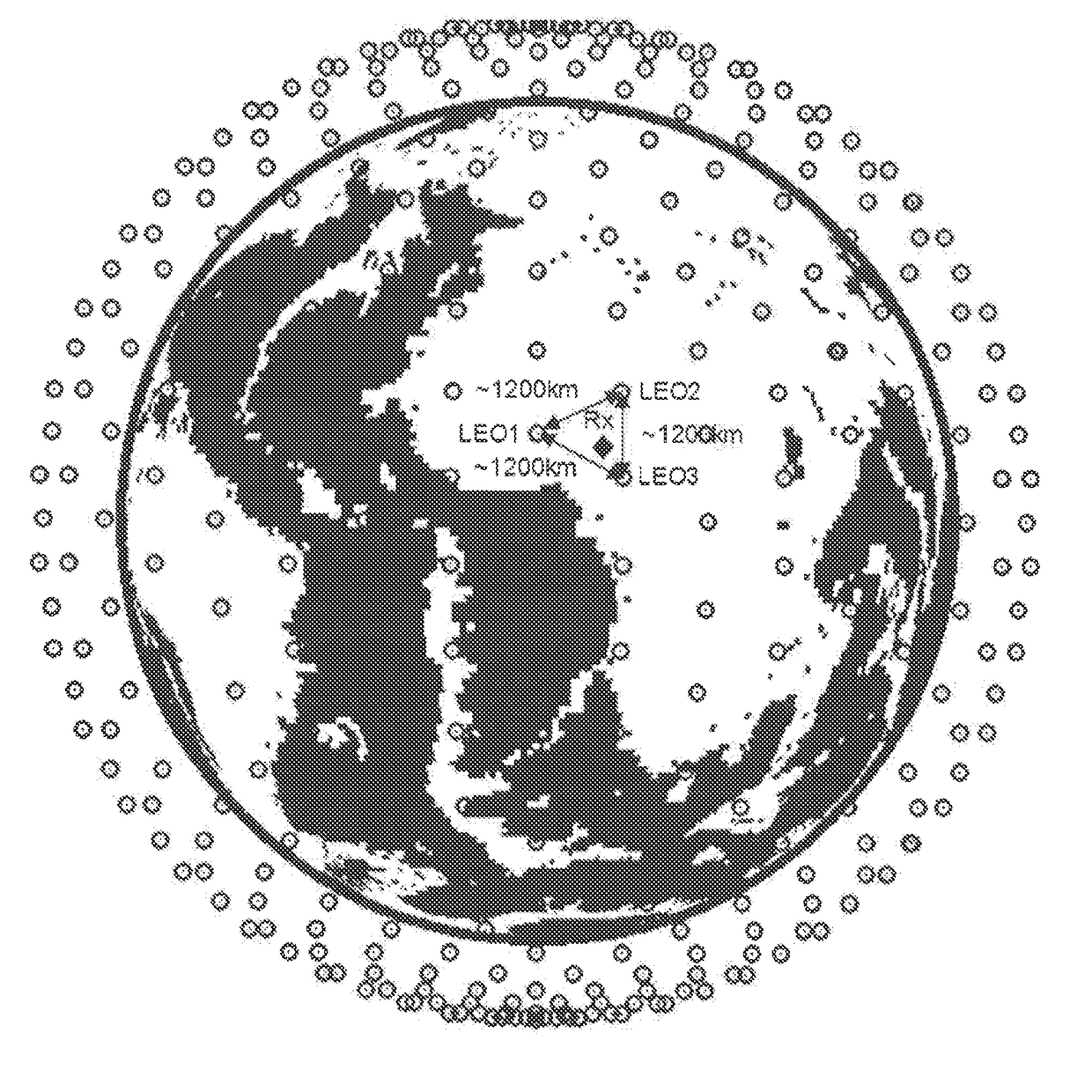
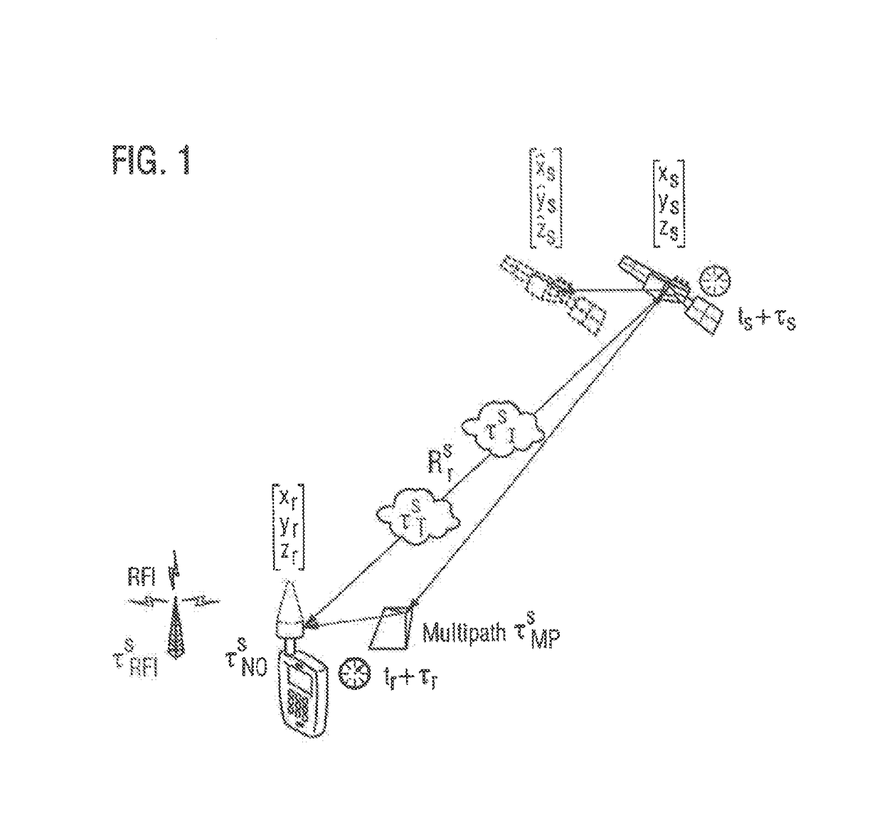
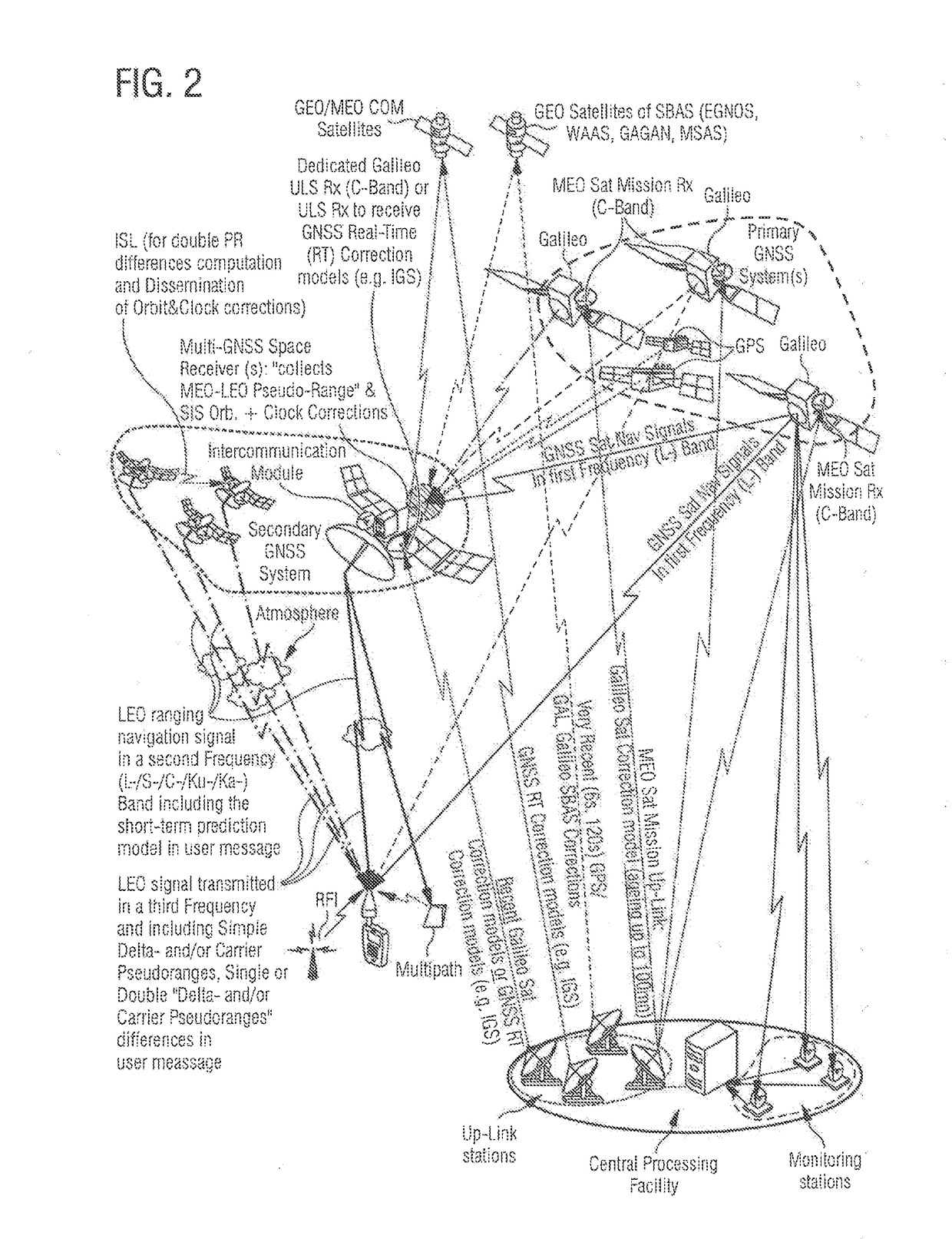
Method for each of a plurality of satellites of a secondary Global Navigation Satellite System in a Low Earth orbit
a global navigation satellite and satellite system technology, applied in satellite radio beaconing, measurement devices, instruments, etc., can solve the problems of prone residual errors in the determination of the orbit and clock correction of the gnss satellites, and achieve the effect of reducing the overall cost of the gnss system, avoiding significant ground infrastructure, and reducing the impact of propagation and local effects
- Summary
- Abstract
- Description
- Claims
- Application Information
AI Technical Summary
Benefits of technology
Problems solved by technology
Method used
Image

Examples
Embodiment Construction
[0032]The variants of the functional and operational aspects as well as their functional and operational aspects described herein are only for a better understanding of its structure, its functions and properties; they do not limit the disclosure to the embodiments. The figures are partially schematic, said essential properties and effects are clearly shown enlarged in part in order to clarify the functions, active principles, embodiments and technical characteristics. Every operation, every principle, every technical aspect and every feature that / which is disclosed in the figures or in the text is / are able to be combined with all claims, each feature in the text and the other figures, other modes of operation, principles, technical refinements and features that are included in this disclosure, or result from it, so that all possible combinations are assigned to the devices and methods described. They also include combinations of all individual comments in the text, that is, in each...
PUM
 Abstract
Description
Claims
Application Information