Crowd-sourced mapping

a mapping and crowd technology, applied in the field of navigation and/or mapping services, can solve the problems of large blind spots, inability to predict events or maneuvers, and inability to scale for an entire roadway network, and achieve the effect of advancing smart contracts

Inactive Publication Date: 2019-09-12
HERE GLOBAL BV
View PDF0 Cites 36 Cited by
  • Summary
  • Abstract
  • Description
  • Claims
  • Application Information

AI Technical Summary

Problems solved by technology

When used alone though, on-board sensor systems may exhibit large blind spots and may be unable to predict events or maneuvers even a short distance away.
Manual observation may be used to identify new features but is not scalable for an entirely of the roadway network.
A dedicated fleet of probe vehicles, however, may be expensive to operate and may not be able to adequately cover the entirety of the roadway.
The HD map, however, is not perfect.
Real time determination of features is not ideal.
Requiring each vehicle to make the determination may also be inefficient.
Each of these methods may have drawbacks.
In the scenario where a central observation bank collects data, the centralization and non-transparent process may be limiting.
One of the biggest issues is the introduction of multiple central authorities: a financial portal as the payment system and the underlying banks that provide the final transaction resolution.
Each layer charges one or more fees while exhibiting a lack of transparency with respect to those fees, the transactions themselves and the security of those transactions.
Furthermore, due to the proprietary and closed system, the central observation bank potentially offers a threat to the autonomous ambitions of other companies.
The central observation bank may cut off or penalize competition or likewise be targeted by the competition leading to a fractured and duplicative collection scheme.
Additionally, there is no loyalty mechanism in these approaches.
None of the methods provide an incentive to remain loyal to the collection program and to continue to participate in the platform.
Raw unformatted data from a camera may quickly overload any transmission system.
Observations during inclement weather may result in low quality (e.g. less accurate) observations.
Observations during the night or on low illuminated roadways may be less accurate.
The size of the ODP may be limited by the amount of bandwidth available.
The smart contract code within transactions of blocks may be immutable (not modifiable), however, storage for contracts may not be.
Certain features may be more difficult to detect or may require more precise (and validated) observations.
Mining is computationally very expensive thus those who choose to offer their compute capacity, electricity and bandwidth are rewarded with fractions of coin.
However, MapCoin is not continually transferred.
Additionally, the illustrations are merely representational and may not be drawn to scale.

Method used


Image

  • Crowd-sourced mapping
  • Crowd-sourced mapping
  • Crowd-sourced mapping

Examples


embodiment 1

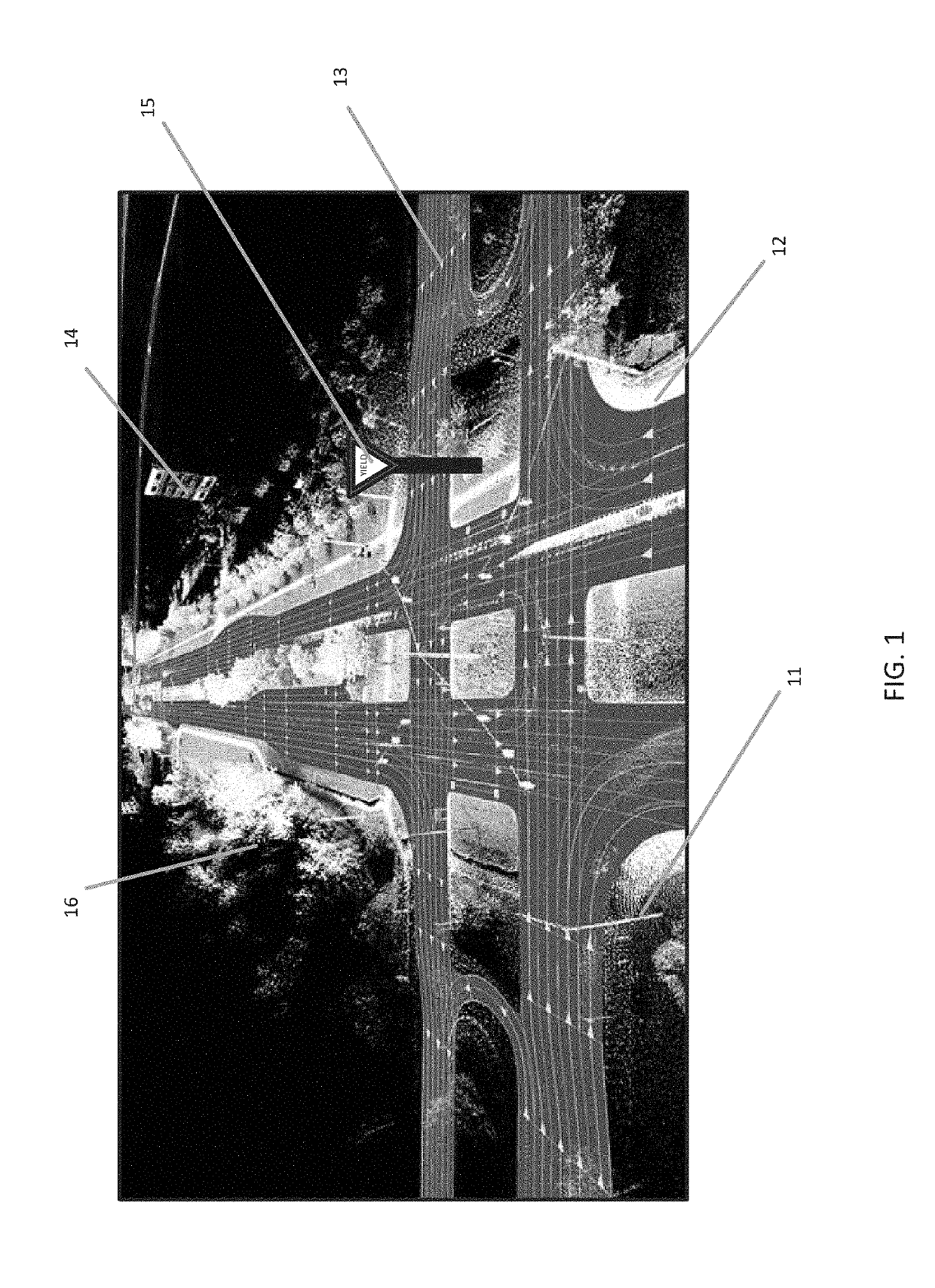
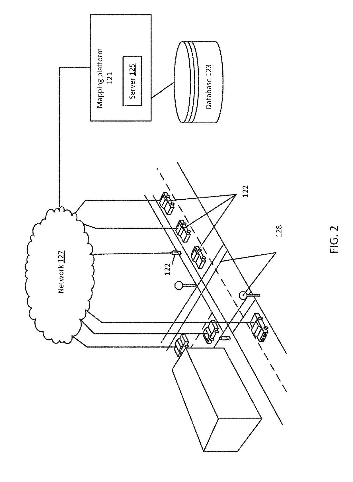
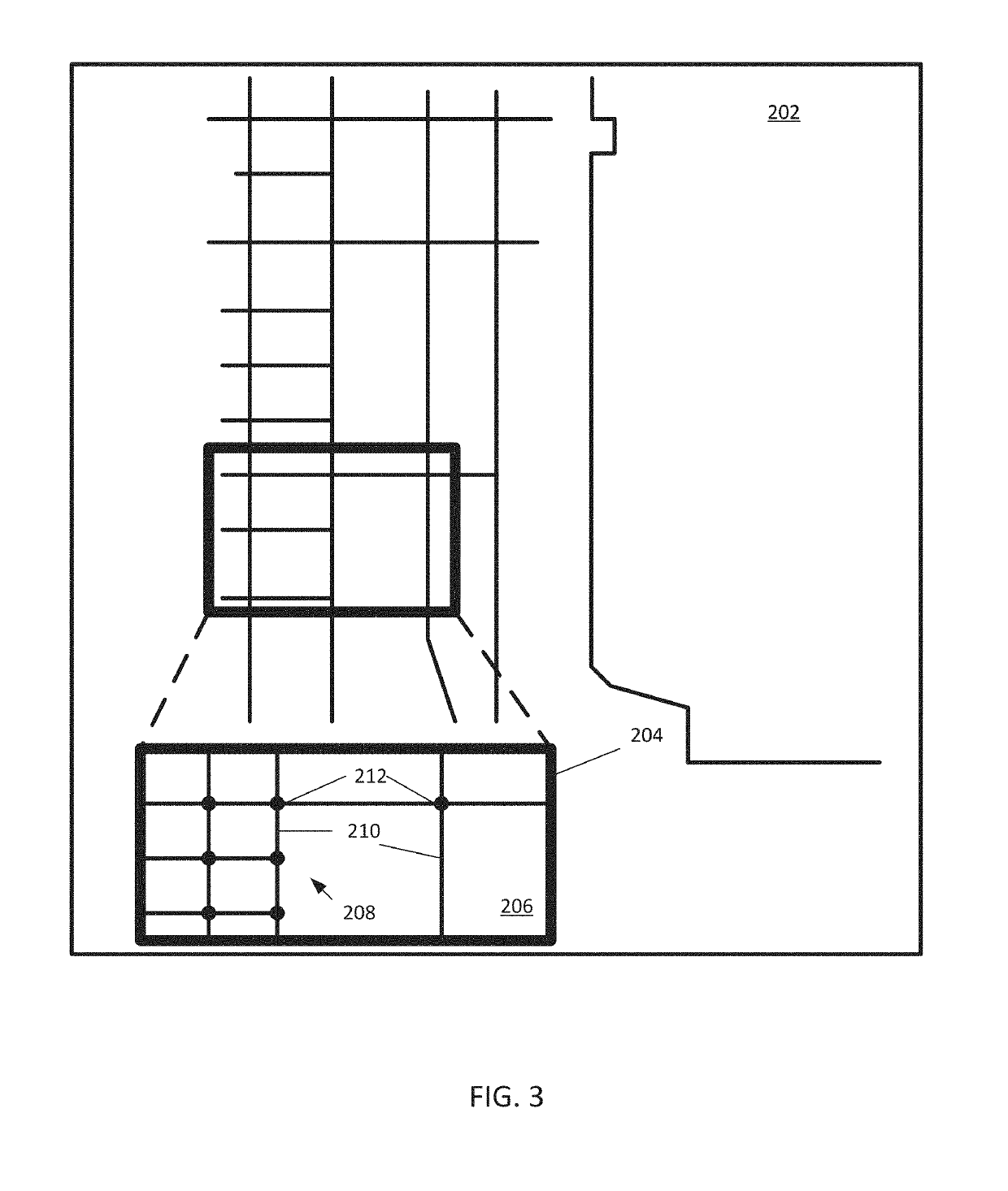
[0148]The following embodiments are disclosed. a decentralized system for incentivizing collection of map data comprising a plurality of devices for collecting map data, wherein each of the plurality of devices comprises: at least one sensor configured to acquire sensor data relating to a feature at a location on a roadway; a communication interface configured to communicate with at least one other device of the plurality of devices; and a device processor configured to generate an observation data package from the sensor data, perform, using the location, a spatial query on a blockchain configured to store a plurality of data entries to identify whether any data entries of the plurality of data entries exist for the observation data package; wherein when no data entries exist, the device processor is configured to generate a new data entry for the blockchain for the observation data package, and wherein when a data entry exists, the device processor is configured to validate the o...

embodiment 15

[0162] A method for incentivizing collection of map data by a navigation device, the method comprising: collecting, by the navigation device, observation data for a new feature on a roadway; generating, by the navigation device, an observation data package based on the observation data; querying, by the navigation device, a blockchain network for a data entry related to the feature data; generating, by the navigation device, a data entry when no existing data entry is found on the blockchain network, or validating, when found on the blockchain, by the navigation device, the existing data entry and augmenting the existing data entry with an address for the navigation device; and transmitting, by the navigation device, the new data entries or the augmented existing data entry to a plurality of nodes of the blockchain network to be added to a block of the blockchain network.

[0163]Embodiment 16: the method of embodiment 15, wherein the blockchain network stores a plurality of data entri...

embodiment 17

[0164] the method of embodiment 15, wherein the new data entry comprises an immutable logic data entry that specifies how an amount of digital currency and how the amount will be distributed upon execution of the immutable logic contract and a modifiable storage data entry that stores one or more wallet addresses.


PUM


Abstract

Systems and methods are provided to incentivize collection of high definition (HD) map content. The system includes at least one sensor, a communications interface, and a device processor. The sensor is configured to acquire sensor data relating to a feature at a location on a roadway. The communications interface is configured to communicate with at least one other device. The device processor is configured to generate an observation data package from the sensor data, perform, using the location, a spatial query on a blockchain configured to store a plurality of data entries to identify whether any data entries of the plurality of data entries exist for the observation data package. When no data entries exist, the device processor is configured to generate a new data entry for the blockchain for the observation data package, and when a data entry exists, validate the observation data package and augment the existing data entry.

Description

FIELD[0001]The following disclosure relates to navigation and / or mapping services.BACKGROUND[0002]Modern vehicles require accurate navigational systems. A vehicle may eliminate many dangerous unknowns by identifying exactly where the vehicle is on the road in real time, along with its immediate surroundings. A high definition (HD) map may be a crucial component of assisted or automatic driving technology. Vehicles may include many sensors, but an HD map may be the most important tool vehicles use.[0003]An HD map may be needed not only to allow a vehicle to precisely position itself laterally and longitudinally, but to enable the car to maneuver correctly. While sensors in vehicles may detect out around 100 meters, a car traveling at 80 miles per hour may only have a sensing horizon of 3 seconds. Vehicles need highly accurate and up to date maps to extend sensor range and “peek” around the corner.[0004]Sensors in vehicles may be able to detect lanes and lane markings in real time usi...

Claims


Application Information

Patent Timeline
Patent Type & Authority Applications(United States)
IPC IPC(8): G06Q30/02G06F17/30G06F21/60H04L9/06G06Q20/36G06Q20/06
CPCG06F16/9537G06F21/602G06Q30/0236G06Q20/065H04L9/0637G06Q30/0215G06Q2220/00G06Q20/36G06F16/29G06F21/64H04L9/3239H04L2209/84G06Q20/3825G06Q20/3827G06Q20/3829H04L9/50
Inventor FINKEN, JOSHUA MICHAELO'HARA, STEPHEN
Owner HERE GLOBAL BV
Why Eureka
Try Eureka