

Multi-antenna device for the rejection of multi-paths in a satellite navigation system and associated method
a satellite navigation system and antenna device technology, applied in the field of satellite navigation systems, can solve problems such as receiver location errors, different patterns, and impaired precision of satellite navigation systems
- Summary
- Abstract
- Description
- Claims
- Application Information
AI Technical Summary
Benefits of technology
Problems solved by technology
Method used
Image


Examples
Embodiment Construction
[0027]The description of the location device described in application WO 2012 / 025306 is taken up again here. The location device according to the present invention is based on the device previously described in the aforementioned application and affords improvements with respect to the latter.
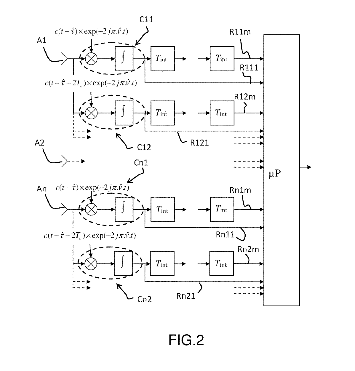
[0028]FIG. 2 describes an architecture of a location device according to the invention.
[0029]The location device according to the invention comprises a plurality of sensors A1, A2, An. These sensors are elementary antennas designed to pick up the radiolocation signals emitted by the satellites of a navigation system such as the GPS or Galileo system. The network of sensors A1, A2, An makes it possible to obtain the directional information by spatial sampling of the wavefront received.
[0030]The location device also comprises means for processing the signals received by the set of sensors A1, A2 to An. Signal processing lines are connected at the output of each sensor.
[0031]We describe in this pa...
PUM
 Abstract
Description
Claims
Application Information