

System for constructing urban design digital sand table
a digital sand table and urban design technology, applied in the field of urban planning, can solve the problems of not solving the problems of digitization, loading and the like of urban design, and the current digital sand table technology is more directed to processing, and achieves the effect of easy impor
- Summary
- Abstract
- Description
- Claims
- Application Information
AI Technical Summary
Benefits of technology
Problems solved by technology
Method used
Image

Examples
Embodiment Construction
[0043]Technical schemes of the present invention are further described in detail below with reference to drawings and embodiments.
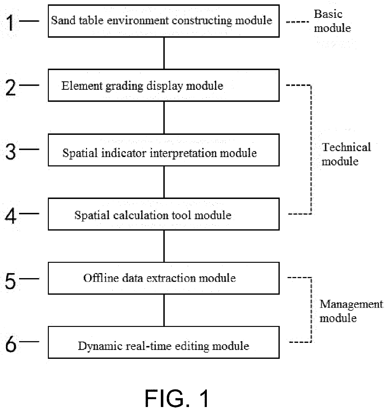
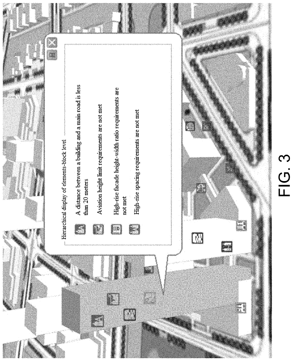
[0044]The present invention discloses a system for constructing an urban design digital sand table. The system includes the following module: a sand table environment constructing module, configured to construct a digital environment of the urban design sand table, that is, perform digital conversion and spatial superposition of the urban built environment, multi-source big data and an urban design scheme. According to actual demands of urban design, the digital sand table is divided into 5 functional modules, including 3 technical modules: an element grading display module, a spatial indicator interpretation module and a spatial calculation tool module; and 2 management modules: an offline data extraction module and a dynamic real-time editing module. The element grading display module is configured to perform hierarchical management on urban design elem...
PUM
 Abstract
Description
Claims
Application Information