Method for identifying spatial-temporal distribution of vehicle loads on bridge based on densely connected convolutional networks
- Summary
- Abstract
- Description
- Claims
- Application Information
AI Technical Summary
Benefits of technology
Problems solved by technology
Method used
Image

Examples
Embodiment Construction
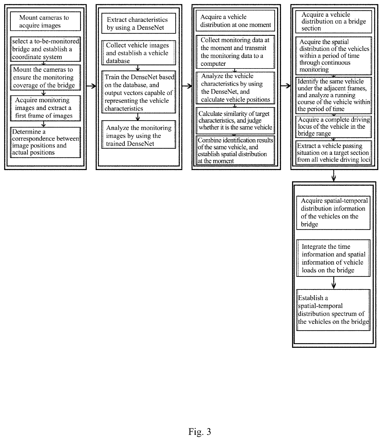
[0048]Specific embodiments of the present invention are further described below in combination with the accompanying drawings.
[0049]A method for identifying spatial-temporal distribution of vehicle loads on a bridge based on a DenseNet includes the following steps:
[0050]A. Mounting the cameras;
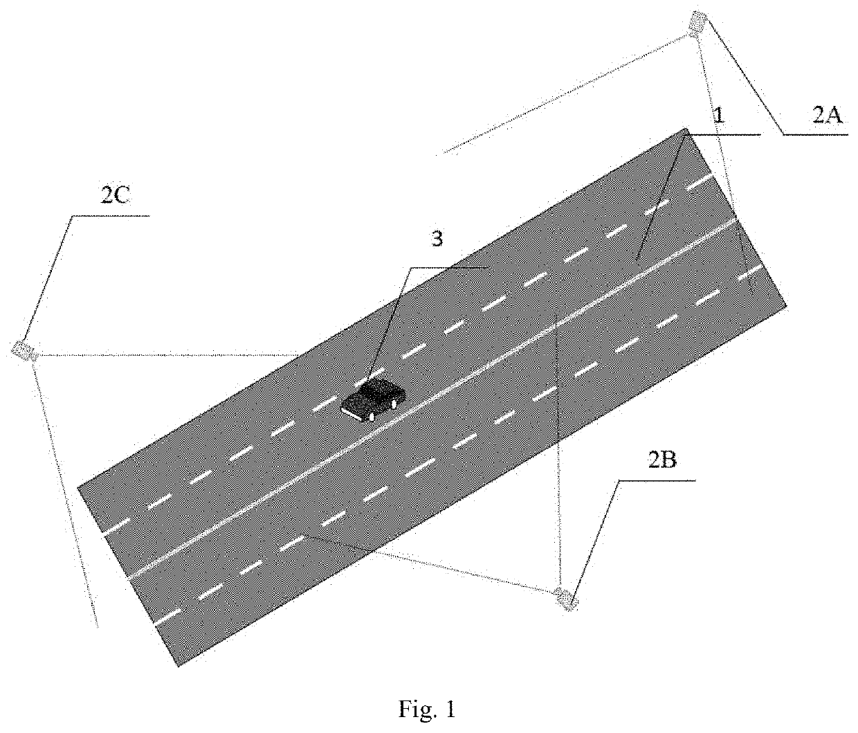
[0051]A1. Selecting a to-be-monitored bridge, determining a start position and an end position of the bridge 1, establishing a coordinate system by adopting a span direction as an axle x, a bridge width direction as an axle y and the center of the start position as an origin, and quantifying the position information on the bridge;
[0052]A2. Mounting the cameras 2 on the bridge according to objective conditions of the bridge such as length, width and upper structures to monitor the bridge;
[0053]A3. Acquiring real-time monitoring images of the bridge by using the cameras, intercepting a first frame of images, and marking time for the subsequent monitoring images by using the time as a base point;...
PUM
 Abstract
Description
Claims
Application Information