
System and Method for Displaying Moving Objects on Terrain Map

a technology for displaying moving objects and terrain maps, applied in the field of data visualization on the terrain map, can solve the problems of difficult to recognize the full picture of what is happening on the basis of the marks, the system operator is not convenient to quickly switch, and the moving objects, such as people or cars, usually move very quickly

Active Publication Date: 2021-12-30
OOO AJ TI VI GRUPP
View PDF0 Cites 2 Cited by
  • Summary
  • Abstract
  • Description
  • Claims
  • Application Information

AI Technical Summary

Benefits of technology

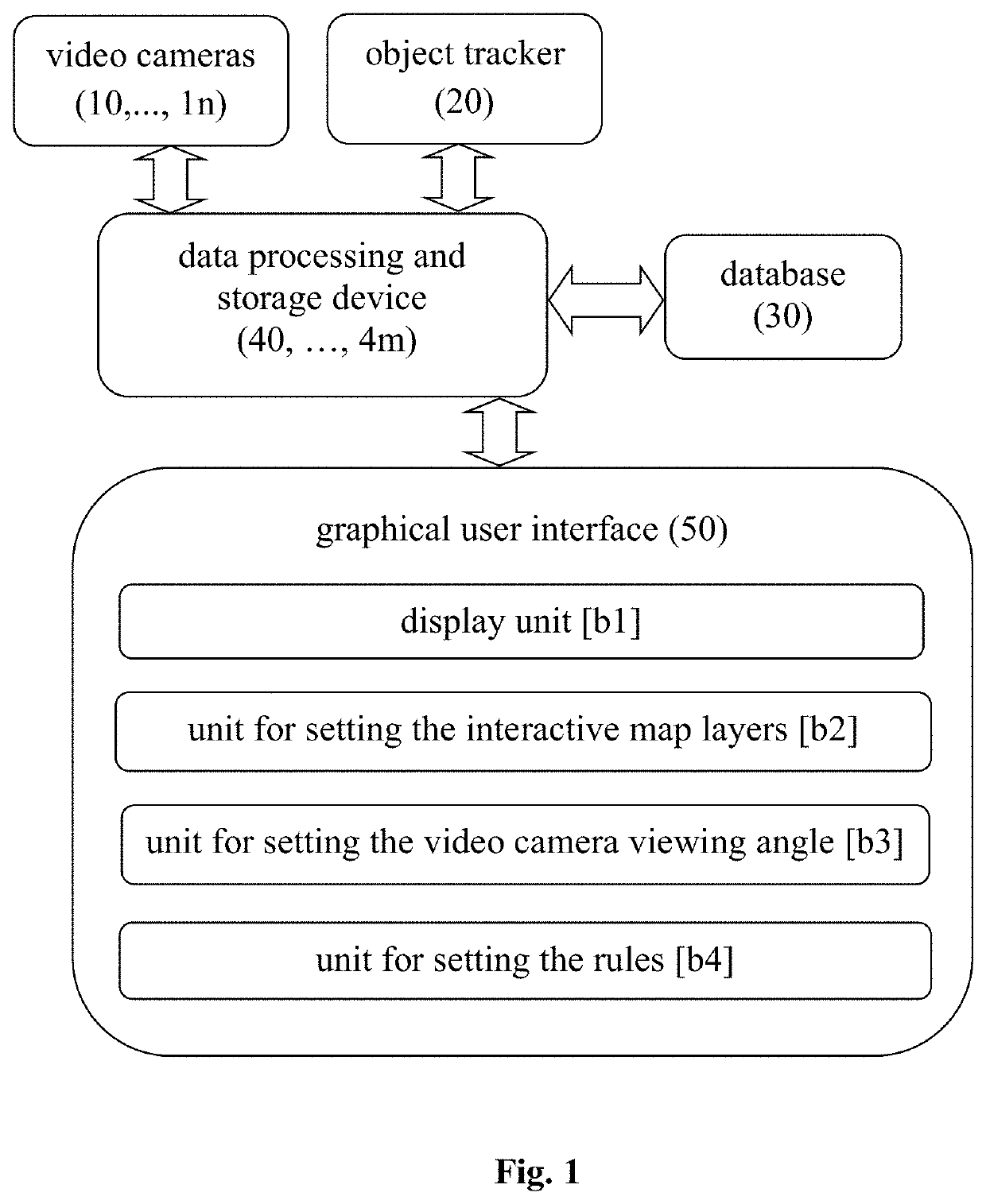
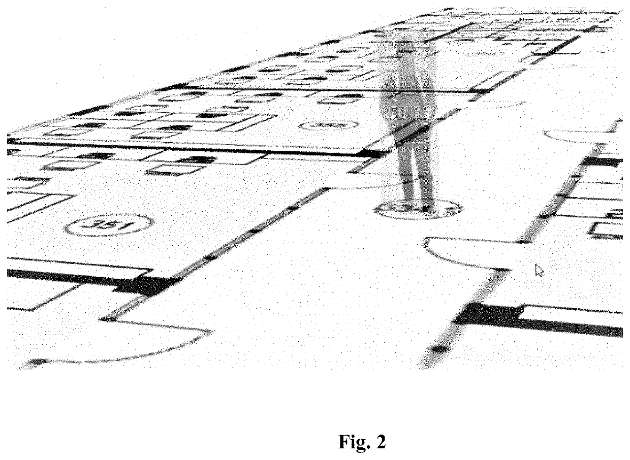
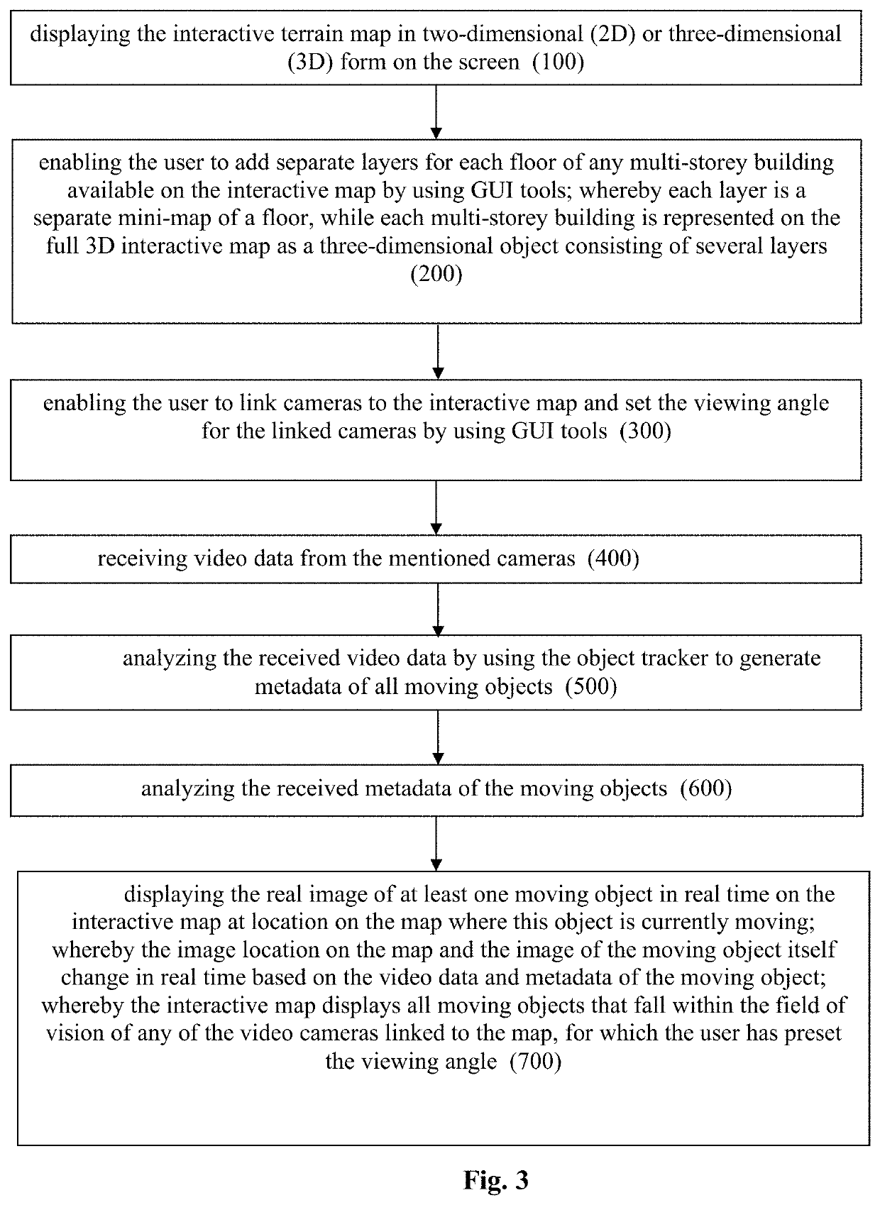
The technical effect of this patent is the development of a system and method for displaying moving objects on an interactive terrain map in real-time. The system includes video cameras, an object tracker, and a data processing and storage device with a graphical user interface. The user can add individual layers for each floor of a multi-storey building and can set the viewing angle for each video camera. The system can display the movement trajectories of all moving objects on the interactive map and can also display the name and photo of a person if the video data analysis determines that the person is a person. The interactive map can be a terrain map or an open street map. The user can set rules for determining the situations or actions of the moving objects.

Problems solved by technology

However, moving objects, such as people or cars, usually move very quickly from the field of vision of one camera to that of another one.
As a result, it may be not convenient for the system operator to quickly switch between different cameras and monitor the overall situation.
Such solutions are not clear enough for use in security systems, because it is difficult to recognize the full picture of what is happening on the basis of the marks.
The main difference of this solution is lack of visual representation of moving objects on the terrain map.
Besides, the known solution is rather complicated in implementation and is used only for vehicle tracking.
Thus, the main disadvantage of the previous field of invention is the lack of quick, accurate, and more informative real-time display of all moving objects on the terrain map, not only on the street, but also in the buildings.

Method used


Image

  • System and Method for Displaying Moving Objects on Terrain Map
  • System and Method for Displaying Moving Objects on Terrain Map
  • System and Method for Displaying Moving Objects on Terrain Map

Examples


Embodiment Construction

[0033]Description of the approximate embodiments of the claimed group of inventions is presented below. However, the claimed group of inventions is not limited only to these embodiments. It will be obvious to persons who are experienced in this field that other embodiments may fall within the scope of the claimed group of inventions described in the claim.

[0034]The claimed technical solution in its various implementation options can be implemented in the form of computer systems and methods for displaying the moving objects on the interactive terrain map, as well as in the form of a computer-readable data carrier.

[0035]FIG. 1 shows a block diagram of one of the implementation options of the system for displaying the moving objects on the interactive terrain map. The mentioned system in its complete set includes: several video cameras (10, . . . , 1n) linked to the interactive terrain map; an object tracker (20); a database (30); and at least one data processing and storage device (3...


PUM


Abstract

The invention refers to the area of data visualization on the terrain map, and more specifically to the analysis of video data received from cameras linked to an interactive terrain map for subsequent display in real time of all objects moving in the frame on the mentioned terrain map. A system for displaying the moving objects on the interactive terrain map comprising multiple video cameras, an object tracker, data processing and storage device that has a graphical user interface (GUI). GUI comprising a display unit, a unit for setting the interactive map, a unit for setting the video camera viewing angle. The data processing and storage device is configured to receive the video data from the video cameras, as well as metadata of all moving objects from the object tracker, analyze the received video data and object metadata, display the real image moving object in real time on an interactive map at location on the map where this object is currently moving. The image location on the map and the image of the moving object itself change in real time based on the video data and metadata of the moving object. The interactive map displays all moving objects that fall within the field of vision of any of the video cameras linked to the map, for which the user has preset the viewing angle.

Description

RELATED APPLICATIONS[0001]This application claims priority to Russian Patent Application No. RU 2020121090, filed Jun. 25, 2020, which is incorporated herein by reference in its entirety.FIELD OF THE INVENTION[0002]The invention refers to the area of data visualization on the terrain map, and more specifically to the analysis of video data received from cameras linked to an interactive terrain map for subsequent display in real time of all objects moving in the frame on the mentioned terrain map.BACKGROUND[0003]Video surveillance systems (security, control) are used to protect and control premises or areas. The mentioned security systems can be of very large scale, i.e. include both outdoor video surveillance and indoor control in the buildings. Automated video surveillance systems are used for huge areas to be monitored. In general, such systems are based on image processing and image recognition algorithms that allow analyzing video without direct involvement of a person. Dependin...

Claims


Application Information

Patent Timeline
Patent Type & Authority Applications(United States)
IPC IPC(8): G08B13/196H04N5/247H04N5/232G06K9/00H04N23/90
CPCG08B13/19682H04N5/247G08B13/1968H04N5/23299G06K9/00718H04N5/23218G06V20/10G06V20/52G06V2201/10H04N23/61H04N23/695H04N23/90G06T17/05G08B13/196G06T7/20H04N7/181G06V20/41
Inventor ATAEV, ALAN ZHASHARBEKOVICHKALUGIN, IVAN YUREVICHALTUEV, MURAT KAZIEVICH
Owner OOO AJ TI VI GRUPP
Learn More