

Method and apparatus using multi-target tracking to analyze borehole images and produce sets of tracks and dip data
a multi-target tracking and image analysis technology, applied in seismology for waterlogging, using reradiation, instruments, etc., can solve problems such as spurious reports, tracking problems implemented around boreholes, and inevitably returning to themselves, so as to improve the resolution of ambiguities
- Summary
- Abstract
- Description
- Claims
- Application Information
AI Technical Summary
Benefits of technology
Problems solved by technology
Method used
Image

Examples
Embodiment Construction
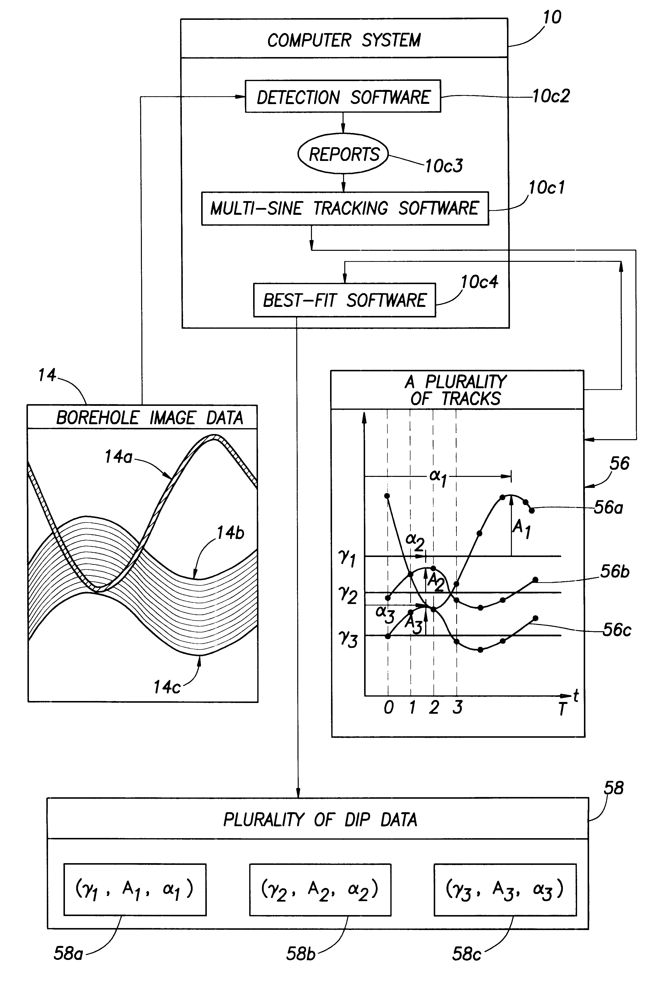
The method and apparatus of the present invention uses modified Multi-Target Tracking concepts to generate a plurality of tracks (sets of connected track points), representing dip events in borehole imagery from a borehole penetrating an earth formation, and a corresponding plurality of dip data, defining the "best fit" sine curves to a plurality of tracks, in response to a set of "borehole image data".
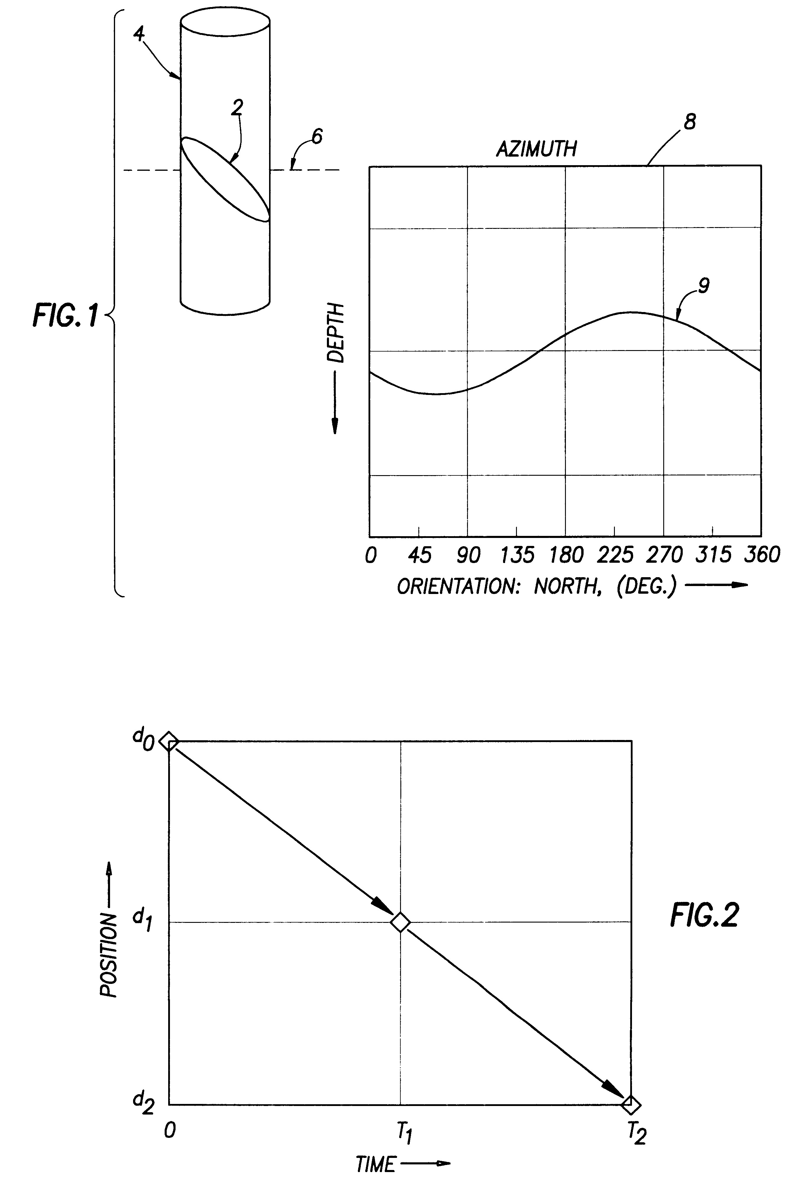
Referring to FIG. 8, an apparatus for generating the "borehole image data", representing images of resistivity variations on a borehole wall, is illustrated.
In FIG. 8, as noted earlier, the method and apparatus of the present invention generates a plurality of tracks and a corresponding plurality of dip data in response to a set of "borehole image data". The "borehole image data" (representing images of resistivity variations on a borehole wall) is generated by a borehole imaging tool, and that borehole imaging tool could be, for example, a "Formation MicroImager" (FMI) borehole imagi...
PUM
 Abstract
Description
Claims
Application Information