

Wavelet-based clustering method for managing spatial data in very large databases
- Summary
- Abstract
- Description
- Claims
- Application Information
AI Technical Summary
Benefits of technology
Problems solved by technology
Method used
Image

Examples
Embodiment Construction
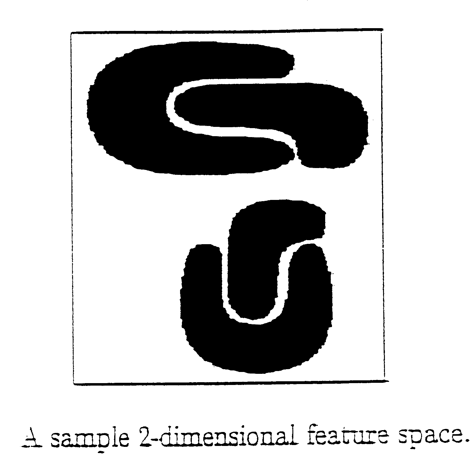
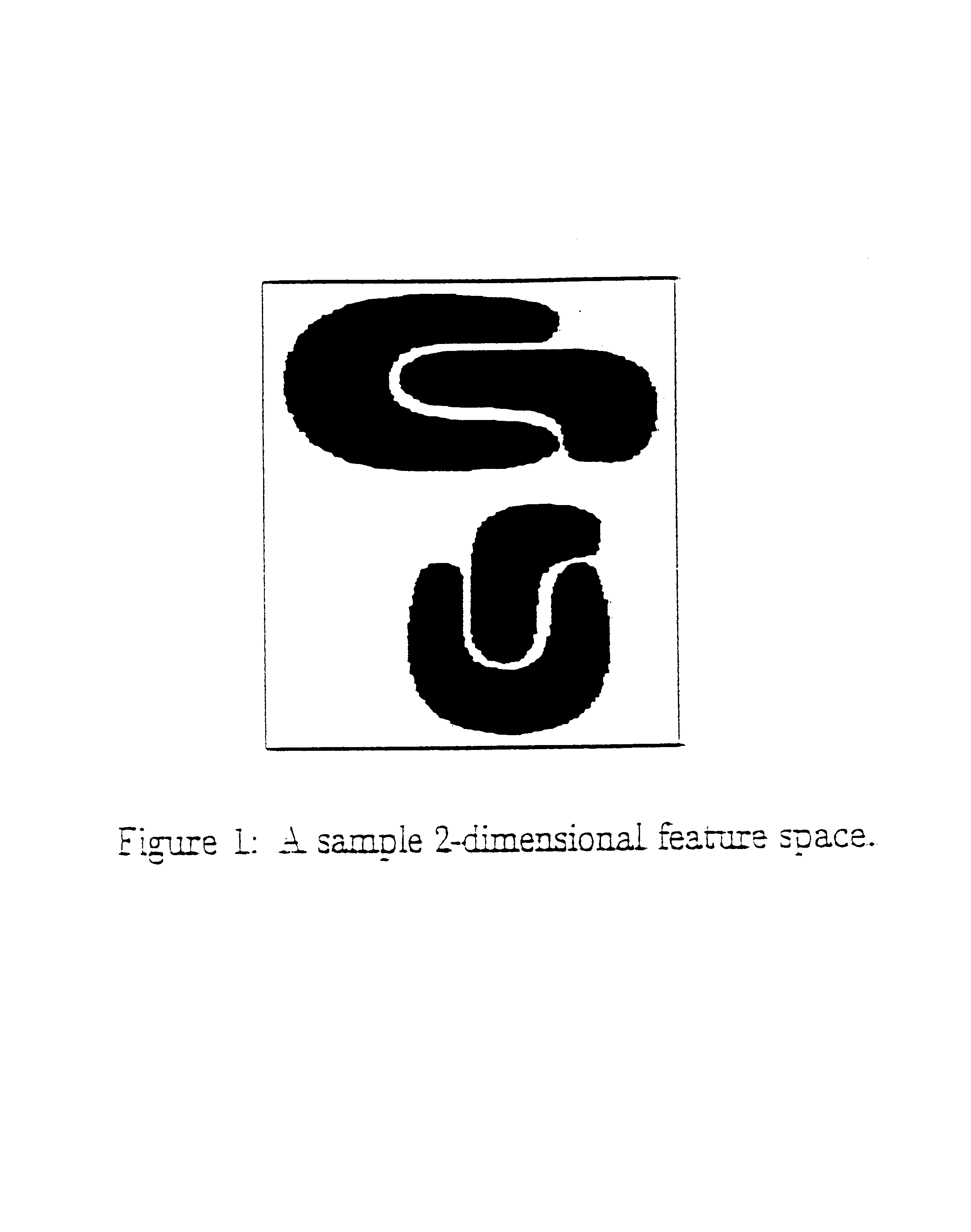
1 Problem Formalization
[0062]Following the definition of Agrawal et. al. [AGGR98], let A=A1, A2 . . . , Ad be a set of bounded, totally ordered domains and S=A1×A2× . . . Ad be a d-dimensional numerical space or feature space. A1, . . . , Ad are referred as dimensions of S. The input data set is a set of d-dimensional points O={o1, o2, . . . oN}, where oi=i1,oi2, . . . ,oid>1≦i≦N. The j-th component of oi is drawn from domain Aj.
[0063]We first partition the original feature space into nonoverlapping hyper-rectangles which we call cells. The cells are obtained by segmenting every dimension A, into m, number of intervals. Each cell ci is the intersection of one interval from each dimension. It has the form il,ci2, . . . ,cid> where cij=[lij, hij) is the right open interval in the partitioning of Aj. Each cell ci has a list of statistical parameters ci.param associated with it.
[0064]We say that a point ok=kl, . . . ,okd> is contained in a cell ci, if lij≦okiij for 1≦ji.param keeps trac...
PUM
 Abstract
Description
Claims
Application Information