Method and system for determining the altitude of a mobile wireless device

a mobile wireless and altitude technology, applied in the field of determining the location of mobile wireless devices, can solve the problems of inability to quickly determine on which floor the emergency is occurring, difficulty in determining the exact location (i.e., altitude) of the calling wireless device, and inability to quickly determine the location of the wireless caller, etc., to improve the ability of emergency personnel, accurate location determination, and quick localization and reach

Active Publication Date: 2006-02-14
AT&T INTPROP I L P
View PDF6 Cites 65 Cited by
  • Summary
  • Abstract
  • Description
  • Claims
  • Application Information

AI Technical Summary

Benefits of technology

[0014]The present invention provides a method and system for determining the three-dimensional location of a mobile wireless device. Given an x-y coordinate location of a mobile wireless device, the present invention determines the altitude at which the mobile wireless device is located. In this manner, the present invention provides a more accurate location determination in situations in which a mobile wireless device could be found at different altitudes on the same x-y coordinates. This enhanced location method can therefore significantly improve the ability of emergency personnel to quickly locate and reach wireless telephone callers in need of help.

Problems solved by technology

Thus, without a means for determining the location of the mobile wireless telephone, the emergency center must rely on the caller's knowledge and communication of her location, which often leads to errors.
The inability to determine the location of a wireless caller is compounded by the fact that an increasing number of 911 calls are coming from wireless telephones.
An emergency responder arriving at the skyscraper, knowing only the x-y coordinates, would therefore be unable to quickly determine on which floor the emergency is occurring.
Thus, the taller building 100 is, the more difficult it is to determine the exact location (i.e., altitude) of the calling wireless device.

Method used


Image

  • Method and system for determining the altitude of a mobile wireless device
  • Method and system for determining the altitude of a mobile wireless device
  • Method and system for determining the altitude of a mobile wireless device

Examples


first embodiment

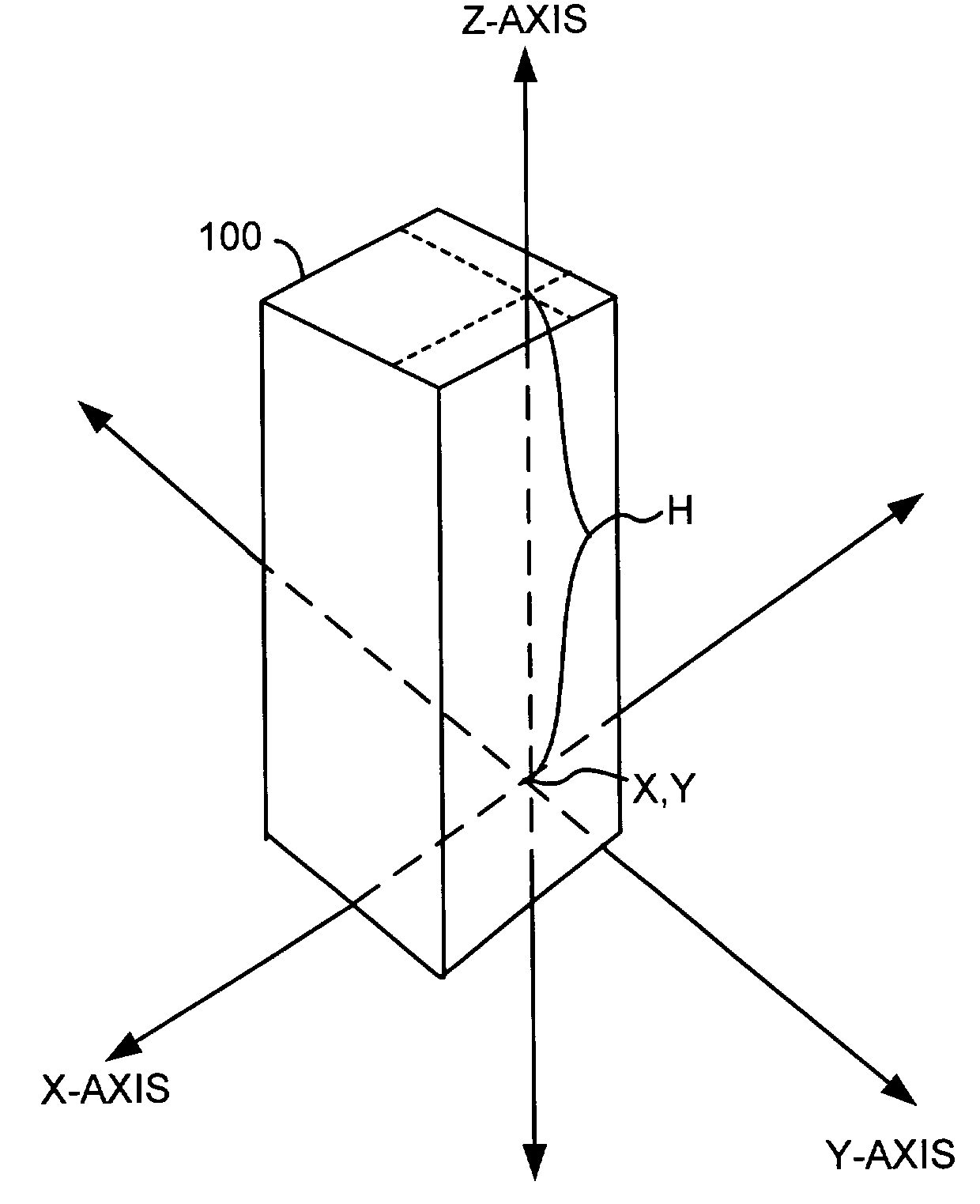
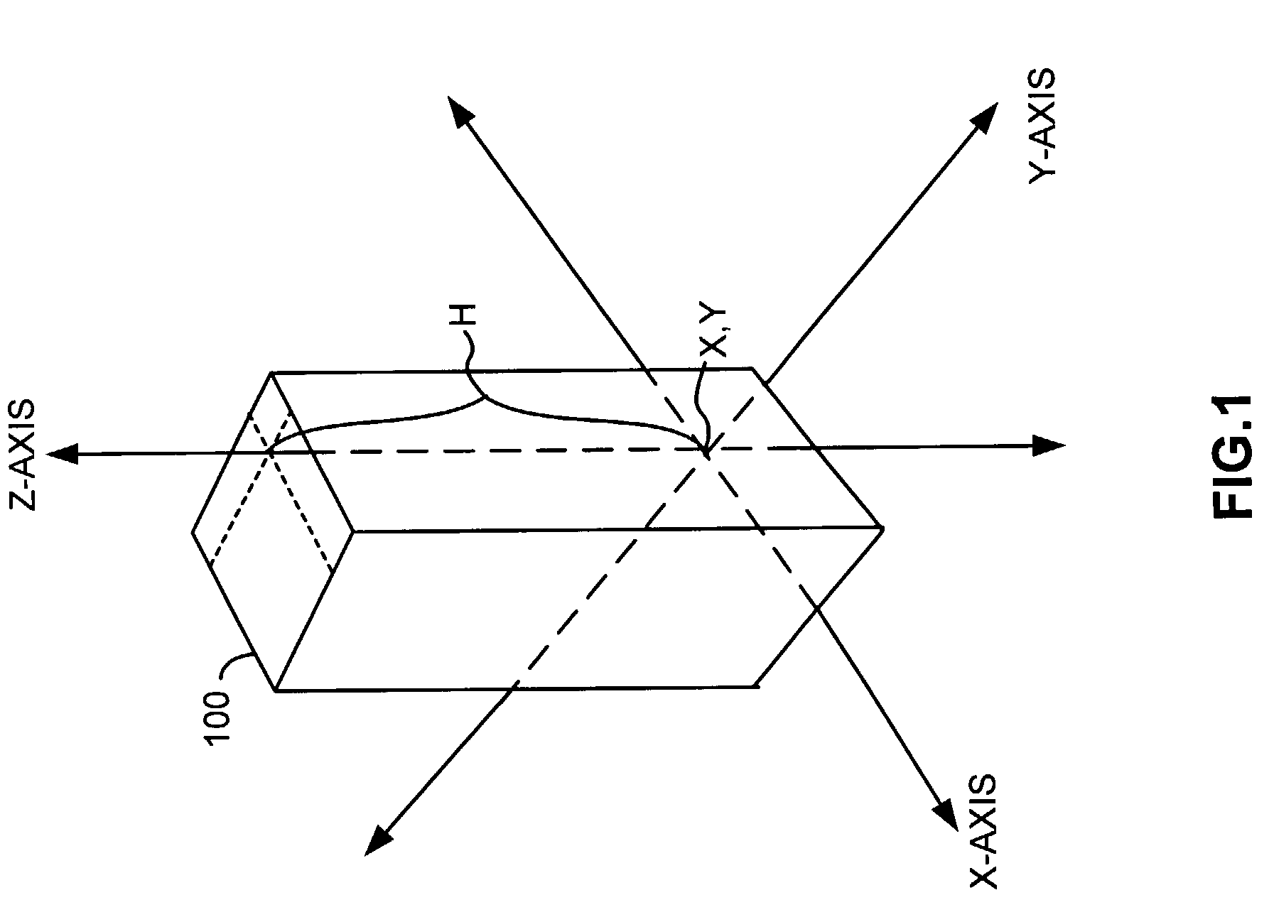
[0049]Given the x-y coordinates, in step 420, altitude processor 312 of wireless service provider 304 measures a transmission metric associated with the mobile wireless device 302. In a first embodiment, this transmission metric is the time that a wireless signal takes to travel from mobile wireless device 302 to a wireless signal receiver of wireless service provider 304. Taking the skyscraper example of FIG. 5, the time for a wireless signal to travel from a mobile wireless device 302 located on the eightieth floor of building 510 to wireless signal receiver 500 would be measured as T3′.

second embodiment

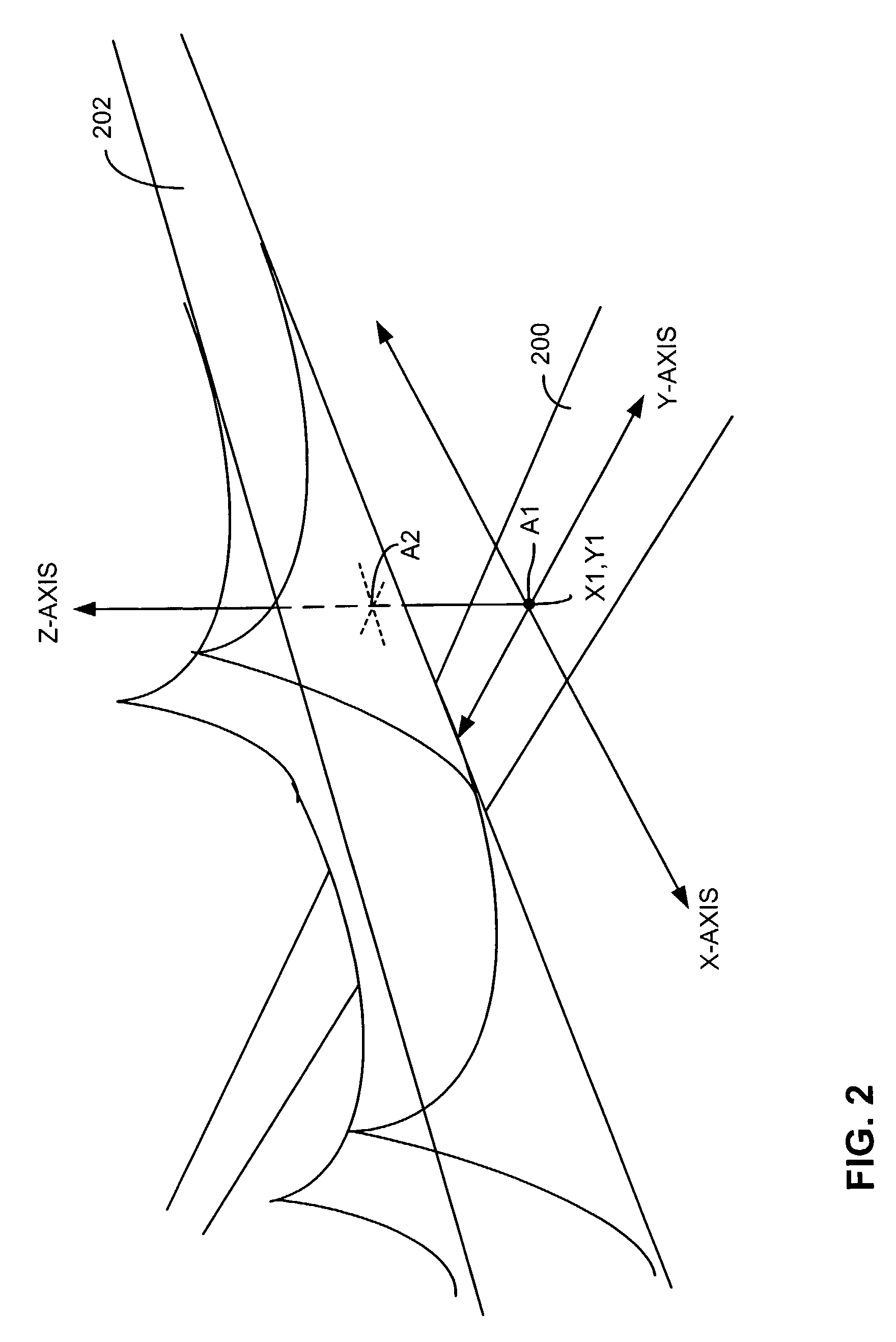
[0050]In a second embodiment, the transmission metric is the angle of arrival of a wireless signal from the mobile wireless device 302. Considering the example of FIG. 6, the angle at which a wireless signal is received from a mobile wireless device 302 on the fortieth floor of building 600 would be measured as θ′.

[0051]Thus, at the end of step 420, wireless service provider 304 has the x-y coordinates of the mobile wireless device 302, as well as a measured transmission metric associated with the mobile wireless device 302. In step 422, altitude processor 312 looks up the given x-y coordinates in altitude database 314. In the exemplary table 700 of FIG. 7, altitude processor 312 would search the x-y coordinate column 702.

[0052]After locating the appropriate x-y coordinate entry in altitude database 314, in step 424, altitude processor 312 looks in the entry for the transmission metric that was measured in step 420 (or a value that is substantial equivalent to the measured transmiss...


PUM


Abstract

A method and system for determining the three-dimensional location of a mobile wireless device. In one implementation, the device is a cellular telephone making a 911 call from one floor of a multi-story building. An embodiment of the method of the invention includes establishing a database that associates transmission metrics with altitudes of x-y coordinate locations having more than one altitude at which the mobile wireless device could be located, receiving a communication from the mobile wireless device, determining an x-y coordinate location of the mobile wireless device, measuring a transmission metric of the mobile wireless device, and consulting the database to determine the altitude from the x-y coordinate location and the measured transmission metric. The transmission metric could be, for example, the transmission time or angle of arrival of a wireless signal received from the mobile wireless device.

Description

BACKGROUND[0001]1. Field of the Invention[0002]The present invention relates generally to determining the location of a mobile wireless device, and more particularly, to determining the altitude of a wireless telephone caller with respect to a particular x-y coordinate location.[0003]2. Background of the Invention[0004]When a 911 emergency center receives a call, the ability to accurately locate the caller can dramatically affect the degree of success emergency personnel have in responding to the need for help. Dispatching the emergency personnel to the correct location is crucial to administering help as quickly as possible. When a person dials 911 from a traditional wireline telephone, the emergency center identifies the number of the wireline telephone and cross-references that number with an address database to determine the location of the wireline telephone, and thus the location of the caller.[0005]Wireless telephones, however, are not fixed in a single location and therefore...

Claims


Application Information

Patent Timeline
Patent Type & Authority Patents(United States)
IPC IPC(8): H04B1/38H04W4/33H04W4/90H04W64/00
CPCH04B1/3805H04W64/00H04W4/04H04W76/007H04W64/006H04W4/22H04W76/50H04W4/90H04W4/33
Inventor ZHAO, WEI
Owner AT&T INTPROP I L P
Why Eureka
Try Eureka