Method and apparatus for using long term satellite tracking data in a remote receiver
- Summary
- Abstract
- Description
- Claims
- Application Information
AI Technical Summary
Benefits of technology
Problems solved by technology
Method used
Image
Examples
Embodiment Construction
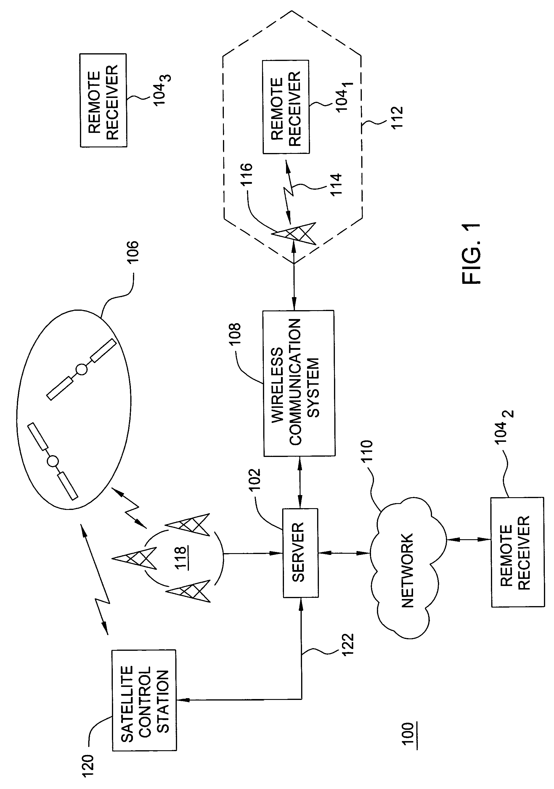
[0024]FIG. 1 is a block diagram depicting an exemplary embodiment of a position location system 100. The system 100 comprises a server 102 and a plurality of remote receivers 104, illustratively, a remote receiver 1041, a remote receiver 1042, and a remote receiver 1043. The remote receivers 104 measure pseudoranges to a plurality of satellites 106 in a constellation of satellites to locate position. For example, the remote receivers 104 may measure pseudoranges to a plurality of global positioning system (GPS) satellites in the GPS constellation. The server 102 distributes data representative of satellite trajectory information, satellite clock information, or both to facilitate operation of the remote receivers 104 (“satellite tracking data”). Notably, the remote receivers 104 may use the satellite tracking data to assist in acquiring satellite signals and / or compute position.
[0025]The server 102 may distribute the satellite tracking data to the remote receivers 104 using a commun...
PUM
 Abstract
Description
Claims
Application Information
 - R&D
- Intellectual Property
- Life Sciences
- Materials
- Tech Scout
- Unparalleled Data Quality
- Higher Quality Content
- 60% Fewer Hallucinations
Browse by: Latest US Patents, China's latest patents, Technical Efficacy Thesaurus, Application Domain, Technology Topic, Popular Technical Reports.
© 2025 PatSnap. All rights reserved.Legal|Privacy policy|Modern Slavery Act Transparency Statement|Sitemap|About US| Contact US: help@patsnap.com


