
Three-dimensional electronic map data creation method

a technology of electronic map data and creation method, which is applied in the field of three-dimensional modeling method, can solve the problems of requiring a lot of labor to obtain three-dimensional data, giving pseudo-three-dimensional modeling, and not sufficiently reflecting the actual state, so as to achieve the effect of generating three-dimensional electronic map data

Inactive Publication Date: 2008-03-11
ZENRIN
View PDF8 Cites 107 Cited by
  • Summary
  • Abstract
  • Description
  • Claims
  • Application Information

AI Technical Summary

Benefits of technology

This method enables accurate and efficient three-dimensional modeling of building structures without height measurement, facilitating the generation of practical three-dimensional electronic map data that reflects actual changes in the built environment, such as new or demolished structures, while reducing the time and labor required for data updates.

Problems solved by technology

Extensive labor is, however, required to obtain three-dimensional data, especially height-relating data, with regard to a large number of building structures as objects of display in the maps.
These methods, however, do not sufficiently reflect the actual state and only give pseudo three-dimensional modeling.
The above proposed techniques thus do not sufficiently relive the labor but still demand an extremely large amount of labor for generation of the three-dimensional electronic map data.
The conventional techniques, however, require a long time for three-dimensional modeling and thus do not meet this time-based demand.

Method used


Image

  • Three-dimensional electronic map data creation method
  • Three-dimensional electronic map data creation method
  • Three-dimensional electronic map data creation method

Examples


Embodiment Construction

[0055]One mode of carrying out the invention is described below in the following sequence:

[0056]A. Construction of Map Data Generation System[0057]A1. Structure of Auto Modeling Module[0058]A2. Structure of Manual Modeling Module[0059]A3. Structure of Texture Creation Module

[0060]B. Modeling Data Collection Device

[0061]C. Modeling[0062]C1. Preprocessing[0063]C2. Auto Modeling Process[0064]C3. Manual Modeling Process[0065]C4. Texture Creation Process[0066]C5. Additional Structure Setting Process

A. Construction of Map Data Generation System

[0067]FIG. 5 illustrates the construction of an electronic map data generation system 100 (hereafter may simply be referred to as the system 100) in one embodiment. The system 100 carries out three-dimensional modeling of a building structure to generate three-dimensional electronic map data. In this embodiment, the system 100 is actualized by the software configuration of the respective functional blocks in a computer. The system is made up of one ...


PUM


Abstract

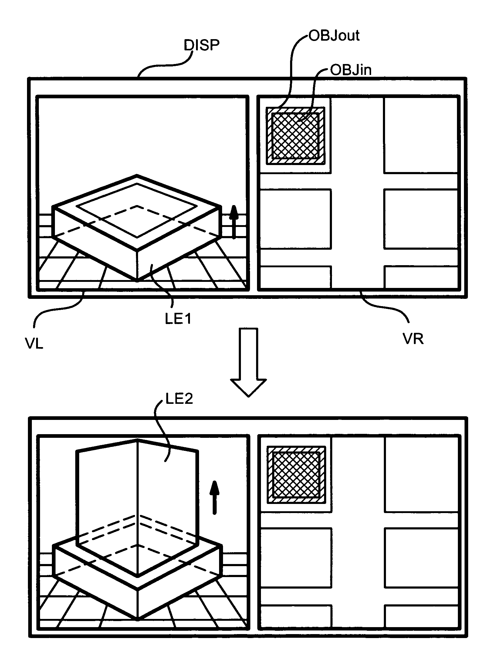
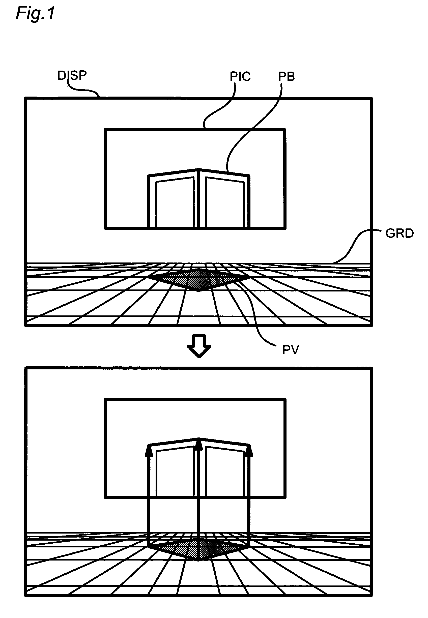
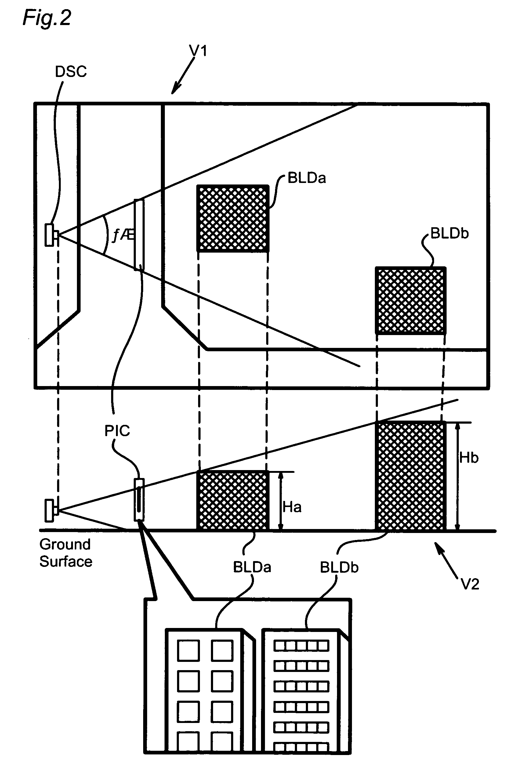
When creating three-dimensional electronic map data, three-dimensional modeling of a building is performed as follows without measuring height of the building. Firstly, a building is photographed and the photographing position and photographing parameters (camera direction, angle of view) are recorded. Secondly, in a virtual space prepared on a computer, a photograph is arranged so as to reproduce the state upon the photographing according to these data. In combination with this, a plan view of the building is arranged according to the two-dimensional map data. Thirdly, the plan view is moved in the height direction until it is overlapped with the photograph, thereby modeling the building. Thus, it is possible to realize three-dimensional modeling without measuring the height.

Description

TECHNICAL FIELD[0001]The present invention relates to a three-dimensional modeling method of generating three-dimensional electronic data of a building structure, as well as to a technique of generating three-dimensional electronic map data by taking advantage of the three-dimensional modeling method.BACKGROUND ART[0002]Use of map data converted in a computer processible form (hereafter referred to as ‘electronic map data’) has recently been spread to various fields. The electronic map data are used for display of maps on personal computers, navigation systems mounted on vehicles, display of maps via the Internet, and production of mechanicals for maps in print. Three-dimensional display is adopted in the navigation system to help the driver's intuitive understanding of the drive course. Three-dimensional display of building structures advantageously assists the user's easy specification of the current position and the drive course.[0003]Three-dimensional data of the building struct...

Claims


Application Information

Patent Timeline
Patent Type & Authority Patents(United States)
IPC IPC(8): G06F17/50G06T15/00G06T17/00G01C21/00G06T17/05G01C21/26G06T7/00G06T17/10G06T19/20G08G1/0969G09B29/00
CPCG06F17/5004G06T7/0051G06T15/04G06T17/00G06T17/05G06T17/10G06T7/50G06F30/13G06F30/00
Inventor KISHIKAWA, KIYONARI
Owner ZENRIN
Learn More