Geophysical data acquisition system

a technology of geophysical data and acquisition system, applied in the direction of geological measurements, sound producing devices, using reradiation, etc., can solve the problems of inability to acquire electromagnetic and seismic data simultaneously, apparatus is not designed for seismic prospecting, and lack of geophones or other seismic sensors

Active Publication Date: 2008-11-18
DEN NORSKE STATS OLJESELSKAP AS
View PDF23 Cites 55 Cited by
  • Summary
  • Abstract
  • Description
  • Claims
  • Application Information

AI Technical Summary

Problems solved by technology

But Constable's apparatus lacks geophones or other seismic sensors, and thus cannot acquire electromagnetic and seismic data simultaneously.
This is a time-consuming sequence of performing a marine seismic prospecting for oil, but no equipment known to us at the time of filing this application is arranged for conducting a simultaneous seismic and EM acquisition.
However, the apparatus is not designed for use in seismic prospecting, and does neither comprise any seismic streamer or receiver cable.

Method used


Image

  • Geophysical data acquisition system
  • Geophysical data acquisition system
  • Geophysical data acquisition system

Examples


Embodiment Construction

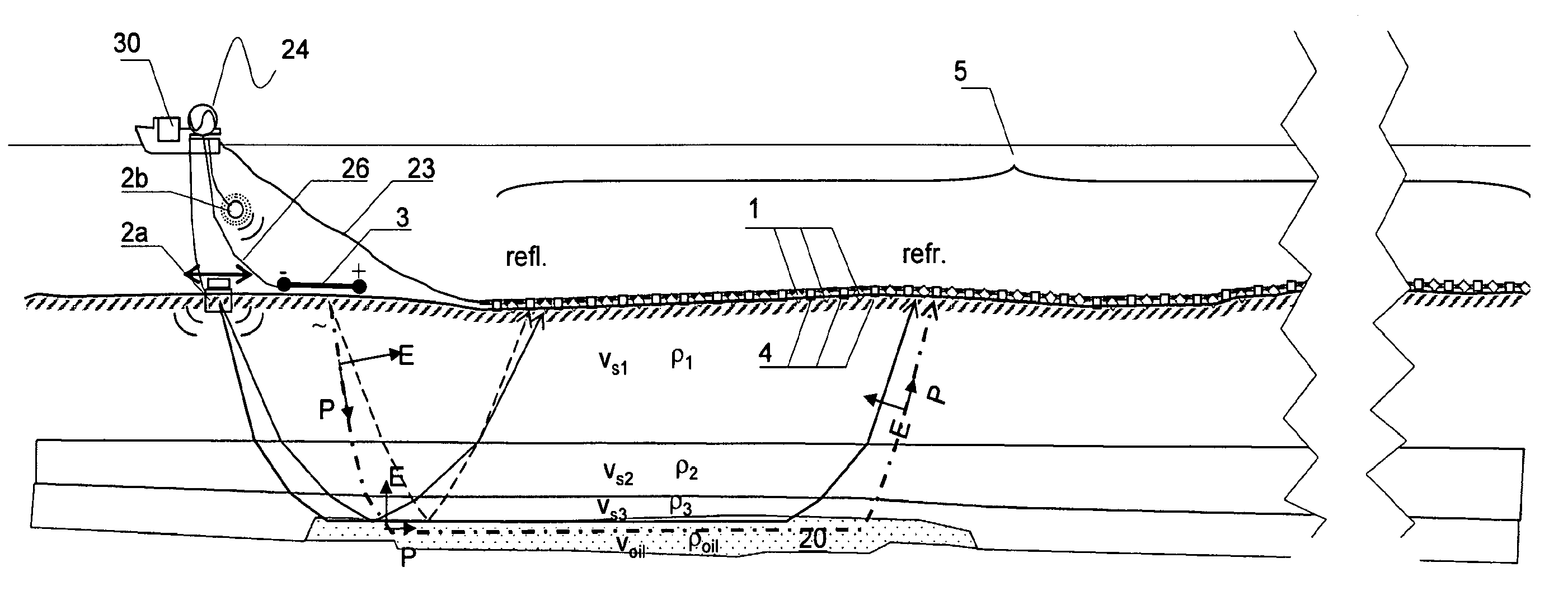
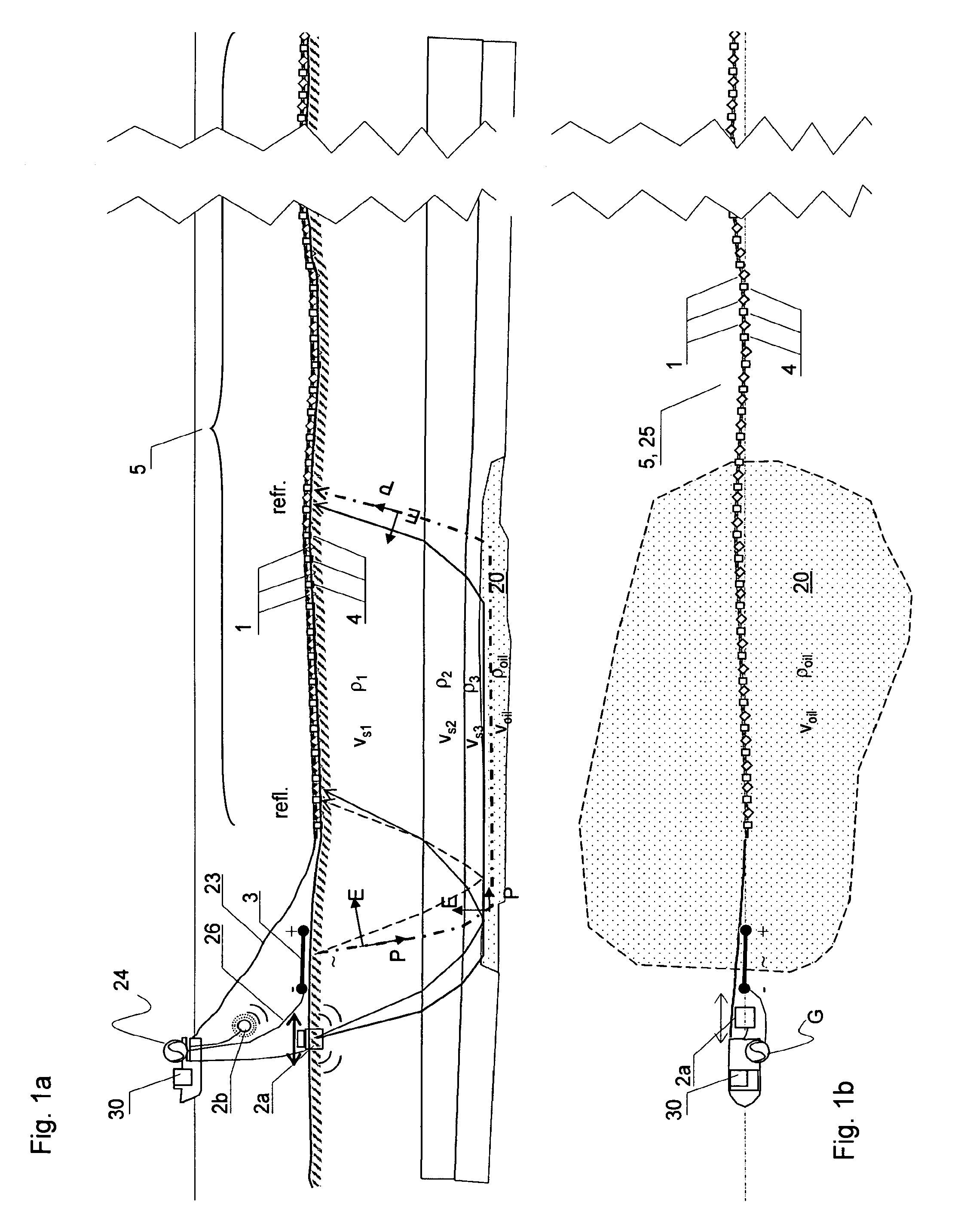
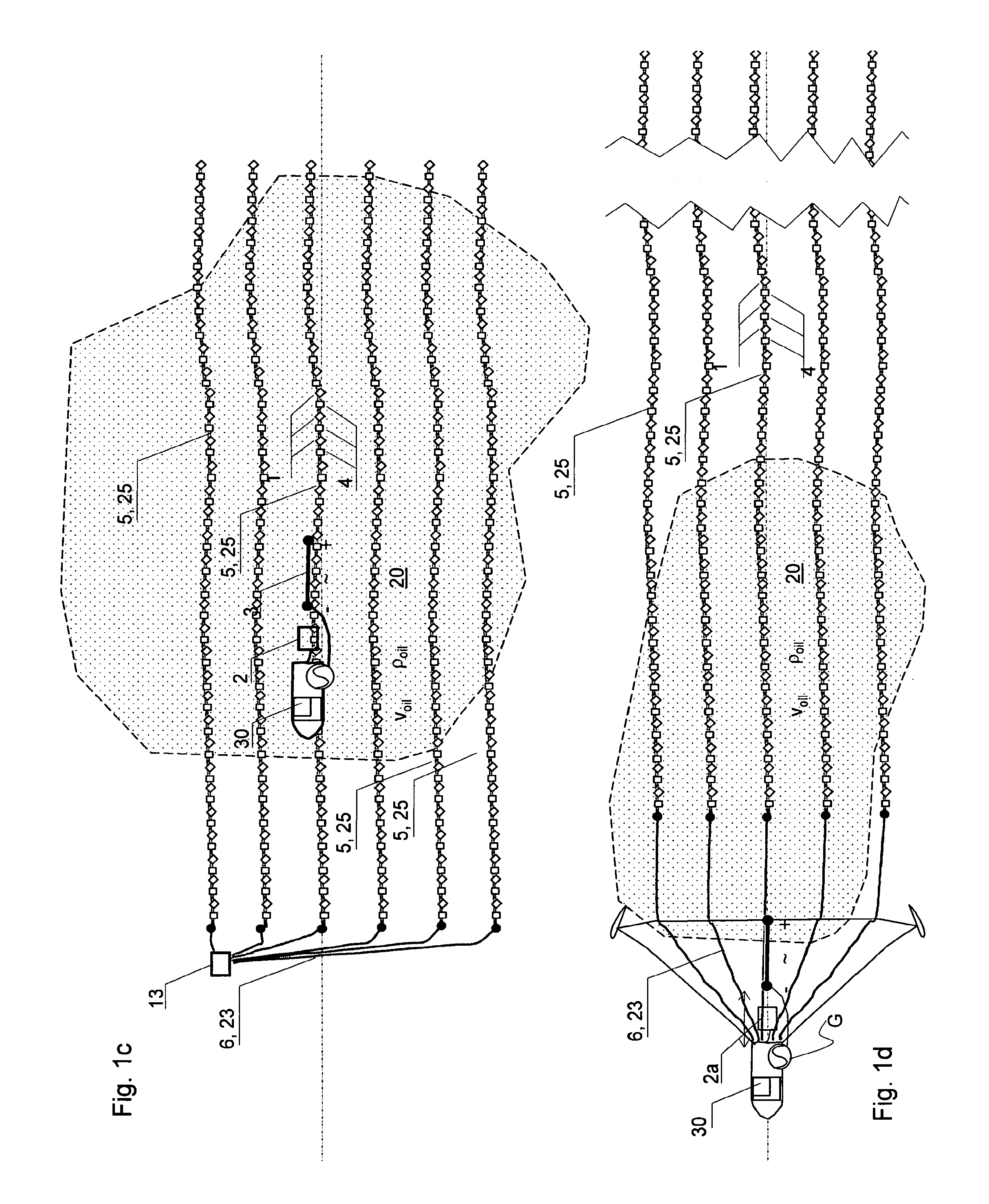
[0032]The invention relates to a marine geophysical acquisition system illustrated in the enclosed FIGS. 1a (plane view) and 1b (side elevation view), and also in FIG. 1c, FIG. 1d, and FIGS. 3a-f, comprising the following features:

[0033]One or more seismic signal sources 2 for being arranged in the sea or at the seafloor and for emitting seismic signals. The seismic signal source may be an airgun in the water masses producing P-waves, or a seismic vibrator arranged for producing P- and or S-waves in the seafloor.

[0034]A plurality of seismic sensors 1 are arranged on a receiver cable 5. The receiver cable is made for being extended in the sea, either towed behind a vessel 30 in the water masses or the receiver cable may preferably be arranged on the seafloor during the measurement, for reasons to be explained below. The seismic sensors 1 are for sensing propagated seismic signals emitted from the signal source 2 and propagating through the geological formations constituting the seabe...


PUM


Abstract

The invention includes a geographical sensor apparatus for use under water in the sea, including a plurality of seismic sensors (1) for sensing seismic waves associated with underground formations, and a plurality of EM-sensors constituted preferably by electrodes (4) for sensing electromagnetic waves associated with the underground formations. In a preferred receiver cable configuration embodiment of the invention, the geophysical sensor apparatus includes a seismic receiver cable with a linear array of a plurality of seismic sensors (1) and EM-sensors arranged inside a flexible outer skin (25), with the EM-sensors having electrodes on the outside of the outer skin. The cable is operated on the seafloor by a surface vessel, the vessel towing an electromagnetic transmitter antenna in addition to the seismic source.

Description

INTRODUCTION [0001]The invention relates to a combination of seismic sensors (hydrophones and / or geophones and / or accelerometers) and electromagnetic sensors (electrical and / or magnetic), in which the sensor apparatus can be submerged in sea-water. Seismic and electromagnetic waves emitted by corresponding signal sources are refracted and reflected through the geological underground strata and picked up by corresponding sensors.[0002]More specifically, the invention is an apparatus which integrates two different geophysical receiver systems, seismic and electromagnetic, in a combined unit for use in the marine environment for petroleum prospecting / exploration and reservoir monitoring. The combination of the two methods will increase the value of the data to more than the sum of the two individual data sets, as more accurate combined mapping and monitoring may be achieved (as the relative receiver positions are constant and the spatial sampling is dense), and more conclusive interpre...

Claims


Application Information

Patent Timeline
Patent Type & Authority Patents(United States)
IPC IPC(8): G01V1/00G01V1/20G01V1/38G01V3/08
CPCG01V1/201G01V1/38G01V3/08G01V11/00G01V11/007Y02A90/30G01V11/002
Inventor JOHNSTAD, SVEIN ERLING
Owner DEN NORSKE STATS OLJESELSKAP AS
Why Eureka
Try Eureka