

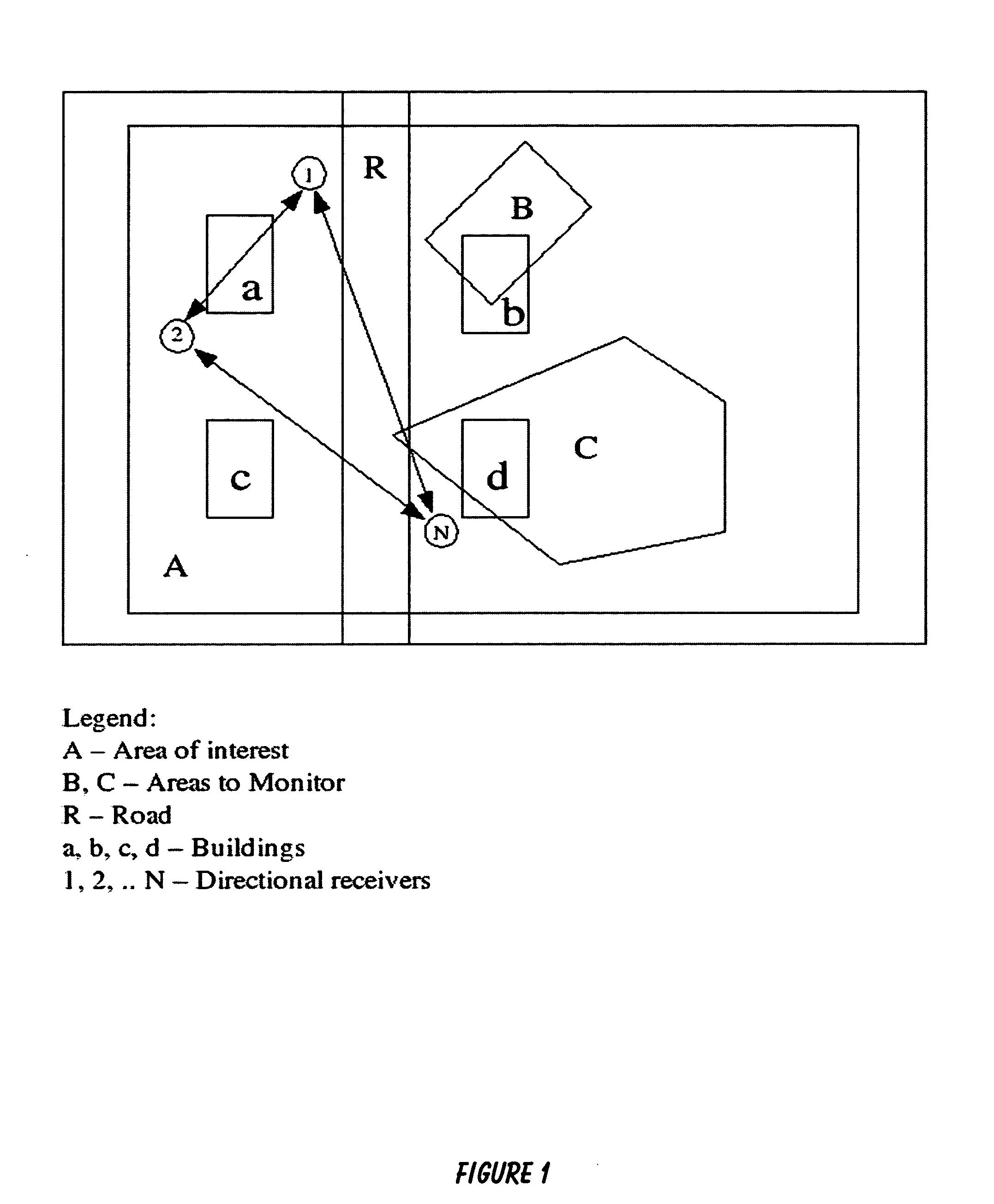
Method and system for collecting and surveying radio communications from a specific protected area of operations in or around a compound
a technology for radio communications and protected areas, applied in the field of electronic information surveillance and security systems, can solve problems such as material damage and loss of life, and achieve the effects of enhancing the operational capabilities of the twenty-first century, facilitating the selection of monitoring areas, and ensuring the accuracy of signal geolocation systems
- Summary
- Abstract
- Description
- Claims
- Application Information
AI Technical Summary
Benefits of technology
Problems solved by technology
Method used
Image

Examples
Embodiment Construction
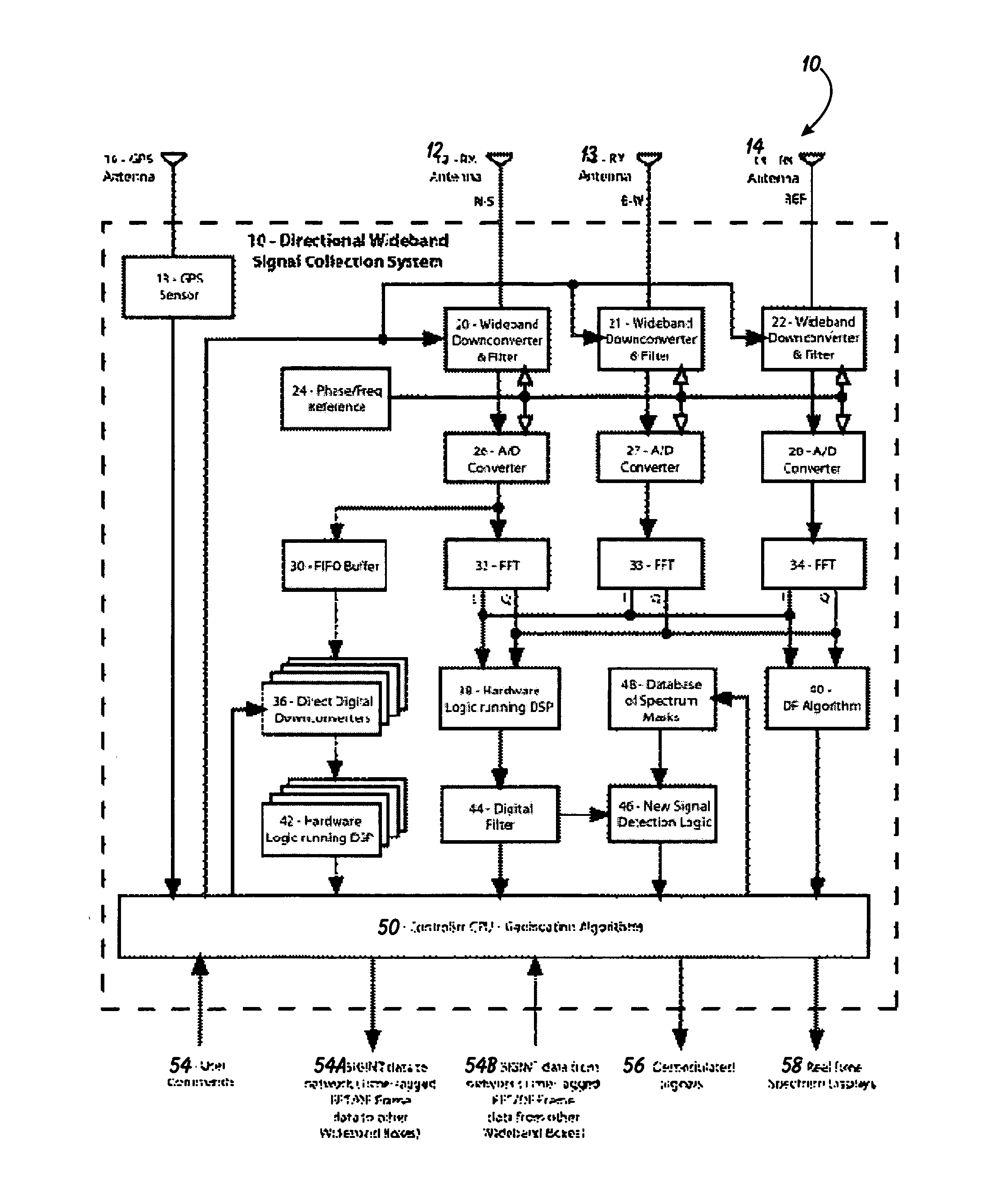
[0022]The following description is provided to enable any person skilled in the art to make and use the invention and sets forth the best modes contemplated by the inventor of carrying out his invention. Various modifications, however, will remain readily apparent to those skilled in the art, since the generic principles of the present invention have been defined herein specifically to provide a Method and System for Collecting and Surveying Radio Communications From a Specific Protected Area of Operations in or Around a Compound.
[0023]The parent applications to this patent application, namely, Ser. No. 10 / 829,858, filed Apr. 21, 2004 for “Method and Apparatus for the Intelligent and Automatic Gathering of Sudden Short Duration Communications Signals” and two of its continuation-in-part applications, namely, Ser. No. 11 / 201,164 filed Aug. 11, 2004 for “Improved Method and Signal Intelligence Collection System That Reduces Output Data Overflow in Real-Time”, and Ser. No. 11 / 201,144 f...
PUM
 Abstract
Description
Claims
Application Information