Multi-station analysis of magnetic surveys
a multi-station, magnetic survey technology, applied in the direction of survey, borehole/well accessories, instruments, etc., can solve the problems of scale factor error, attenuation, and error in the determination of wellbore azimuth and trajectory
- Summary
- Abstract
- Description
- Claims
- Application Information
AI Technical Summary
Benefits of technology
Problems solved by technology
Method used
Image
Examples
Embodiment Construction
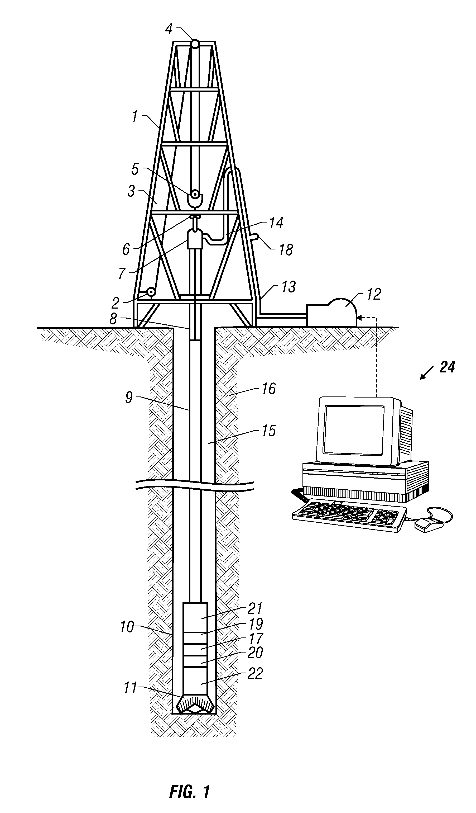
[0017]FIG. 1 illustrates a rig engaged in drilling operations; the equipment includes a derrick 1, drawworks 2, cable 3, crown block 4, traveling block 5, and hook 6, supporting a drillstring which includes a swivel joint 7, kelly 8, drill pipe 9, drill collars 10, and drill bit 11. Pumps 12 circulate drilling fluid through a standpipe 13 and flexible hose 14, down through the hollow drillstring and back to the surface through the annular space 15 between the drillstring and the borehole wall 16. During the course of drilling a borehole for oil or gas exploration, it is advantageous to measure from time to time the orientation of the borehole in order to determine its trajectory. This may be accomplished by the use of a survey tool 17 located within the drill collars 10, for measuring the direction and magnitude of the local gravitational and magnetic fields with respect to a tool-fixed coordinate system. A survey may be taken each time the drilling operation is interrupted to add a...
PUM
 Abstract
Description
Claims
Application Information
 - R&D
- Intellectual Property
- Life Sciences
- Materials
- Tech Scout
- Unparalleled Data Quality
- Higher Quality Content
- 60% Fewer Hallucinations
Browse by: Latest US Patents, China's latest patents, Technical Efficacy Thesaurus, Application Domain, Technology Topic, Popular Technical Reports.
© 2025 PatSnap. All rights reserved.Legal|Privacy policy|Modern Slavery Act Transparency Statement|Sitemap|About US| Contact US: help@patsnap.com


