
Bicycle directions

a technology for bicycles and directions, applied in the field of mapping systems, can solve the problem that the mapping system does not offer customizable maps and directions tailored for bicyclists

Active Publication Date: 2013-12-03
GOOGLE LLC
View PDF12 Cites 9 Cited by
  • Summary
  • Abstract
  • Description
  • Claims
  • Application Information

AI Technical Summary

Benefits of technology

The patent text describes a mapping system that helps bicyclists plan their routes by providing maps and directions that are specifically tailored to their needs. The system uses data about bike trails and bike lanes to determine the best way to travel along each segment of road. It also takes into account information about steep hills and other conditions that may make the ride more or less challenging. Users can select their starting point and destination and the system will generate the best route with the least cost. The recommended route will be displayed on a map and will include directions for the bicyclist to follow. Overall, this system makes it easier for bicyclists to plan their routes and have a more pleasant ride.

Problems solved by technology

However, typically, mapping systems have not offered customizable maps and directions tailored for bicyclists.

Method used


Image

  • Bicycle directions
  • Bicycle directions
  • Bicycle directions

Examples


Embodiment Construction

I. Configuration Overview

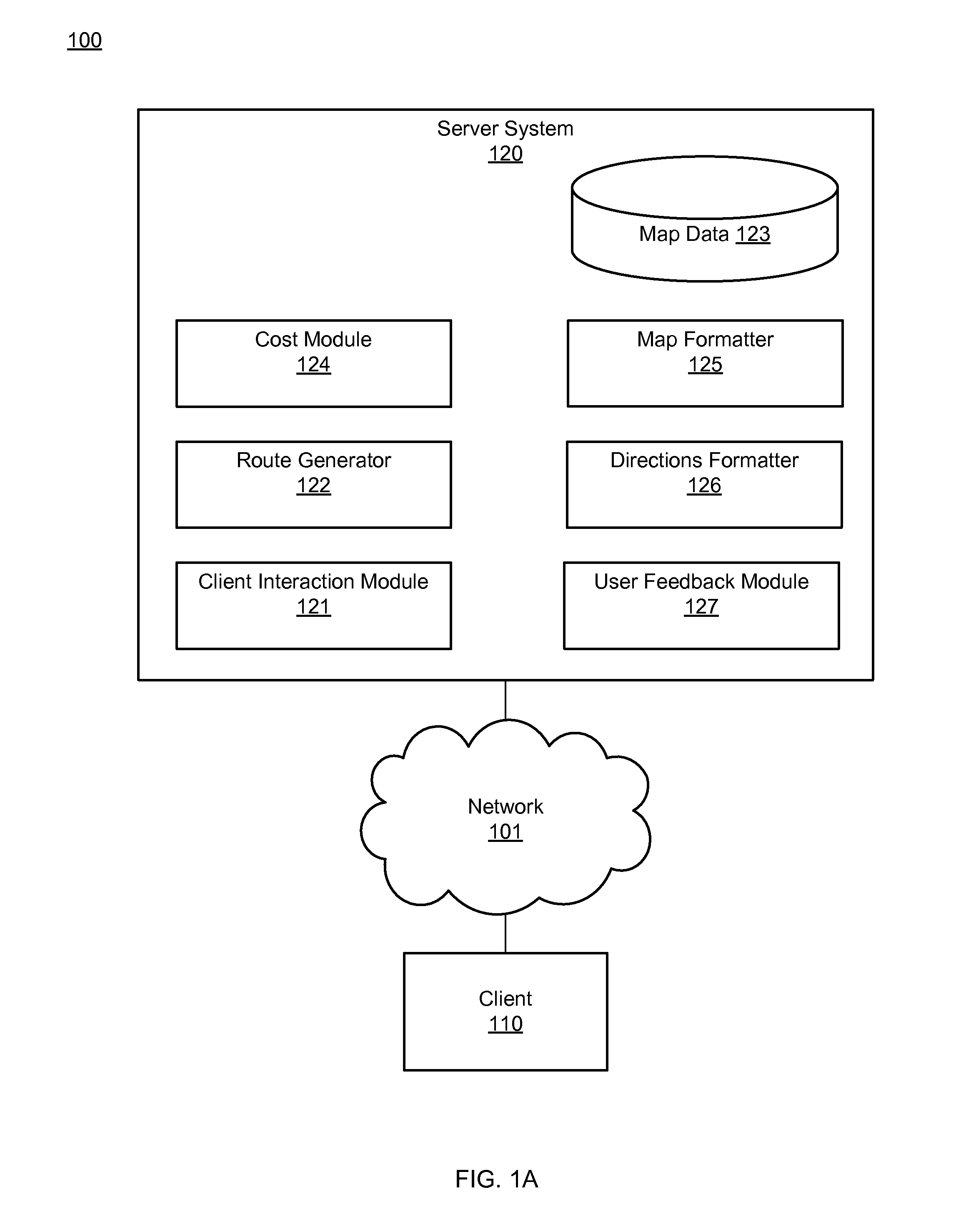
[0015]Embodiments disclosed herein provide a mapping system that tailors maps and directions for bicyclists. FIG. 1A illustrates an example computing environment 100 of the mapping system. The computing environment includes a client 110 and a server system 120 connected by a network 101. The network 101 represents the communication pathways between the client 110 and the server system 120. In one embodiment, the network is the Internet. The network 101 can also utilize dedicated, custom, or private communications links that are not necessarily part of the Internet.

[0016]The client 110 is a computer or other electronic device used to request bicycle directions or maps. The client 110 can be, for example, a personal computer executing a web browser, or a network-capable device other than a personal computer, such as a personal digital assistant (PDA), a mobile telephone, or the like. The client receives bicycle directions or maps from the server system 120 and...


PUM


Abstract

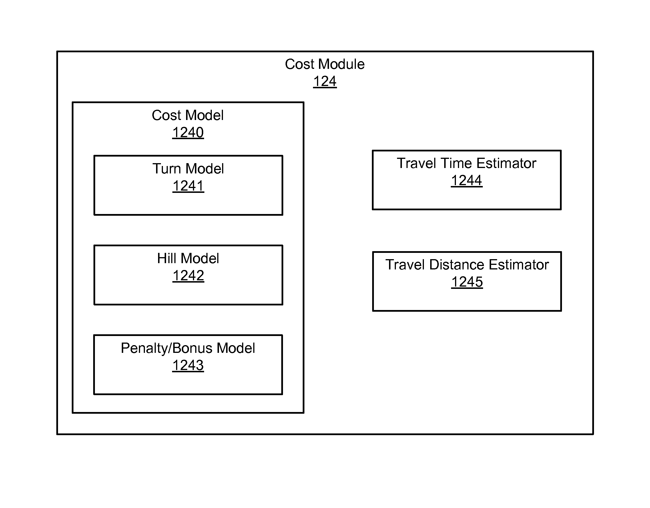
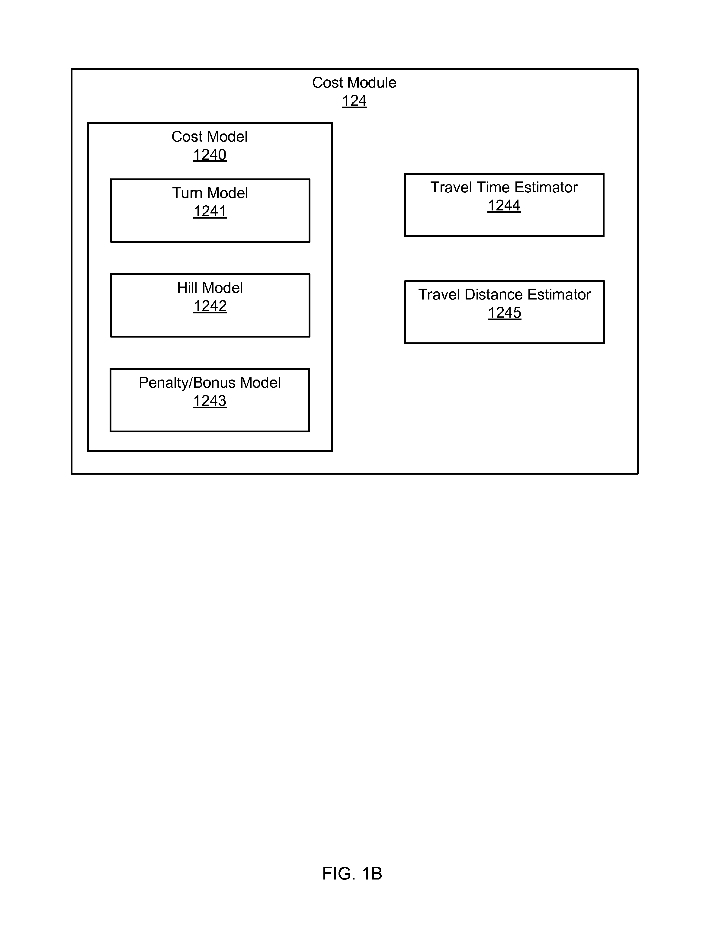
A mapping system tailors maps and directions for bicyclists. The mapping system stores map data including data about the suitability for biking along roads in a road network. A cost model, including a turn model, a hill model, and a penalty / bonus model is applied to the road network. The turn model models how long it takes to traverse an intersection. The hill model models a bicyclist's speed based on the road grade. The penalty / bonus model adjusts the calculated cost of a road segment under the turn model and hill model to take account of steep hills and other unfavorable or favorable conditions along the road segment for bicycling. The mapping system generates one or more routes between an origin and destination. The generated route that has the lowest adjusted cost is determined to be a recommended route. The mapping system formats maps and / or directions to display recommended routes.

Description

CROSS-REFERENCE TO RELATED APPLICATION[0001]This application claims priority under 35 U.S.C. 119(e) to U.S. Provisional Application No. 61 / 312,649, filed Mar. 10, 2010, which is incorporated herein by reference in its entirety.BACKGROUND[0002]1. Field of Art[0003]This disclosure relates to mapping systems used to plan routes for bicycling.[0004]2. Description of the Related Art[0005]Mapping systems that provide driving, walking, and public transit maps and directions have been widely used. However, typically, mapping systems have not offered customizable maps and directions tailored for bicyclists.SUMMARY[0006]Embodiments provide a mapping system that tailors maps and directions for bicyclists. The mapping system stores map data including road network data comprising bike trail data, bike lane data, and other data about the suitability for biking along a road. A cost model is applied to the road network to determine estimates for the travel time of road segments in the road network....

Claims


Application Information

Patent Timeline
Patent Type & Authority Patents(United States)
IPC IPC(8): G01C21/36
CPCG01C21/3453
Inventor LEEN, JOHN M.SHAWCROFT, SCOTT T.KALAI, ILJYASCHWERIN, ANDREW M.JONES, JONAH
Owner GOOGLE LLC
Learn More