Underwater acoustic navigation systems and methods

a navigation system and acoustic technology, applied in direction/deviation determination systems, instruments, using reradiation, etc., can solve the problems of cumbersome and costly use, inability to accurately determine absolute positions, and inability to direct receive gps or other rf signals, which would otherwise provide good positional information,

Active Publication Date: 2014-02-18
SHB INSTR
View PDF84 Cites 23 Cited by
  • Summary
  • Abstract
  • Description
  • Claims
  • Application Information

AI Technical Summary

Benefits of technology

[0006]An underwater acoustic navigation system and method for a plurality of submerged acoustic receivers which determine their absolute position using signals broadcast from single, compact array of acoustic transmitters located near the surface of the water is disclosed. Position and attitude of the transmit array are measured using conventional GPS / inertial / compass technology. The individual elements of the transmit array collectively produce an acoustic signal suitable for precise ranging into which the array position and attitude information and GPS time of transmission are encoded. The timing of the signal is predictable with respect to GPS time. In an embodiment, the underwater receiver comprises a hydrophone and a clock synchronized with GPS time and uses the signal transmitted by the array along with the transmission time information encoded in the signal to accurately measure the ranges to each of the elements of the array. The underwater receiver also decodes the array position and attitude information present in signal. By combining the ranging information, which determines the position of the receiver relative to the array, with the received absolute array position and attitude information, the underwater receiver calculates its own absolute position. Once the absolute position is available, the underwater receiver can easily implement all the functionality expected from a modern GPS receiver, such as, for example recording tracks, marking and navigating to waypoints, displaying location on maps, and the like.

Problems solved by technology

A problem commonly encountered underwater is an inability to accurately determine absolute position.
Because high frequency radio waves do not propagate through water, direct reception of GPS or other RF signals, which would otherwise provide good positional information, is not possible.
Their locations must be surveyed after deployment and they must eventually be retrieved, making their use cumbersome and costly.
Such systems have a limit on the number of underwater units that can be tracked by the USBL array, and such underwater units have reduced battery life and increased size because of the power used to transmit to the USBL array.

Method used


Image

  • Underwater acoustic navigation systems and methods
  • Underwater acoustic navigation systems and methods
  • Underwater acoustic navigation systems and methods

Examples


Embodiment Construction

[0024]The features of the inventive systems and methods will now be described with reference to the drawings summarized above.

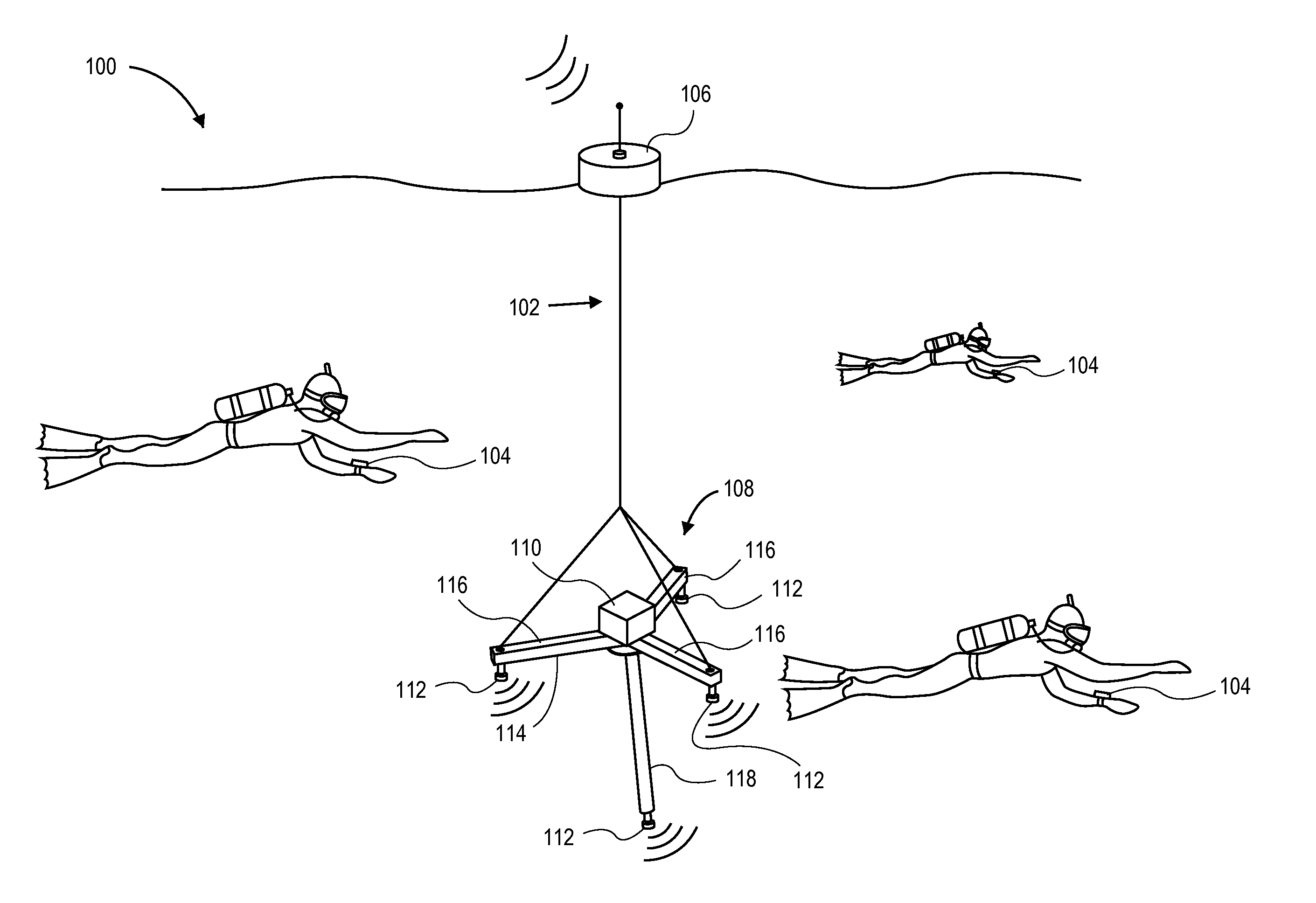
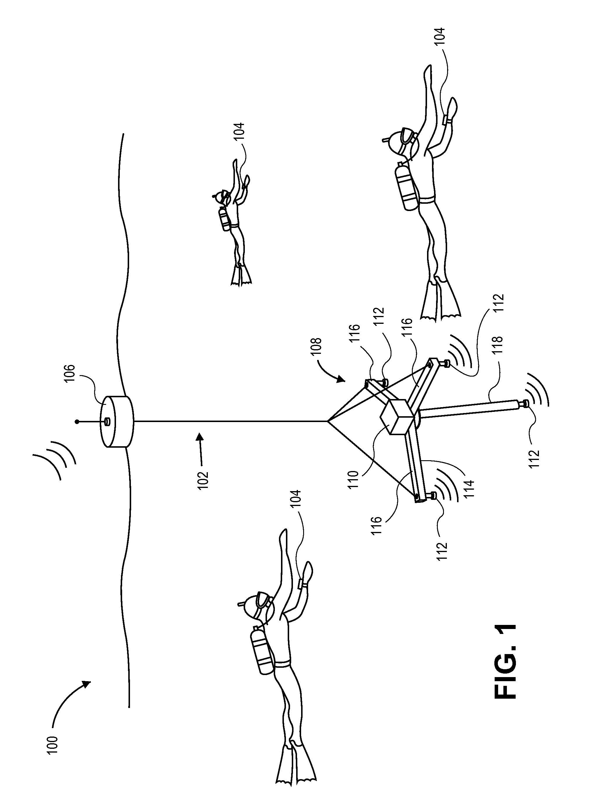
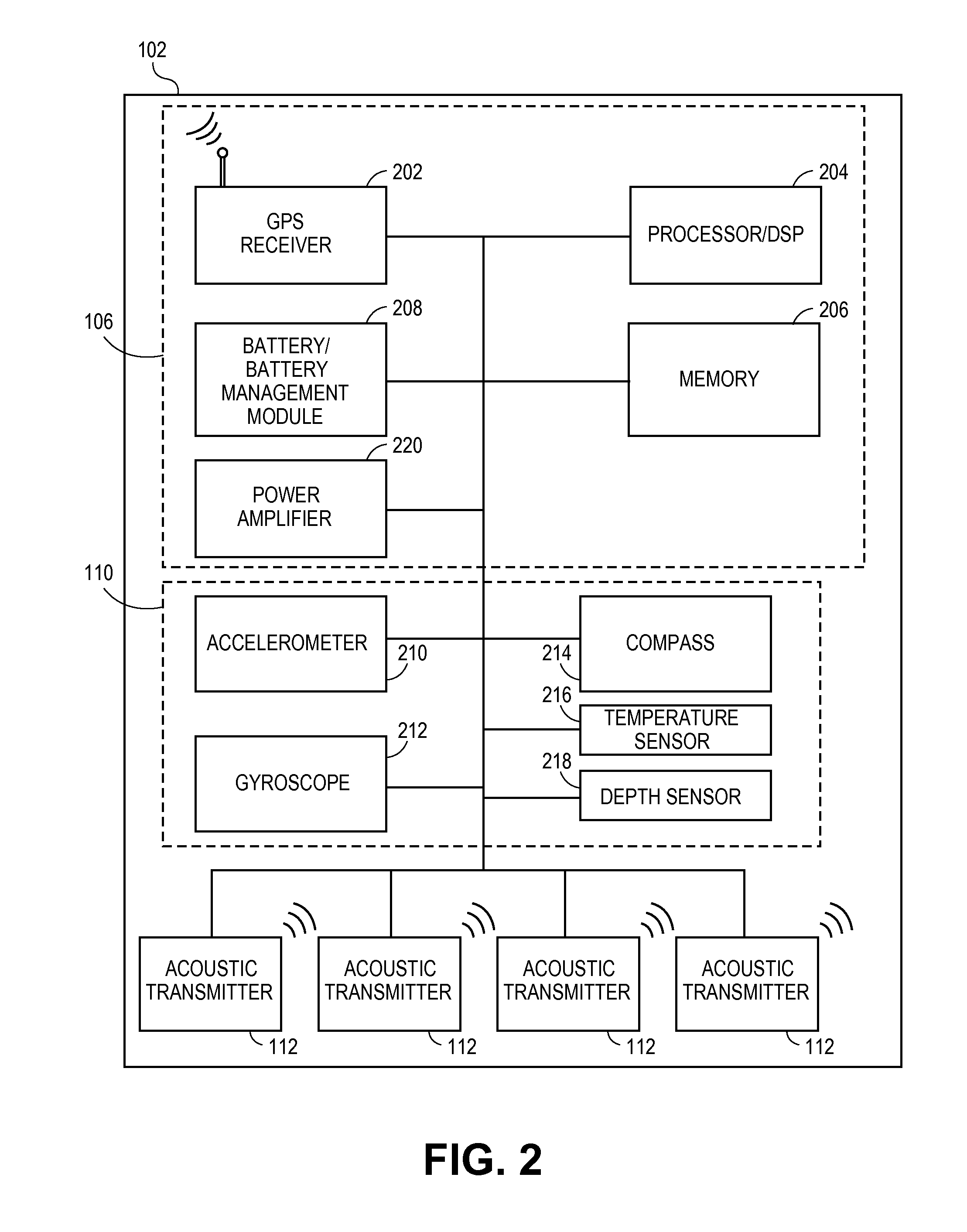
[0025]FIG. 1 illustrates an embodiment of an underwater acoustic navigation system 100, according to certain embodiments. The system comprises a transmitter unit 102 and at least one underwater receiver 104. Because GPS signals are not available underwater, the system 100 functions through the transmitter unit 102 that deploys a transmit array 108 into the water. In an embodiment, the transmitter unit 102 deploys into the water near the surface of the water. The transmitter unit 102 has a radio antenna to receive signals in order to determine its location, and transmits to the underwater receivers 104 via the underwater transmit array 108, using acoustic signals. In an embodiment, the acoustic signals are navigational signals. As a result of receiving these acoustic / navigational signals, the underwater receivers 104 have their azimuth, elevation and range fro...


PUM


Abstract

An acoustic underwater navigation system is disclosed. For instance, an underwater receiver determines its position using signals broadcast from an array of acoustic transmitters located near the surface. The position of the array is measured using global positioning system (GPS) technology and the transmitters collectively produce an acoustic signal in which the position and attitude of the array and the GPS time of transmission are encoded. An underwater receiver which is synchronized with the GPS time uses the transmitted position and attitude of the array and the transmission time information to calculate its position.

Description

[0001]This application claims the benefit of priority under 35 U.S.C. §119(e) of U.S. Provisional Patent Application No. 61 / 287,144, filed on Dec. 16, 2009 and titled “Acoustic Underwater Navigation System,” the entirety of which is hereby incorporated herein by reference to be considered part of this specification.BACKGROUND[0002]1. Field[0003]Systems and methods for underwater positioning and tracking are disclosed. In particular, an exemplary system provides an acoustic / navigation signal from a transmitter array to an underwater receiver, where the underwater receiver uses the acoustic signal to compute its absolute position.[0004]2. Description of the Related Art[0005]A problem commonly encountered underwater is an inability to accurately determine absolute position. Because high frequency radio waves do not propagate through water, direct reception of GPS or other RF signals, which would otherwise provide good positional information, is not possible. Long baseline positioning s...

Claims


Application Information

Patent Timeline
Patent Type & Authority Patents(United States)
IPC IPC(8): G01S3/80G01S3/808
CPCG01S11/14G01S3/8083H04B11/00G01S5/0045G01S5/30
Inventor MEGDAL, BARRYSCHOLZE, HANS
Owner SHB INSTR
Why Eureka
Try Eureka