

Geophysical signal processing
a geophysical signal and processing technology, applied in the field of geophysical signal processing, can solve the problems of difficult in practice to position the seismic sources and receivers exactly on a regular basis, prior art binning techniques are subject to further errors, and become unreliable, so as to improve the accuracy of the resulting value of the integral and improve the integration. the effect of precision
- Summary
- Abstract
- Description
- Claims
- Application Information
AI Technical Summary
Benefits of technology
Problems solved by technology
Method used
Image


Examples
Embodiment Construction
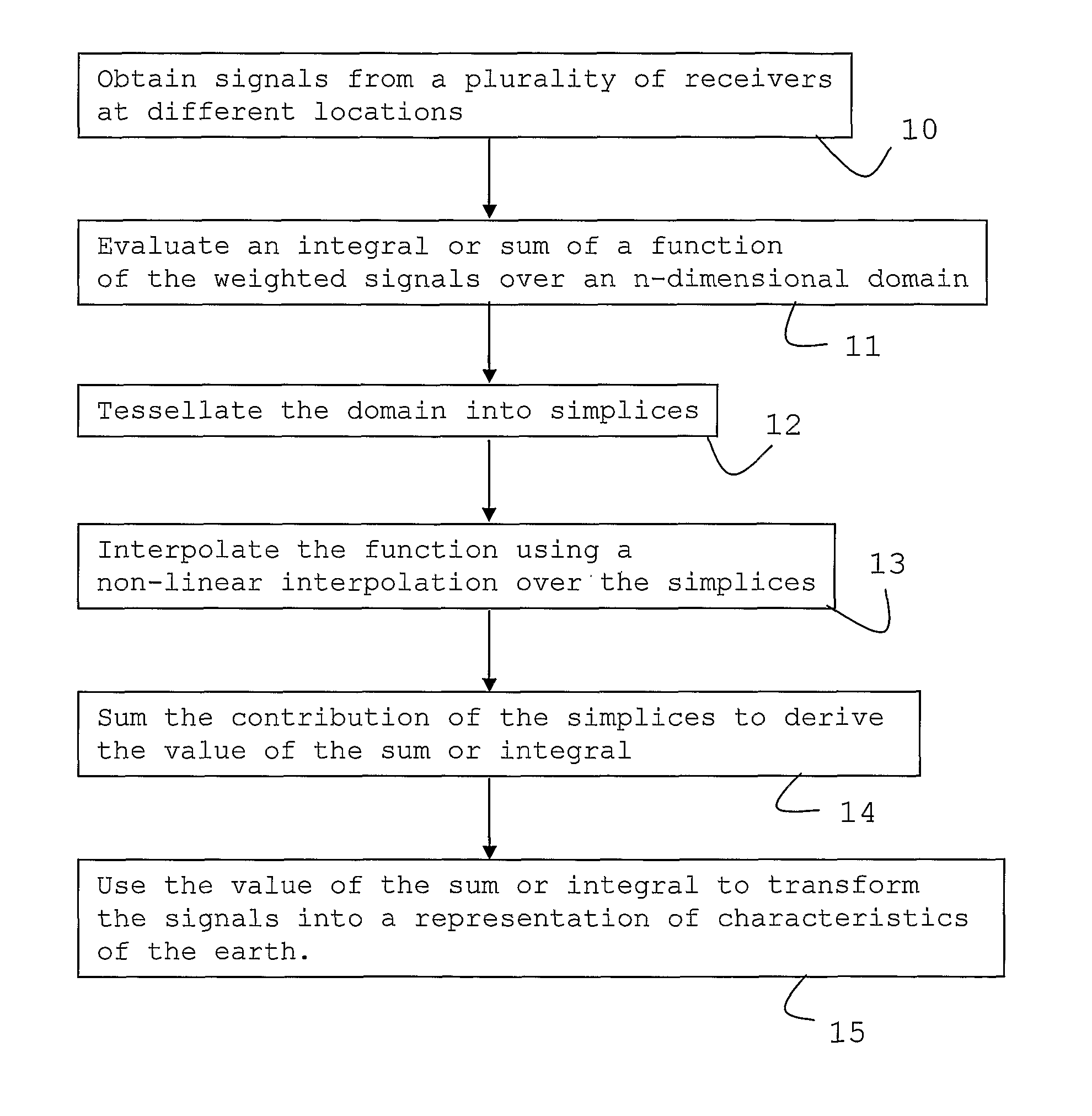
[0026]As shown in the flow chart of FIG. 1, which represents steps of an example of the novel methods in accordance with the present invention, the present invention includes the evaluation (Step 11) of integrals over functions of weighted geophysical signals obtained initially by arrays of receivers (Step 10).
[0027]The integrals and functions can be characterised by the general form:
[0028]∫Dn∏i=1p∏j=1qwi(x)dj(x)ⅆx[4]
where Dn is a n-dimensional integration domain, dj are the signals, or data derived from the signal, known only at a number of discrete points. The gradient of dj at these points or different points will be known in some cases as well either through direct measurement or calculation. The weight or taper functions wi can be known everywhere or again at a number of discrete points.
[0029]The application of this form of integration can be over, for example, source and receiver positions, midpoints only, midpoint and offsets or scattering angles etc. The integration d...
PUM
 Abstract
Description
Claims
Application Information