
System for fast three-dimensional locating wireless sensor network and method thereof

A wireless sensor, three-dimensional technology, applied in radio wave measurement systems, positioning, instruments, etc.

Active Publication Date: 2011-06-29
ZHUHAI INST OF ADVANCED TECH
View PDF2 Cites 0 Cited by
  • Summary
  • Abstract
  • Description
  • Claims
  • Application Information

AI Technical Summary

Problems solved by technology

However, the main disadvantage of this centralized method is that the nodes closer to the central node will consume power prematurely due to the high communication overhead, resulting in the interruption of information exchange between the entire network and the central node, resulting in the inability to locate in real time
[0010] Moreover, traditional wireless sensor network node positioning is based on planes, which cannot be applied to any geographical environment, such as hills

Method used


Image

  • System for fast three-dimensional locating wireless sensor network and method thereof
  • System for fast three-dimensional locating wireless sensor network and method thereof
  • System for fast three-dimensional locating wireless sensor network and method thereof

Examples


Embodiment Construction

[0043] Preferred embodiments of the present invention are described in detail below.

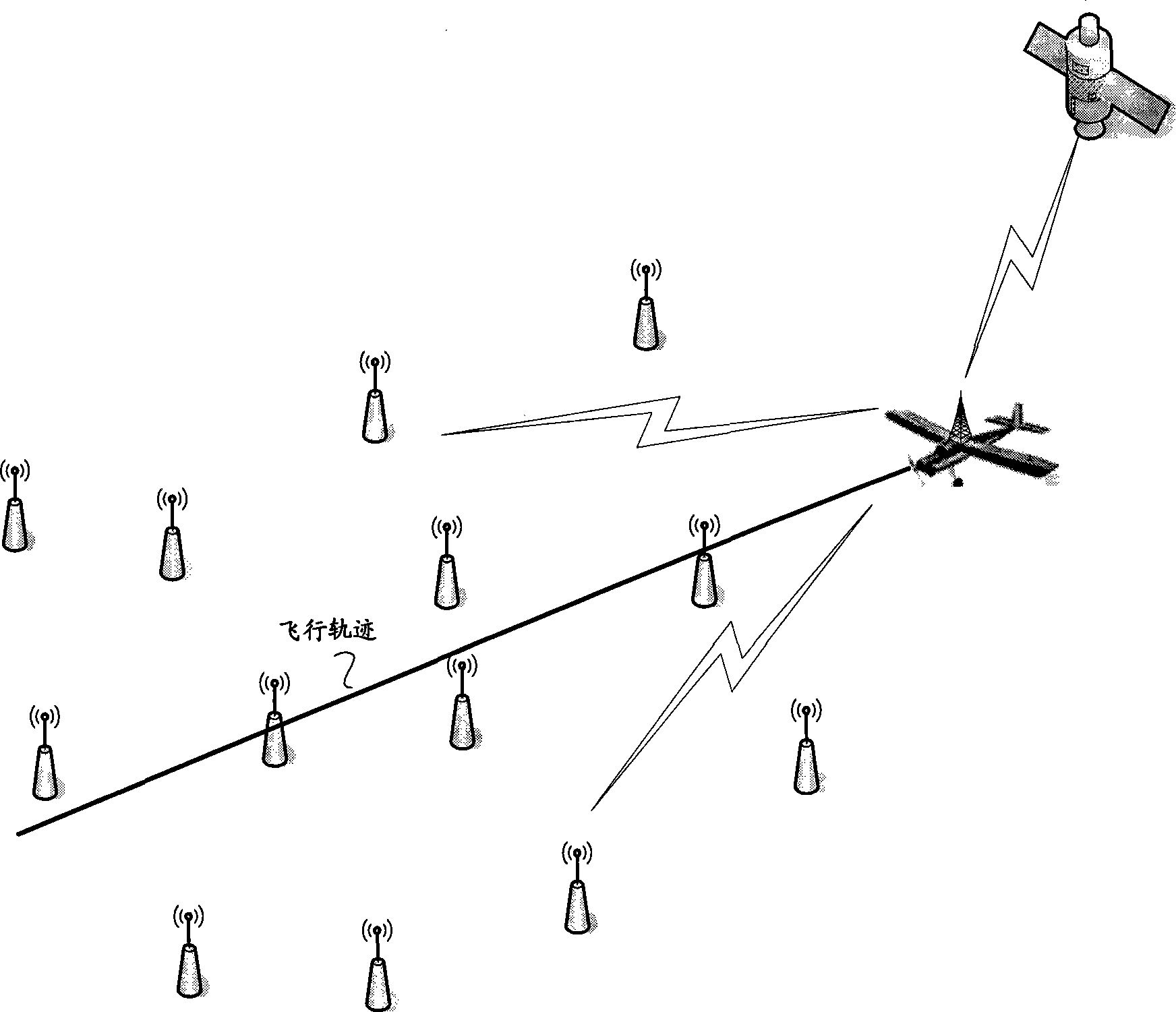
[0044] The present invention solves the problem of distributed positioning not based on distance measurement. The model of the problem is as follows: the aircraft deploys sensor nodes in a designated area, and the randomly deployed sensor nodes cannot know their own positions in advance, and the model aircraft is equipped with GPS The mobile anchor point of the device completes the positioning of the node itself.

[0045] Such as figure 1 As shown, the present invention provides a system for three-dimensional rapid positioning of a wireless sensor network, which includes a GPS positioning device, a mobile anchor point and a wireless sensor node; wherein, the GPS positioning device is set on the mobile anchor point, It is used to receive information from GPS satellites to obtain the current position coordinates of the mobile anchor point; there may be multiple mobile anchor points, which ar...

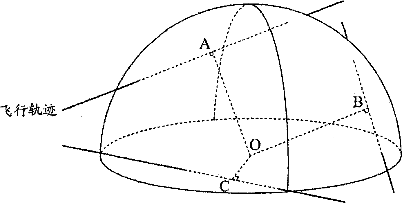
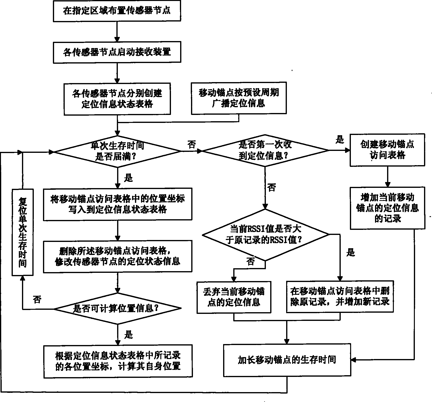

PUM


Abstract

The invention discloses a system and a method for 3D rapid positioning of a wireless sensor network, which comprises a GPS positioner, a movable anchoring point and wireless sensor nodes. The GPS positioner is for receiving info from a GPS satellite, so as to get the coordinates of the location of the movable anchoring point; the movable anchoring point is for broadcasting positioning info in preset period, and passes a specified area, and the moving path of the movable anchoring point is a line in a specified area. The wireless sensor nodes are for receiving positioning info, comparing the intensities of received signals of positioning info, selecting positioning info with the max. intensity, and storing the location coordinates for the positioning info with the max. intensity; and storing the location coordinates of any one from other positioning info; and judging whether enough location coordinates have been obtained for calculating their own location, and calculating its own location. In this way, it is not necessary to get the distance between nodes. The invention uses a distributed calculation method to achieve information exchanging and coordination between nodes, and gets the location of sensor nodes through self calculation by the nodes.

Description

technical field [0001] The present invention relates to the technical field of self-positioning in a wireless sensor network, and in particular to a system and method for realizing fast positioning of nodes in a wireless sensor network in distributed, three-dimensional positioning not based on ranging by adopting a mobile anchor point method. Background technique [0002] The wireless sensor network is composed of a large number of micro-sensor nodes deployed in the monitoring area, and forms a multi-hop self-organizing network system through wireless communication. information and send it to observers. [0003] The sensor node is usually a miniature embedded system, its processing ability, storage ability and communication ability are relatively weak, and it is mainly powered by a battery with limited energy. In a sensor network, location information is very important to the monitoring activities of the sensor network. The location of the event or the location of the node ...

Claims


Application Information

Patent Timeline
Patent Type & Authority Patents(China)
IPC IPC(8): G01S5/10
Inventor 余刚刚于峰崎封磊
Owner ZHUHAI INST OF ADVANCED TECH
Learn More