Forest resources space remote sensing and ground angle gage sampling and matching system integration technology and method

A forest resource and aerospace remote sensing technology, which is applied in the field of integration of forest resource space remote sensing and ground angle gauge sampling supporting systems, can solve the problems of real-time and poor automation of forest resource information, long forest resource survey cycle, large manpower, material and financial resources, etc. , to achieve large-scale forest resources investigation, reduce field workload, and achieve high work efficiency

Inactive Publication Date: 2008-07-09
BEIJING FORESTRY UNIVERSITY
View PDF0 Cites 8 Cited by
  • Summary
  • Abstract
  • Description
  • Claims
  • Application Information

AI Technical Summary

Problems solved by technology

[0002] The traditional forest resource survey is based on sampling technology and regular observation of fixed plots, which not only requires a lot of manpower, material resources, and financial resources, but also has a long period of forest resource survey, and the real-time and automation of forest

Method used


Image

  • Forest resources space remote sensing and ground angle gage sampling and matching system integration technology and method
  • Forest resources space remote sensing and ground angle gage sampling and matching system integration technology and method

Examples


Embodiment Construction

[0009] The integration technology and method of forest resources aerospace remote sensing technology and ground angle gauge sampling supporting system are different from the existing technology, specifically:

[0010] (1) According to the implementation area, select the appropriate remote sensing data source, and draw the map according to the "Regulations for the Production of Remote Sensing Image Plane Map" with the corresponding scale.

[0011] (2) Making thematic maps of forest vegetation information: specifically extracting vegetation information according to the normalized difference vegetation index, performing binarization, completing the extraction of forest vegetation information, and counting forest vegetation area information S.

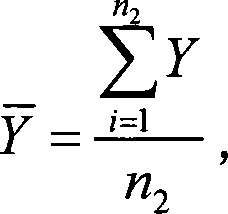
[0012] (3) Use the typical random sampling method to conduct field sample surveys in the implementation area. Field sample surveys are selected in representative forest areas, and the survey contents include: location, geographical coordin...


PUM


Abstract

The invention discloses a method for integrating a space remote sensing system and a ground angle gauge sampling matched system for forest resources. The method finishes the second type investigation of forest resources based on remotely-sensed data and in combination of ground angle gauge sampling data in the field. The method comprises the following steps of: reading the images of a forest investigation region from a space remote sensing satellite to extract forest vegetation information, calculating forest vegetation area and distribution information, checking and modifying the reading result in combination of the ground angle gauge sampling data in the field, calculating accumulation per hectare at the sampling point, inversely calculating the accumulation remote sensing model of a forest survey factor with ground typical random sampling technique in combination of image mechanical sampling technique, and calculating the total accumulation of forest resources in the investigation region. The inventive method reduces field work load, improves investigation efficiency, and realizes large-region and short-period forest resources investigation.

Description

1. Technical field [0001] The invention relates to a technical method for forest resource investigation, in particular to a technical method for integrating the supporting system of forest resource aerospace remote sensing and ground angle gauge sampling. 2. Technical background [0002] The traditional forest resource survey is based on sampling technology and regular observation of fixed plots, which not only requires a lot of manpower, material resources, and financial resources, but also has a long period of forest resource survey, and the real-time and automation of forest resource information is poor. It is increasingly unable to meet the requirements of modern precision forestry for the survey and monitoring system, which is also promoting the development of supporting integration technology of aerospace remote sensing technology and ground angle gauge sampling. [0003] The integrated technical method of space remote sensing and ground angle gauge sampling supporting...

Claims


Application Information

Patent Timeline
IPC IPC(8): G01B11/28G01S17/89
Inventor 冯仲科吴露露隋宏大姚山
Owner BEIJING FORESTRY UNIVERSITY
Why Eureka
Try Eureka