

Method for real-time conveying DGPS data through unmanned aerial vehicle control periodic line
A drone and data technology, applied in radio transmission systems, radio wave measurement systems, transmission systems, etc., can solve the problems of increased power supply pressure, increased body weight, too far apart, etc., to reduce supply pressure and body weight. , The effect of reducing system cost and simple scheme
- Summary
- Abstract
- Description
- Claims
- Application Information
AI Technical Summary
Problems solved by technology
Method used
Image

Examples
Embodiment Construction
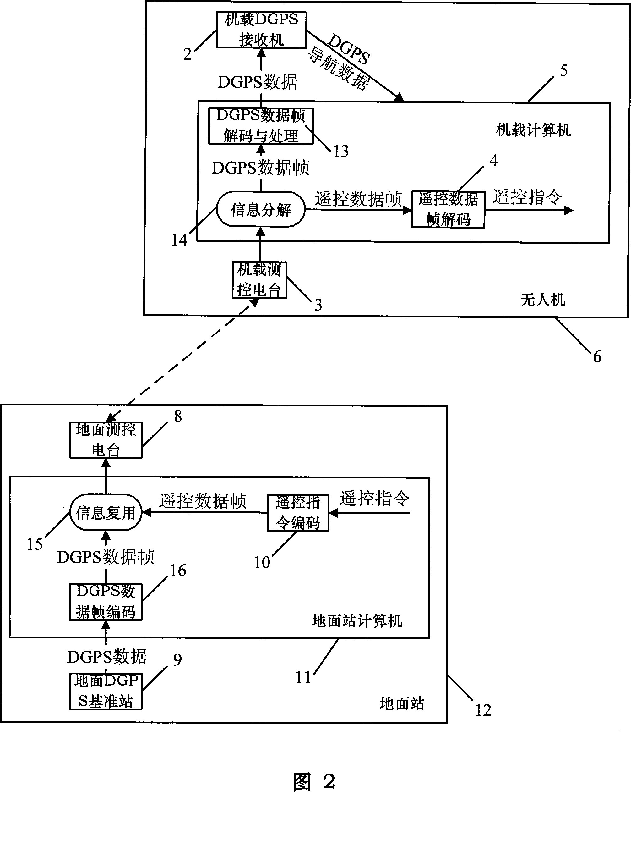
[0043] The present invention will be further described below in conjunction with specific examples.
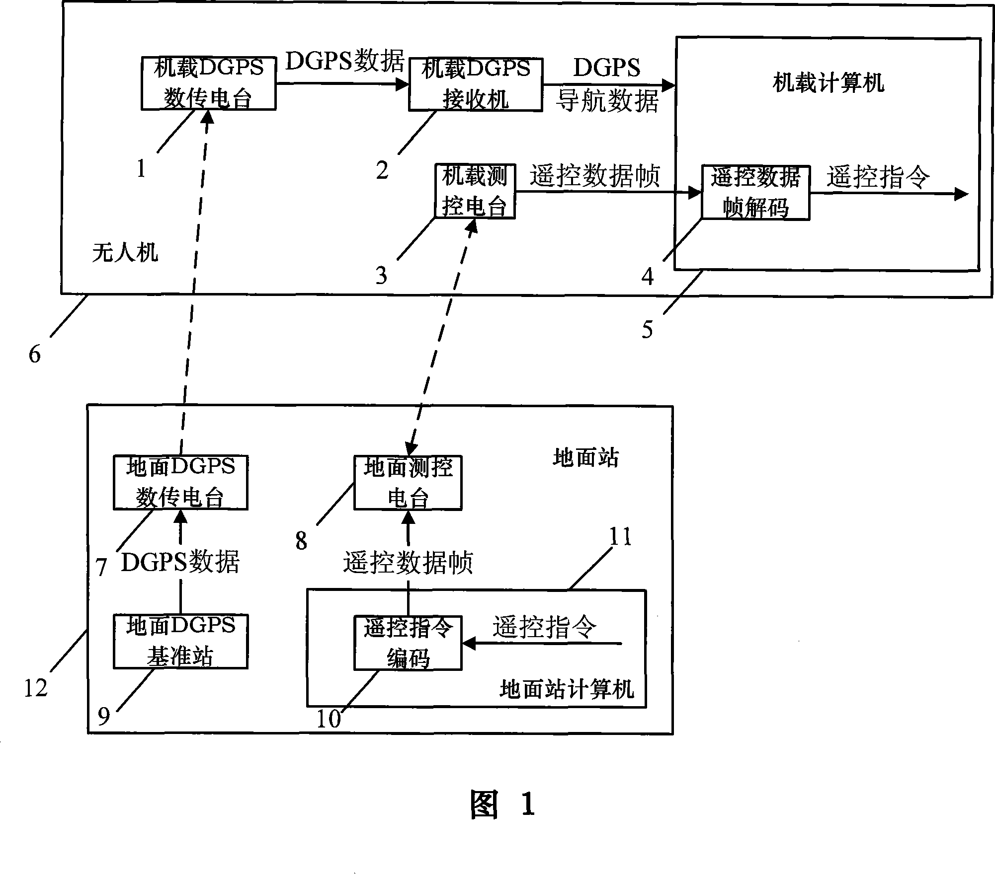
[0044] As shown in FIG. 2 , it is a schematic diagram of the technical solution of the present invention to transmit DGPS data in real time using the UAV measurement and control link. The transmission process of DGPS data in the present invention involves the airborne DGPS receiver 2, the airborne measurement and control station 3, the airborne computer 5, the ground measurement and control station 8, the ground DGPS reference station 9 and the ground station computer 11. First, the ground station computer 11 receives a frame of complete original DGPS data from the ground DGPS reference station 9 for processing; then, the processed data is sent to the UAV 6 by the ground measurement and control station 8; then, the UAV 6 The airborne measurement and control station 3 receives the radio wave signal sent by the ground measurement and control station 8 and processes it to obtain ...
PUM
 Abstract
Description
Claims
Application Information