Astronomical aided single-star positioning method

A single-satellite positioning and satellite positioning technology, applied in the field of positioning and navigation, can solve the problems of inapplicability, increased error, inability to use GNSS positioning, etc., and achieve the effect of high user positioning accuracy

Inactive Publication Date: 2009-06-24
DALIAN MARITIME UNIVERSITY
View PDF0 Cites 17 Cited by
  • Summary
  • Abstract
  • Description
  • Claims
  • Application Information

AI Technical Summary

Problems solved by technology

In this case, positioning is required in military or other special application fields. At present, inertial navigation is often used to solve this problem. The inertial navigation calculation method gradually increases the error with the passage of time. It is not suitable for GNSS that cannot be used for a long time. Positioning situation

Method used


Image

  • Astronomical aided single-star positioning method
  • Astronomical aided single-star positioning method
  • Astronomical aided single-star positioning method

Examples


Embodiment Construction

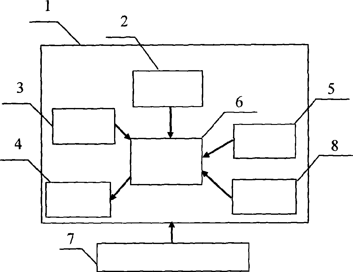
[0030] In the daytime, firstly, according to the positioning calculation terminal device 1, the solar celestial body is recommended, and the observed celestial body has an elevation angle of 73°45′30″ and an azimuth angle of 120°18′25″. The index difference and device difference are 1.2', and it is known that the current local time of the device is 10:25:32 on November 12, 2008.

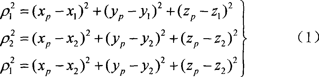
[0031] According to the prompt of the positioning solution terminal device 1, the observation data and the observation equipment error are input into the positioning solution terminal device 1, and the positioning solution terminal device 1 automatically searches for the correction value related to the celestial body in the celestial body ephemeris database module 3, and according to the formula ( 2) Obtain the latitude 38°52.33′ where the user is located, and use the jointly measured GNSS satellite data into formula (1) to obtain the longitude data of the user 121°38.46′.

[0032] At night, observe ...


PUM


Abstract

The invention belongs to the positioning and navigation field, and relates to a celestial positioning and satellite positioning cross application subject. The invention is achieved by a positioning resolution terminal device 1. The positioning resolution terminal device 1 comprises a satellite positioning measurement module 2,a celestial satellite historical data base module 3, a liquid crystal display module 4, a keyboard operating module 5, a MCU main control module 6, a power supply module 7 and an optional accurate clock input module 8. When the number of GNSS satellite signals received is less than 3, the positioning resolution terminal device 1 still can resolve a user site under the celestial assistance. The invention is suitable for positioning and navigation under the severe environment, and obtaining user site data with higher accuracy.

Description

Technical field [0001] The invention belongs to the field of positioning and navigation, relates to the interdisciplinary subject of celestial body positioning and satellite positioning, and in particular to an astronomically assisted single-satellite positioning method. Background technique [0002] In harsh environments (such as canyons, forests, etc.), positioning cannot be performed when less than 3 satellite signals are received. In this case, positioning is required in military or other special application fields. At present, inertial navigation is often used to solve this problem. The inertial navigation calculation method gradually increases the error with the passage of time. It is not suitable for GNSS that cannot be used for a long time. The positioning situation. Contents of the invention [0003] The purpose of the present invention is to provide a method to solve the user's current position with the assistance of astronomical and celestial bodies when receiv...

Claims


Application Information

Patent Timeline
Patent Type & Authority Applications(China)
IPC IPC(8): G01S1/02G01S5/02G01C21/02G01S19/01
Inventor 张淑芳胡青
Owner DALIAN MARITIME UNIVERSITY
Why Eureka
Try Eureka