Extracting method of thematic information of towns by principal component of fuzzy clustering of remote sensing images

A technology of thematic information and fuzzy clustering, which is applied in the field of remote sensing, can solve problems such as information interference, low extraction efficiency, and complex surface features, and achieve the effects of improving clustering speed, improving adaptability, and high repeatability

Inactive Publication Date: 2011-07-27
TONGJI UNIV
View PDF0 Cites 0 Cited by
  • Summary
  • Abstract
  • Description
  • Claims
  • Application Information

AI Technical Summary

Problems solved by technology

It is characterized by the refinement of classification, but it relies heavily on classification protocols (it is better to have protocol library support), and it is not a system specifically for the extraction of thematic information of villages and towns, and the efficiency of the extraction of thematic information of villages and towns is not high
Due to the high resolution of remote sensing images involved in the extraction of thematic information of villages and towns, and the complex representation of ground features, the difficulty of information extraction is increased, and the extraction effect is affected
Aiming at the shortcomings of the existing method of extracting village and town topic information by using remote sensing images, it is seriously disturbed by various information, the extraction efficiency is low and the effect is poor, and the extraction method is not specifically for the extraction of village and town topic information from high-resolution remote sensing images. An effective method for extracting thematic information of villages and towns from remote sensing images is one of the research goals of researchers in this field

Method used


Image

  • Extracting method of thematic information of towns by principal component of fuzzy clustering of remote sensing images
  • Extracting method of thematic information of towns by principal component of fuzzy clustering of remote sensing images
  • Extracting method of thematic information of towns by principal component of fuzzy clustering of remote sensing images

Examples


Embodiment 1

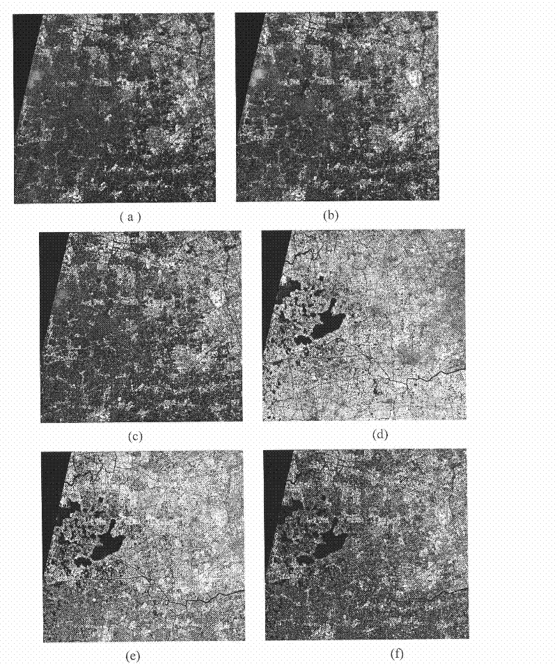
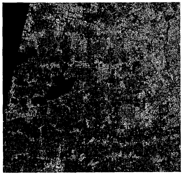
[0025] Embodiment 1: The specific implementation method will be described below in conjunction with an implementation example, that is, to carry out thematic information identification on a multi-band remote sensing image in a village and town area, and obtain thematic information vector data (.shp file) that meets the requirements of general GIS software. Its implementation process is as follows:

[0026] 1. RgPCA feature dimensionality reduction of remote sensing multi-band images,

[0027] Specifically, it includes vector encoding and principal component transformation. They are:

[0028] 1) Remote sensing spectral vector coding is characterized in that the discretization coding is specifically: according to remote sensing image data, a certain TM (thematic imager) data is taken here—the image size is 2516×2395 pixels, including 7 Band, which already has geocoded information - the coordinates of the upper left corner of the image are (285950, 3475350), and the pixel resol...


PUM


Abstract

The invention belongs to the field of remote sensing technology, in particular to an extracting method of thematic information of towns by principal component of fuzzy clustering of remote sensing images. The method comprises the following four steps: vector coding: remote sensing data is coded into vector according to different feature attributes and the principle component is transformed; the vector carries out forward transformation to principle component dimension by adopting the principle component, the front dimensions which account for large part of information is preserved in the maincomponent dimension by Beta values of rough set, especially, if the image has three wavebands, three dimension is directly used; fuzzy clustering: category classification is carried out to feature sets with reduction dimension (if the three waveband image is three-dimensional); man-machine interaction: the clustering results select image blocks by man-machine interaction, so as to obtain extractedthematic information; post processing of extracted thematic information based on morphology: filtering and tracking are carried out to image data of the obtained thematic information so as to generate vector data of thematic information meeting general GIS software requirements. The invention has less influence caused by noise and error, has strong robustness and can process wide data with littletime consumption.

Description

technical field [0001] The invention belongs to the technical field of remote sensing, and in particular relates to a method for extracting principal components and fuzzy clustering village and town topic information of remote sensing images. Background technique [0002] The thematic information of villages and towns mainly refers to the thematic information of residential areas (building areas), water bodies, roads, farmland and forest land in villages and towns. It is an important basis for the construction, management and monitoring of village and town information systems. The image can quickly and efficiently obtain large-scale thematic information that meets the requirements of village and town informatization construction. At present, there are practical methods for extracting thematic information of villages and towns using remote sensing images: manual methods and semi-automatic acquisition methods; among these methods, manual methods require a lot of manual operati...

Claims


Application Information

Patent Timeline
Patent Type & Authority Patents(China)
IPC IPC(8): G06T7/00G01S7/48
Inventor 叶勤谢锋王栋童小华林怡
Owner TONGJI UNIV
Why Eureka
Try Eureka