Local airport monitoring method, device and system therefor
A technology for wide-area augmentation systems and airports, applied to measuring devices, radio wave measuring systems, instruments, etc., can solve problems such as increasing user burden and reducing real-time performance, so as to reduce computing burden, improve robustness, and improve real-time performance Effect
- Summary
- Abstract
- Description
- Claims
- Application Information
AI Technical Summary
Problems solved by technology
Method used
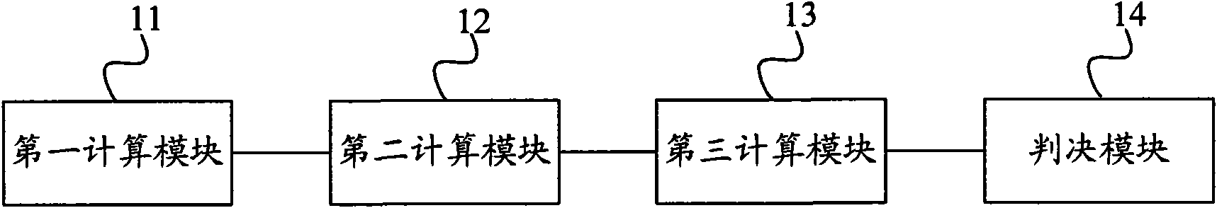
Image


Examples
Embodiment Construction
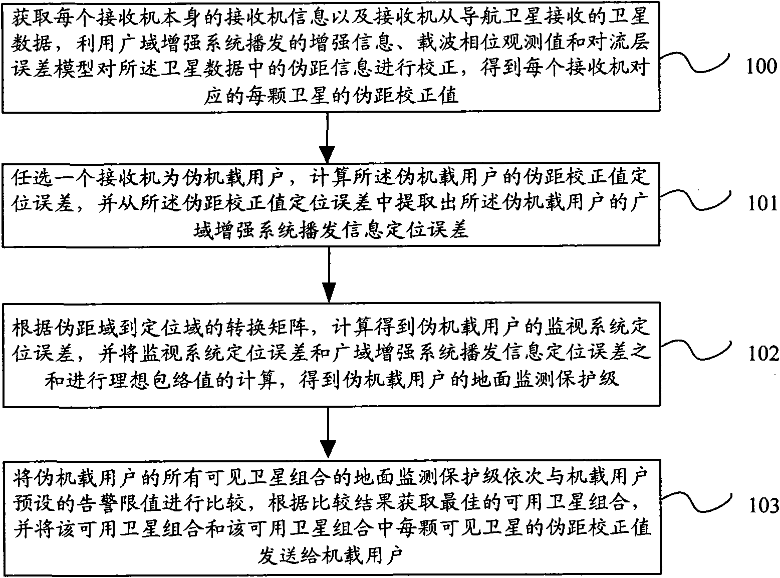
[0027] The technical solutions of the embodiments of the present invention are further described below with reference to the accompanying drawings and specific embodiments.
[0028] With the vigorous development of satellite navigation, countries around the world are building their own satellite navigation systems, such as the GPS system in the United States, the GLONASS system in Russia, and the Galileo system in Europe that is under construction. However, due to the influence of ionosphere, troposphere, multipath effect and thermal noise, as well as the problems of satellite navigation system itself, such as ephemeris error, star clock error, etc., satellite navigation cannot meet the performance required by the system in many applications. index. For example, in the application of the precision approach system of civil aircraft, not only high requirements are placed on the accuracy of satellite navigation, but also on its integrity, continuity and availability.
[0029] In o...
PUM
 Abstract
Description
Claims
Application Information
 - R&D
- Intellectual Property
- Life Sciences
- Materials
- Tech Scout
- Unparalleled Data Quality
- Higher Quality Content
- 60% Fewer Hallucinations
Browse by: Latest US Patents, China's latest patents, Technical Efficacy Thesaurus, Application Domain, Technology Topic, Popular Technical Reports.
© 2025 PatSnap. All rights reserved.Legal|Privacy policy|Modern Slavery Act Transparency Statement|Sitemap|About US| Contact US: help@patsnap.com