Method for inversing land surface temperature from MODIS data

A surface temperature and data inversion technology, applied in the field of surface temperature inversion, can solve the problems that it is difficult to meet the personal development and use of scientific researchers and the complex surface temperature inversion method.

Inactive Publication Date: 2010-01-20
INST OF AGRI RESOURCES & REGIONAL PLANNING CHINESE ACADEMY OF AGRI SCI +1
View PDF0 Cites 43 Cited by
  • Summary
  • Abstract
  • Description
  • Claims
  • Application Information

AI Technical Summary

Problems solved by technology

[0009] The purpose of the present invention is to provide a method for inversion of surface temperature from remote sensing data MODIS, to overcome the complexity of the existing surface temperature inversion method, and it is difficult to meet the needs of individual development and use of scientific researchers, and to further enrich domestic researchers for thermal infrared The product algorithm developed by the remote sensor provides a reference for the surface temperature retrieval method for thermal infrared sensors on 100 satellites that my country plans to launch before 2020, and can further improve the retrieval accuracy of the surface temperature in the current business operation of the Ministry of Agriculture, and improve drought monitoring and crop monitoring. Yield estimation accuracy [has been proposed as one of the methods selected for the surface temperature inversion method in the agricultural monitoring of the Ministry of Agriculture]

Method used


Image

  • Method for inversing land surface temperature from MODIS data
  • Method for inversing land surface temperature from MODIS data
  • Method for inversing land surface temperature from MODIS data

Examples


Embodiment Construction

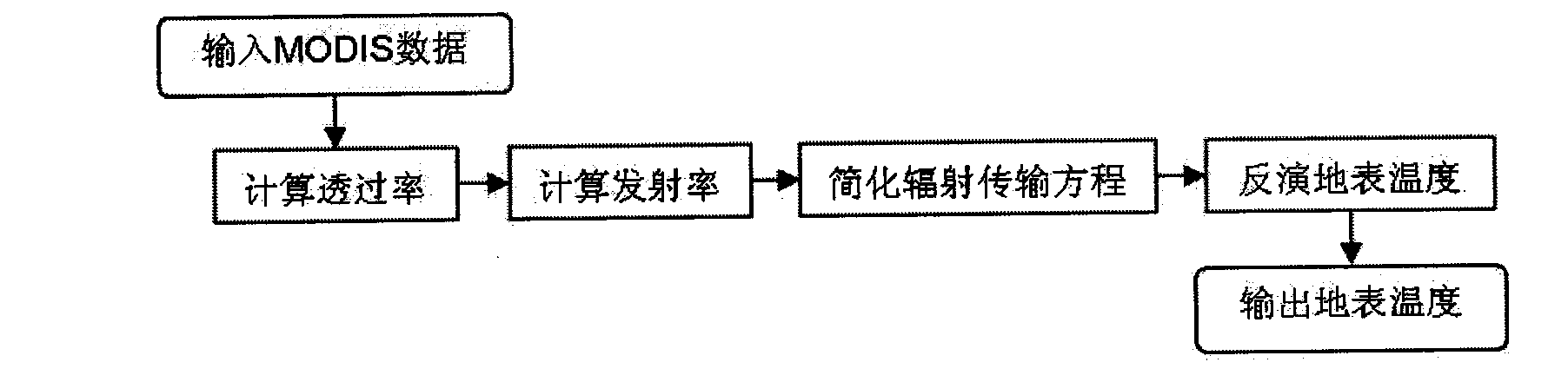
[0075] Here we use a scene of MODIS image data in China's Bohai Rim region in early August 2003 for specific inversion. This method mainly includes four steps, as follows: figure 2 .

[0076] The first step is to calculate the transmittance of MODIS bands 31 and 32 through the atmospheric water vapor content

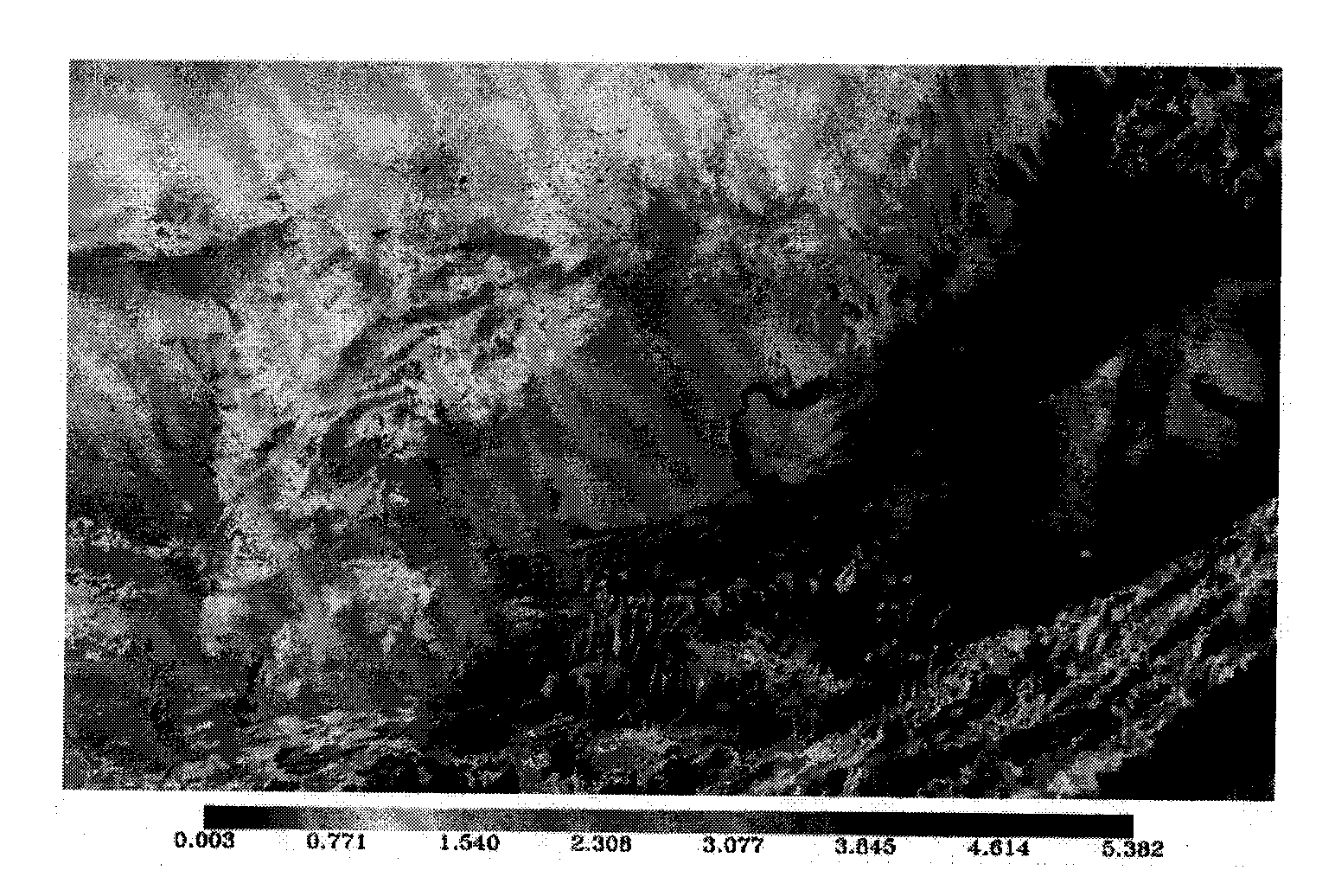
[0077] 1-1) Use MODIS band 19 and band 2 to calculate the ratio T, and then use this ratio to calculate the atmospheric water vapor content W, such as image 3 :

[0078] T = ρ 19 ρ 2

[0079] W = ( 0.02 - ln T 0.651 ) 2

[0080] 1-2) Using the relationship between atmospheric water vapor content and MODIS bands 31 and ...


PUM


Abstract

The invention relates to a method for inversing land surface temperature from MODIS data, which can be applied in meteorology, environmental monitoring, land management, agricultural condition monitoring, disaster monitoring and other remote sensing application departments. The method comprises four steps: the first step is to calculate the transmittance of 31st and 32nd wave bands of MODIS through water vapor content of atmosphere. The second step is to calculate the emissivity of the 31st and the 32nd wave bands of the MODIS sensor through vegetation index NDVI. The third step is to simplify a radiation transmission equation. The fourth step is to carry out inversion calculation on the MODIS data and obtain the land surface target object temperature and the emissivity distribution situation, so that the method can be used in meteorological forecasting, environmental monitoring, agricultural condition monitoring, disaster monitoring and other departments.

Description

technical field [0001] The invention relates to a method for retrieving the surface temperature by using the ground thermal radiation information obtained by the MODIS sensor on the earth observation satellite. The method overcomes the shortcomings of asynchronous parameter acquisition, complexity and difficulty in practical use in the previous inversion method. It can be applied in remote sensing departments such as meteorology, agriculture, environmental monitoring and drought monitoring. Background technique [0002] The surface temperature refers to the temperature of the surface layer of the earth, which is skin temperature in English. The importance of surface temperature in the study of regional resources and environment has made thermal infrared remote sensing an important field of remote sensing research. At present, many practical inversion methods for surface temperature remote sensing have been developed, such as thermal radiation transfer equation method, split ...

Claims


Application Information

Patent Timeline
Patent Type & Authority Applications(China)
IPC IPC(8): G01J5/00G01S17/00
Inventor 毛克彪李三妹张立新覃志豪周清波王道龙
Owner INST OF AGRI RESOURCES & REGIONAL PLANNING CHINESE ACADEMY OF AGRI SCI
Why Eureka
Try Eureka